Your Boat, Your Skills, Your Expectations
The article below, written by Mike Huston, was published in the September 2015 issue of 48° North. After our recent Alaska themed issue, we decided it was a good idea to share it once again. It’s a nice complement to Marty McComber’s excellent Alaska article in the June 2019 version. They’re both high quality writers and sailors with great experience and thoughtful advice.

Thinking about going to Alaska? A ways back, maybe fifteen years ago, my wife and I met a couple who had sailed to Alaska several times. I don’t remember much of the conversation, but I clearly remember my feelings of envy – I wanted to go, but doing so seemed daunting. I felt we lacked the skills and experience needed to make the trek – and I was right.
Let’s face it, at the time we were competent sailors but we lacked cruising experience. We had visited the San Juan Islands many times, but little else. Over the next several years we slowly, but steadily, expanded our knowledge, abilities and range. By 2011 we felt confident enough to make our first trip to Alaska. We went again in 2013 and both trips were fabulous and both went smoothly.
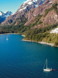
The motivations for a trip to Alaska are real – awe inspiring scenery, encounters with wildlife we don’t normally experience and a fabulous sense of achievement come to mind. But this is not a trip for everyone, as the challenges are also real; to go from Seattle to Glacier Bay and back is a 2000 mile journey and it will take at least 10 weeks (sure it could be done in less, but it would be unfair to you). There are two open ocean crossings and several tidal rapids to transit. And, there are dozens of unfamiliar ports and bays you will need to navigate in order to anchor or find moorage.
Please understand, my wife and I are not the most experienced Alaska cruisers. There are others who have done this trip for years. But we learned our lessons recently enough to still remember the process. So what was it we needed to learn and what did we do to our boat to prepare for the trips? I will do my best to share what we learned. It is my hope this information will help those of you intrigued by an Alaskan adventure to realize it is doable, but it takes some preparation.
The first thing you will need is a competent cruising boat and some basic skills. Your boat does not have to be large, I know people who successfully cruised Alaska in a 24’ sailboat. But it will need to be outfitted with appropriate gear for the trip (see Boat and Gear section). And you will need to have a basic foundation in boating skills to work from. For the purposes of this article I am assuming the reader is a competent local cruiser and has the associated skills (boat handling, VHF radio use, chart reading, anchoring, boat maintenance, etc.) as I am going to discuss only the things which go beyond this level (see the Skills section). And last, I will share some observations and helpful information (see the Expectations and Tips section).

Boat and Gear:
Listed below are some Alaska-specific comments on general boat systems:
Fuel Capacity – The distances between fuel stops can be sizeable (100 NM) and sometimes they are out of fuel. Having the range to pass one or two can be very handy. We added fuel tanks to our boat giving us a 500 mile range, others carry several jerry cans.
Full Enclosure – We added a full enclosure to our boat just before our first trip to Alaska and we still consider it one of our best boat investments. Unless it was really nasty or cold out I was usually in a t-shirt or sweatshirt. Of course, we did not know this ahead of time, so my wife packed several pairs of thermal underwear and a number of sweaters, most were never worn.
Water – Potable water is generally available but showers are not, so having enough water onboard for showers makes life feel cleaner.
Maintenance – All systems should be maintained and tested prior to leaving – this is an important item. DO TEST EVERYTHING BEFORE you leave on your trip. A multi-day shake-down cruise is best. And this assumes you have been busy all winter doing maintenance.
Spares – There are basic spare parts available in the main ports but some of the areas are a long way from nowhere. So having a good supply of spare parts onboard is recommended, for example, we carried an alternator and starter. Several fuel filters (in case of bad fuel) and oil changing supplies are also a good idea. Then there are the ‘normal’ spares like impellors, head parts, etc.
Furnace – Having some form a heat is a necessity as there will be cold, wet days and the nights can be chilly.

Navigation will be made easier and safer with the following gear:
Chart Plotter – Probably the most important and helpful of the electronic devices one can put on a boat. It provides two crucial pieces of information: where you are and your COG. The COG is your course over ground which tells you what direction your boat is really traveling.
Radar – I think it would be impossible to make this trip without running into fog. Therefore, having radar, and being comfortable using it, are both worth the investment in time and money.
Automated Identification System – While AIS is not mandatory, it will make the trip less stressful. Here is why – in Alaska there are more tugs, cruise ships, fishing vessels and ferries than there are other pleasure boats. All of these vessels, except for the smaller fishing vessels, will have AIS. AIS will allow you to identify them and know how close you will pass to them. And, assuming your AIS transmits, they will have the same information about you. Because there is no traffic system in Alaska, all these vessels are responsible for arranging their own passings, so you can expect them to call you on the radio in a tight situation. AIS makes this process much easier as they can call you by name and vice versa.
Autopilot – Again, not a necessary piece of equipment, but ours was a well used item during our trips north. It does not reduce the need for constant watch, especially for logs, but it does make the long days underway easier on the muscles.
Radar Reflector(s) – While radar allows you to see other vessels, they may not be able to see you unless your boat returns a good signal. We found we needed two radar reflectors in order to be seen well by our boating companions. We mounted them up above the top spreaders which proved to be effective.

The lack of traffic lanes in Alaska puts vessel-to-vessel communications somewhere between likely and mandatory. In addition, many areas of the Inside Passage and Alaska are quite desolate, no cell phone, no Internet, and at times, no VHF (this is rare but if can happen in some places, like Fords Terror). Therefore, having good communications gear is essential, here is the gear we found useful:
Cockpit Mic – This is a must. It is not safe to travel these waters with the only radio being below decks. We used a RAM (remote access microphone) tied into our main radio and it worked very well. A second radio is another good option.
Hand-held VHF – Our hand held radio was useful in several ways: First, it played back-up to the main radio. Next, it was helpful when we were traveling with another boat – we would have the hand-held set on our inter-boat channel so we would not need to change channels on the main radio. And, it came in handy if someone went ashore or exploring in the dinghy – just in case.
Sat phone – We did not take one, but depending on your needs and/or comfort level, a satellite phone can provide that extra level of communication.
Computer/Tablet – In most of the main towns we found we could get a Wi-Fi connection somewhere. It was frequently the local pub, but at least we were able to get updated weather info and connect with friends and family.
As we started to spread our wings we headed to Desolation Sound. It was there we learned some valuable lessons on anchoring. As one goes further north the anchorages tend to be deeper, 70 ft in Alaska is common. And in many places it is necessary to anchor on a sloped bottom, requiring a stern-tie. Making matters worse, the tidal swings become greater as one goes north – swings of 20-25 ft. are the norm in Alaska. Taking these factors into consideration we found the following items to be necessary:
Anchor and Rode – All chain rode is the way to go, assuming your boat will tolerate the weight up front. We carry 320 feet and more would be better. Also, be sure to have a secondary anchor.
Stern-Tie Gear – We have a 600’ roll of poly line that fits nicely in our transom walk-through. Many boats have reels mounted on the stern pulpit.
Trip-line – Be sure to have a sturdy line and a float for use in areas where the bottom might foul your anchor. Typically rocky bottoms or areas where there has been logging and cables on the bottom are a real possibility.
Information – Tide tables, charts and weather data will all be needed for the area. For more extensive information on anchoring techniques, see the Sailing Tips articles in the August 2010 (page 32) and July 2012 (page 42) issues of 48° North, available at www.48north.com
The following reference materials would be considered a bare minimum:
Paper Charts – In Canada paper charts are legally required and are essential anyway. The set of charts we purchased for our trip north cost about $1500. Also, having Chart #1 (both US and Canadian) will be handy as some symbols used up north may not be common in your area. Be sure the chart chip in your chart plotter covers the full area of you trip.
Tide and Current Tables – Ports and Passes works well from Olympia to Prince Rupert. I have not found a substitute for the NOAA Pacific Coast tables for
Alaskan waters.
Cruising Guides – Waggoner has worked well for us and covers everything up to Ketchikan. In southeast Alaska, Douglas seems to be the preferred book for Alaska.
Optional – Books about the flora and fauna are useful if you are interested in such things, and hopefully you are, because they are a major attraction in the area.
Skills
Having reference materials onboard is one thing, being competent at using them is another. And the only good way to gain this competency is to practice. The same applies to using the radio, anchoring and navigating in unfamiliar waters. Training, such as an ASA Advanced Cruising class, can help shorten the process.
Tide and Current Tables – Because of the large tidal swings it is crucial to know what the waters are doing. Some areas require high water to transit (Rocky Pass) and there are many tidal rapids requiring a slack water passage. And anchoring will require tidal data. So, reading the Port & Passes or the NOAA tables becomes a more-than-once-a-day ritual. The NOAA tables have very few primary readings so being able to use the secondary listing is a must.
Weather – Listening to the VHF weather reports is another daily ritual. Knowing the weather reporting locations is a must, as they are not the names one would expect. There is a good map of these in Waggoner (around page 35) that covers the inside passage. In Alaska, the naming is not as confusing but knowing the area ahead of time will help. We did a lot of pre-planning using Google Earth and the cruising guides – this familiarity helped. And when the Internet is available, getting a longer term overview of the weather is a good idea.
Don’t Be Shy – Locals can be a very good source of information. We frequently would wander over to a fishing boat or harbor master and ask questions about the area.
Cruising Guides – These books are written by those who have done this trip many times and know the areas. Become familiar with their format to get the most out of them.
VHF Radio – The radio is your primary communications device, so you will need to be very comfortable using it. You should know how to setup scanning of several channels (I usually do 16, 13, the VTS channel (Vessel Traffic System such as Victoria Traffic), when near a traffic lane, and 22A in the US and 83A in Canada for the Coast Guard. And, you should be comfortable talking to large ships – they will talk to you, just be professional and concise. I would suggest listening to their conversations with each other to learn their lingo. For example, they might say “I’m planning on red to red if that is okay with you?” This means a port to port passing. For an overview on radio usage see the Sailing Tips article from the October 2011 48° North.
Navigating – Being able to navigate in unfamiliar and tricky waters is a must. This skill requires the ability to merge information from several sources, but first and foremost what you see.
Then merge in the charts, plotter, radar, AIS, cruising guides, etc. to make sound decisions. For what it is worth, my wife and I found our first trip to Barkley Sound to be very good practice for these skills. It required crossing open ocean and, at the time, navigating unfamiliar waters.
As mentioned earlier, being able to run safely in fog is necessary, so practice with your radar during non-foggy times. You should be able to safely maneuver in open water without looking up from the screen, but have someone else watching for logs, boats, and hazards as you are learning. When running in fog for real, look up from the screen and do so frequently as your view of the water is shortened and logs will come at you quickly. If you can, it is best to have one person on log watch and another on the radar.
Another form of specialized navigation is running tidal rapids. They really are not that difficult, the trick is to run through at slack water so there are no rapids – it’s all in the timing.
Anchoring and Stern Ties – This simply requires some practice. Being able to read the charts to find an area where the protection is good, the bottom will hold, and it’s not too deep is what it’s about. The cruising guides are very helpful in this area. Anchoring with a great view or maybe bears roaming the beach does not hurt, and both are very doable. By the way, I have run into a bear while stern tying – I quickly aborted that mission!

Expectations and Tips:
As indicated at the start of this article, the trip up north is a bit out of the ordinary – here are some of the things your can expect:
Long Distances – This area is not like the San Juan or Gulf Islands where you can get from one anchorage to another in a couple of hours. We found an average day’s travel was between 50 to 75 miles. Some days less and some days over 100 miles, the point is the distances are large. This means running 6 to 10 hours per day is the norm.
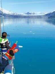
Lots of Stuff in the Water – During our first trip up north we happened to be there when the rivers were high and the tidal swing was large, this combination put lots of logs and sticks in the water. At times it was hard to get through and we had to slow to an idle. Also, north of Petersburg, it is common to find icebergs, especially near the mouth of glacial fjords.
Weekly Provisioning – The long distances and the spectacular sightseeing create routing where stops at towns with good provisioning will likely be 7 to 10 days apart. So, plan meals and storage accordingly. This also applies to fuel.
Weather – Some years are great, some are not. So, be prepared for wet and/or windy conditions as they will happen, but fortunately are not usually the norm. We found, in general, the daytime temperatures in May and June to be in the 50’s and 60’s – not really all that cold. Some days and most nights were cool, so the furnace got its share of use.
Sailing vs. Motoring – During both trips we sailed about 10% of the time and motored the rest. This was caused by two factors, there was not much wind and we needed to travel 50 to 75 miles per day. An added obstacle to sailing was the geography of the inside passage – when the wind did blow, it was on our nose or stern, neither one truly good for making way. Many days we would sail for a while, enough to get our fix, and then motor to get to port. And, we did a fair amount of motor sailing.
Changing Plans – Having some flexibility in your scheduling is a good idea. For example, we built some ‘weather days’ into our schedule around the two ocean crossings (Queen Charlotte and Dixon Entrance). And if the winds are blowing, staying put for a day or two will range somewhere between a good idea and completely essential. On the other hand, if you get some really nice weather it would be a good time to see Glacier Bay, Tracy Arm, or the Misty Fjords. These areas have spectacular scenery and are best seen when the clouds are not down to the top of your mast.
Provisioning Stops – On our first trip up we planned two days in port to re-provision, do laundry, see the sites, re-fuel, and any needed maintenance. As you might guess, this proved to be a bit of a panic. During our second trip we scheduled at least three nights for these stops and found they shifted from a tiring rat-race to something more enjoyable.
One other hint worth mentioning is to rent a car in Juneau and Sitka. In Juneau the distances are large and there are two worthwhile stops, Costco and the Mendenhall Glacier. In Sitka, the really good grocery store is a couple miles north of the docks and there are some interesting sites, like the bear preserve. We rented at the airport in both places and I think we saved enough by buying in bulk to pay for the rentals. At most of the other main stops, the stores are an easy walk from the docks.
Transiting Canada – The route to Alaska goes through Canada so know the rules on what you can take. Waggoner has a good article on clearing customs. In fact, Waggoner has many good articles; there are general ones in the front forty-or-so pages and ones on specific areas, such as rounding Cape Caution, located near the area’s section of the guide.
Start Early – During most summer days the winds are calm at night and build during the day. Then as the sun starts to go down they are dying again. When this pattern is in place leaving early, meaning like 4 AM, is a good way to avoid rough waters. This is most useful when doing the two ocean crossings or on some of the main straits in Alaska, all of which can get very lumpy.
Hopefully, this information will be helpful. I am sure I have forgotten many things, so feel free to send in a letter and let us all know about your trips and what you have learned.

Mike Huston is an ASA instructor, Flotilla Leader, and Partner at San Juan Sailing in Bellingham, WA.