In our latest destinations installment courtesy of SalishSeaPilot.com‘s Jim Burgoyne, we discover what makes Pruth Bay so special.
and beyond to Fitz Hugh Sound.
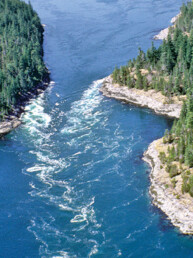
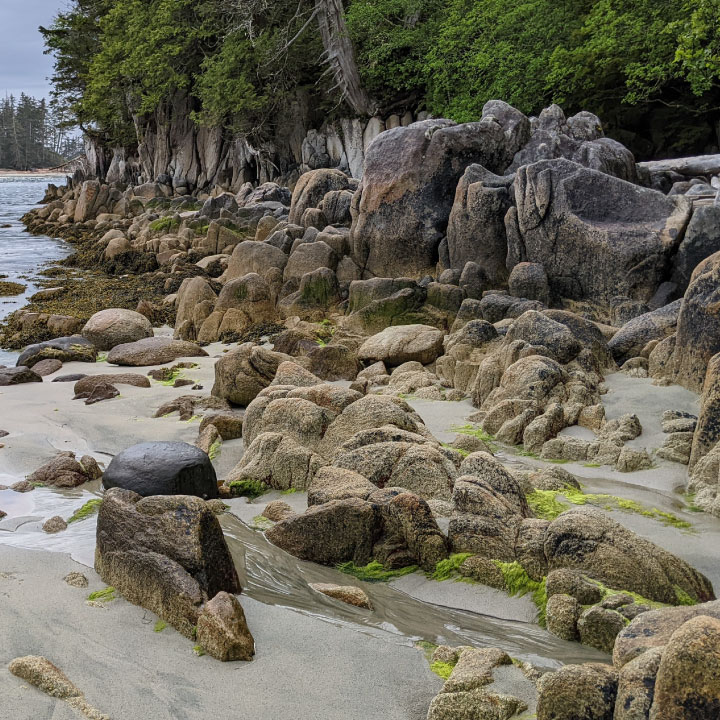
Pruth Bay, some 36 nautical miles north of Cape Caution, is one of the region’s gorgeous anchorages, with stunning views off the western shore, fine sand beaches and inspiring hiking trails.
The prospect of getting here is daunting for some. It is officially on the central coast, a glass ceiling for boaters who have not made the leap around Cape Caution. The central coast, south of Shearwater, is for all intents and purposes an extension of the Broughton Archipelago in the sense that there are many anchorages providing excellent protection.
North of Shearwater is another matter, with long hours spent transiting Princess Royal and Grenville channels and other passages, both beautiful and monotonous, and often mile after mile between secure anchorages.
So let’s say you round Cape Caution on a calm, pleasant morning and make your way to Fury Cove, or to one of the other lovely and secure anchorages nearby. From Fury Cove, it’s another 20nm north to Pruth Bay, at the end of Kwakshua Channel which narrowly slices between Calvert Island and Hecate Island.
Some quicker vessels in a single day can travel to Pruth Bay from Port Hardy (66nm) or from one of the anchorages southeast of Cape Caution, like Allison Harbour (51nm). Coming from the north, Pruth Bay is 38nm from Shearwater.
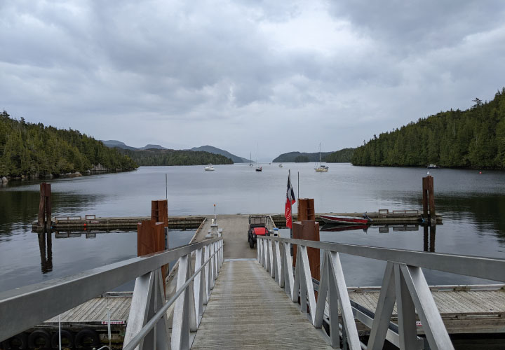
Overlooking Pruth Bay is the Hakai Institute, a scientific research, teaching and meeting center that specializes in ecological research and has active research programs in archaeology, earth sciences, terrestrial ecology and marine ecology. It has partnerships with neighbouring First Nations peoples and local schools, as well as government agencies and universities.
Excellent anchorage is found off the institute’s pier or in coves to the north and south of the western end of the main channel, as well as in Keith Anchorage about 1.5nm from the pier. We have yet tested all areas of the the anchorage, but we found good holding and reasonable depths about 100 meters off the pier. It can be a busy anchorage convenient distances from the pier as the anchorage is a popular waypoint for many vessels transiting Fitz Hugh Sound during the high season.
Another nice touch is that the institute has public WiFi. We had to come ashore to get connected, but your results may vary if you have a booster, which we do not.
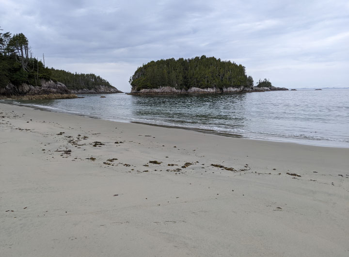
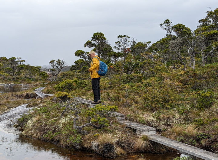
Dinghies are welcome to tie up at the dock and walk the trails across to the beaches on the northwestern shore of the Calvert Island.
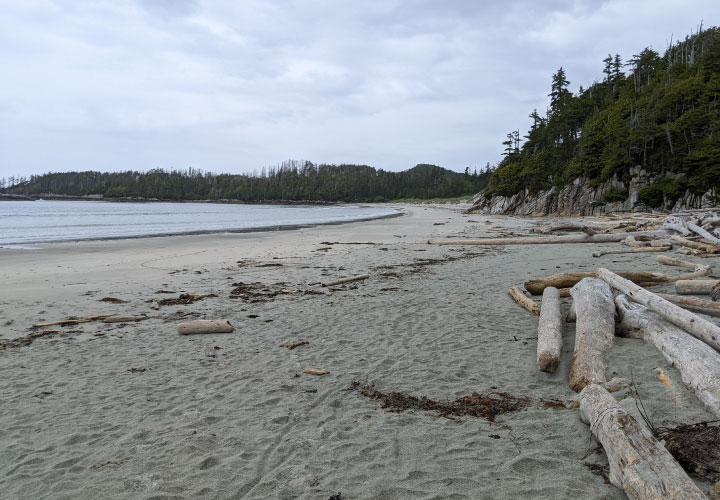
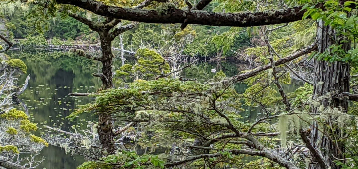
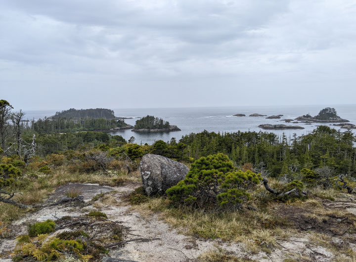
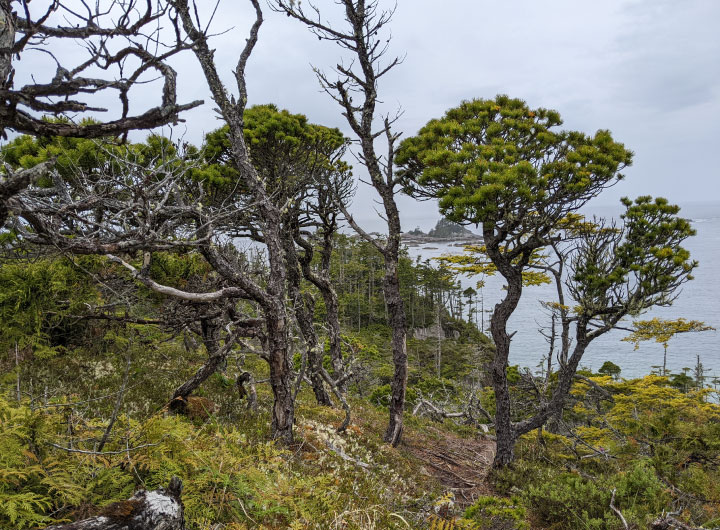
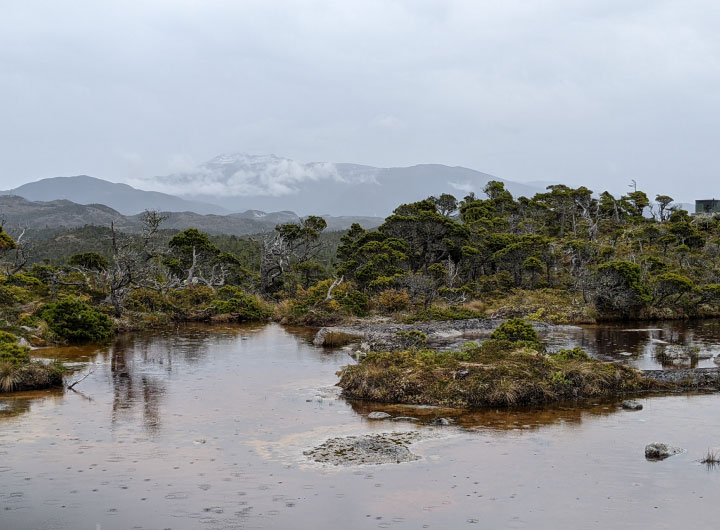
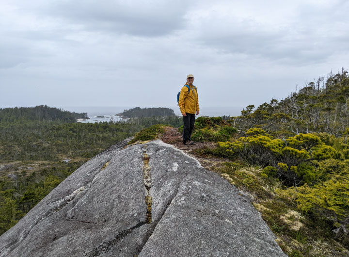
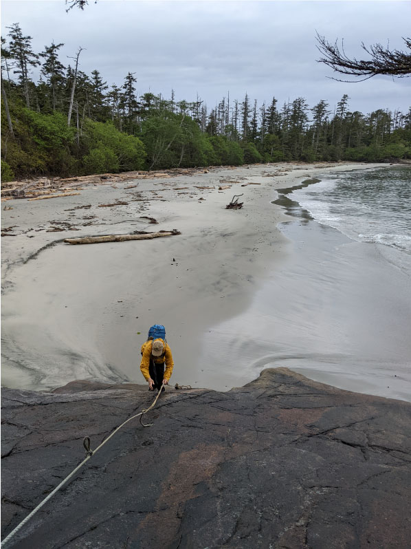
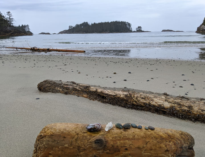
Here are found eight beautiful beaches, including the large North Beach and West Beach, as well as six more which are like links in a chain to the south, the beaches becoming more challenging to access as you move down the chain. Trails also climb into the hills overlooking the ocean and past freshwater ponds which are alive with creatures and are not to be missed.
It takes the better part of a day to walk the trails and all the beaches, each somewhat different from the last. The effort is rewarded with special memories.
And when you are done, and rested, you could visit the waterways and islands of Hakai Passage, just north of Hecate Island, where the fishing has a reputation on the spectacular side.
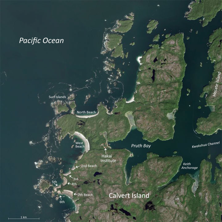
We added some text to identify nearby waterways, islands and beaches.
At the north end of the beach is a trail that leads to North Beach.
the small white smudge is actually a swan.
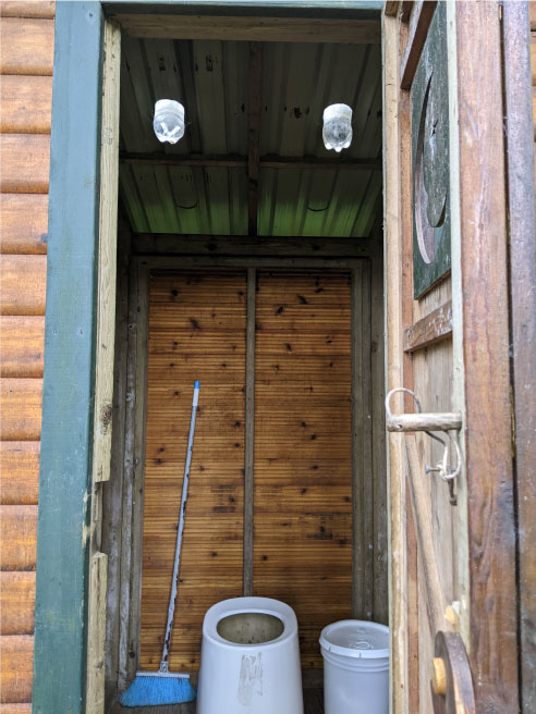
was this outhouse in which Coke bottles filled with water
were installed as skylights.
Note: This post was originally published on SalishSeaPilot.com.