 Photos by Karen Johnson.
Most boaters visit the northern half of the West Coast of Vancouver Island as part of a counterclockwise circumnavigation, heading down the coast from north to south. This article is written with that in mind. Moreover, we’re now entering the most common window—late June to the first weeks of August—for this quintessentially adventurous voyage, considered by many boaters to be the ultimate Pacific Northwest boating challenge. Reverence for the undertaking and the rugged beauty of Vancouver Island’s West Coast notwithstanding, many may be surprised to hear there are some outstanding hikes to be had along the way. Here are some of our favorites on the northern half of the island.
SEA OTTER COVE
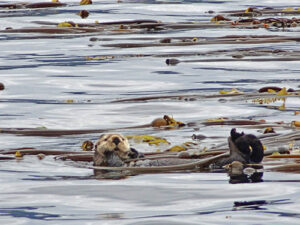
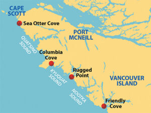
The first protected anchorage you come to after rounding Cape Scott and heading south down the coast is Sea Otter Cove. Some people skip it, in part because of the tricky entrance, but it is more than worth the stop. There isn’t as much anchoring room as you might expect, as the larger part of the cove dries at lower tide. But there are several public mooring buoys suitable for large fishing boats during major storms. The buoys are so large that tying to one from a small boat presents its own challenges; but once tied you are totally secure.
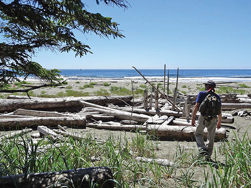
The hike from Sea Otter Cove to Lowrie Beach forms the pattern for many great hikes along this coast: anchor in a protected bay around a corner from the ocean, walk across the intervening land to an ocean beach then hike the beach. From the trailhead near the head of Sea Otter Cove a one mile trail that is crudely marked with surveyors tape crosses low land to Lowrie Beach. Much of it is marsh, so rubber boots are definitely the recommended footwear.
And what a spectacular beach it is—beautiful white sand open to the full force of the Pacific Ocean with Cape Scott in the distance. We were awestruck when we first saw it. At its southern end is a small emergency shelter cabin for any mariners that might be shipwrecked on this beach. When we were there we saw no flotsam or other sign of human presence and no footprints other than our own. And at that time, the water and beach were covered with by-the-wind-sailors, a jellyfish-like sea creature we had never seen before. For us, this was one of those magical hikes and an awesome introduction to the truly remote West Coast of Vancouver Island.
COLUMBIA COVE
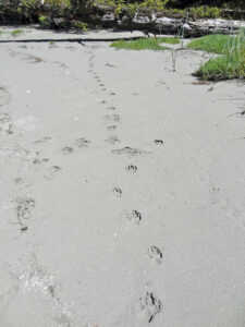
Columbia Cove is at the southeast corner of Brooks Peninsula and it is the perfect place to stop after rounding the Peninsula from the north. There is anchoring room for five or six boats, more than you are likely to see in this remote place. The only downside is the constant wind coming off the high Brooks bluff overlooking the cove. There was a relentless 15-knot wind here, even when it was calm just outside the cove. And even though it was sunny in the cove, we never saw the top of Brooks as it was shrouded in fog the whole time. It’s said that Brooks Peninsula makes its own weather and, from Columbia Cove, we could see that in action.
From the head of Columbia Cove, a trail crosses low and somewhat marshy terrain to a beach on the south side of Brooks Peninsula. Named Shed #4, it is the easternmost of the southern Brooks beaches and collects large quantities of driftwood and flotsam of all kinds. We didn’t find any glass floats but we did find large amounts of styrofoam, which we unfortunately had to leave there. The beach is also a popular surfing site—at least as popular as could be expected for a beach on the Brooks Peninsula—and one person from a neighboring boat did carry a board to the beach.
RUGGED BEACH
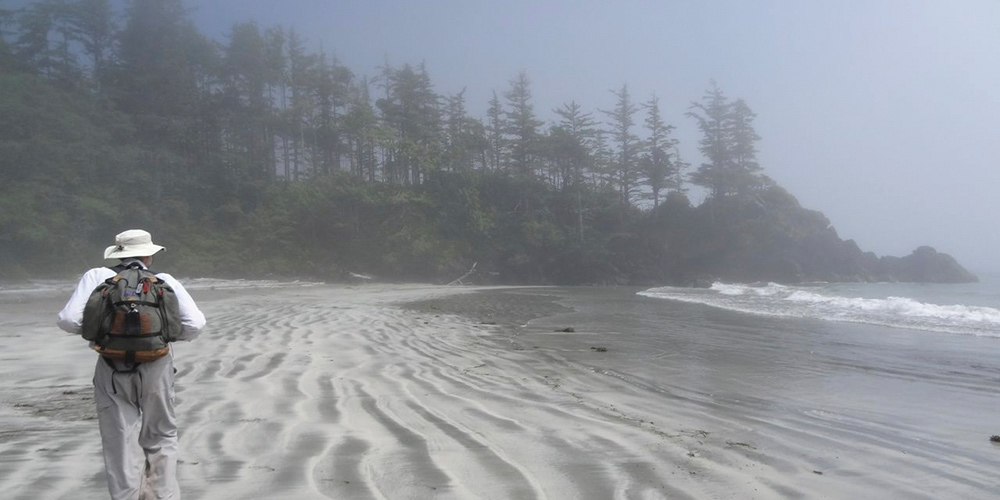
Located at the southwest corner of the entrance to Kyuquot Sound, the Rugged Beach anchorage is a shallow bay, fully open to the northeast and exposed to ocean swells wrapping around Rugged Point. We anchored in the bay, being careful to avoid the reefs, just for the hike out to the beach. We didn’t stay the night, weighing anchor after our hike and moving to a more secure location farther into the Sound.
Like other hikes on this coast, a path from the anchorage demands only a short walk as it leads to a sandy ocean beach. This hike had more actual trail than some of the others, which were often marshy; definitely nice for a change. When we were there, the weather was beautiful in the anchorage but foggy at the beach. Such is the nature of the West Coast, completely different conditions at two places within half a mile of each other.
FRIENDLY COVE
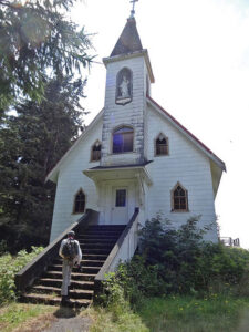
Friendly Cove, in Nootka Sound at the southeast corner of Nootka Island, was the original meeting place between the late eighteenth century Spanish and English explorers, with names like Quadra and Vancouver, and the First Nations people of the West Coast. It is still a First Nations community and has much to offer. The cove has plenty of room to anchor and the protection is good. We prefer to stay at the small public dock just for the convenience because there are a lot of different things to see and do in Friendly Cove.
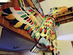
Our first walk is to visit the caretaker, pay our dock fees, and get information on the local attractions and especially the church. From a stained glass window depicting the first encounter with Europeans to the iconic First Nations house poles and carvings—the beautiful decorations inside are totally unexpected in a Catholic chapel. It is definitely an enlightening church to visit.
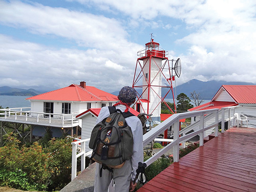
Jumping ahead to the modern, we would take the walk to the light station that is one of the last manned light stations on the West Coast. The keepers love to chat and tell you about their job and their life there. It doesn’t seem to have changed all that much from a hundred years ago, though the helicopter pad does make it a bit less isolated now. We learned that in the service, Friendly Cove is the location most in demand, so it is manned by keepers with the greatest seniority. We could definitely see why.
For a real hike, head for the beach. The first part of the trail heads north through a campground run by the local First Nations community before hitting the beach and continuing for many miles. It’s a great beach walk, and even though it doesn’t have the primitive feel of the smaller beaches farther north, we definitely liked that you don’t have to walk through a swamp to get there. Friendly Cove feels very civilized after those more remote hikes.
The West Coast is a uniquely rewarding boating and hiking experience that all adventurous Pacific Northwest boaters should consider. If you’re planning a circumnavigation of Vancouver Island, seek out our column in the December 2025 issue of 48° North that offers hike suggestions on the southwest coast, making it a good companion to this article for those completing their counterclockwise cruise.
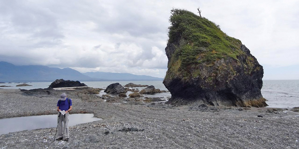
 Michael and Karen have been cruising the Salish Sea and beyond for more than 20 years, hiking every chance they get. For more resources for hikers visit their web site at mvmischief.com/library/