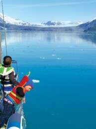
The northern half of Vancouver Island’s West Coast has long been the domain of those with the time and spirit to do a circumnavigation, and these rugged and remote destinations are undeniably special for that reason. On the other hand, Clayoquot and Barkley Sounds in the southern half of the island can easily be reached from Puget Sound without committing to a circumnavigation; just head west out the Strait of Juan de Fuca. It’s even easier now that there is a marina in Port Renfrew to break up the long haul between Sooke and Barkley Sound.
Here’s the exciting part: we find these more accessible West Coast cruising grounds every bit as amazing for boaters. It won’t be surprising for regular readers, but part of that draw for us is the presence of some outstanding hikes along this stretch of coast. Here are a few of our favorites in the southern half of the island, from north to south.
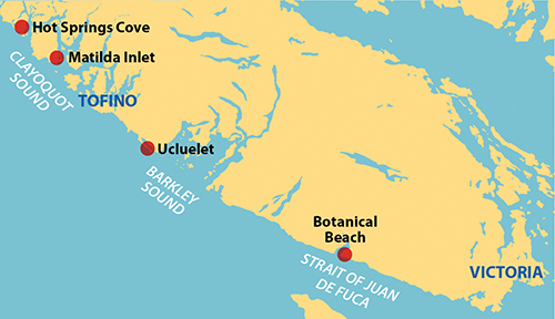
HOT SPRINGS COVE
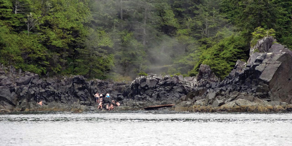
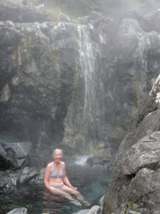
Hot Springs Cove is a narrow inlet just off the ocean at the northern entrance to Clayoquot Sound. As you turn in, you can see the steaming hot springs waters falling over the rocks into the inlet and, about a mile farther, a public dock where the inlet widens. We like to anchor in this wide area, but not close to the dock.
Hot Springs Cove has become a tourist mecca. It’s not the passing cruisers, but rather the steady stream of tourists coming from Tofino by high speed boat or float plane and landing at the dock throughout the day. This all comes to an abrupt end at about 6:00 every evening, the perfect time to disembark and dinghy to the dock.
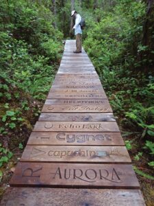
While it’s fair to be focused on the dreamy and steamy destination, there’s a lovely walk to enjoy getting to and from the hot springs. From the dock, a path leads a mile south to the hot springs—much of which is boardwalk with boat names carved into the boards. We stopped at the changing shelter and left our boots and socks then climbed down to the hot water.
There is actually a stream filled with hot water that tumbles over a waterfall (hot shower time but no soap, please) and through a series of pools before entering the inlet. If the tide is right, the lowest pools may fill alternately from the hot stream and the cold inlet making for a unique experience. Wonderful. And we had it to ourselves for almost an hour.
When we got back to the shelter I found one of my boots was missing. A search was undertaken and we found it in the bushes not too far away where no doubt some small animal had dragged it. It seems even the popular hikes can have wild encounters here on the West Coast.
MATILDA INLET

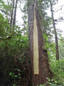
In the southeast corner of Flores Island, Matilda Inlet has several points of interest for the passing boater. About halfway down on the west side of the inlet is the small community of Ahousat with a long public float, general store, and fuel dock. It’s worth a stop, if only to talk to the residents. A bit farther along, the inlet divides with the eastern arm leading to the First Nations community of Marktosis. The western arm continues to an anchorage at the head of the inlet. Anchoring can be tricky since much of the water you see is too shallow at low tides. But if you consult the chart and your depth sounder, you won’t find it too difficult. The holding is excellent.
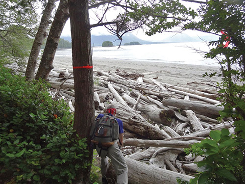
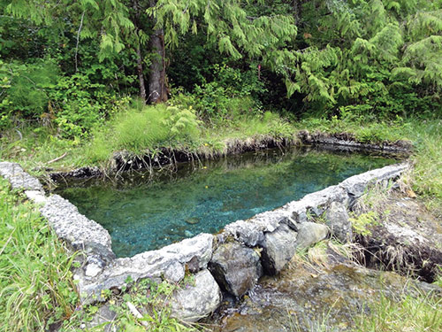
The trailhead near the anchorage is easy to recognize; there is a large stone and concrete basin that is supposed to contain lukewarm, sulfur spring water, though it was pretty cold and stagnant when we were there. You are now in Gibson Marine Park. Following a common pattern on the West Coast, a short trail goes through woods and marsh, with many of the wettest places covered by boardwalk. After a half-mile this primitive access trail ends at a beautiful, wide curving sand beach on the ocean at Whitesand Cove. This is the junction with the Wildside Trail which can then be followed along the shore in both directions. The trail to the east ends in the village and the much longer trail to the west ends at Cow Bay. This latter section includes a crossing that must be done at low tide (or a long, difficult detour.) You may meet other people here since there is a primitive campsite for kayakers at the eastern end of Whitesand Cove. If you’re here in August, it could very well be foggy.
UCLUELET
Located at the northwest entrance to Barkley Sound, the town of Ucluelet is both a major destination for tourists coming by road from Victoria and a very welcoming stop for West Coast cruisers. There is plenty of room to anchor near town but we prefer to tie up at the Small Craft Harbour which has good facilities and is only a short walk to the center of town, and an even shorter walk to the local coffee shop.
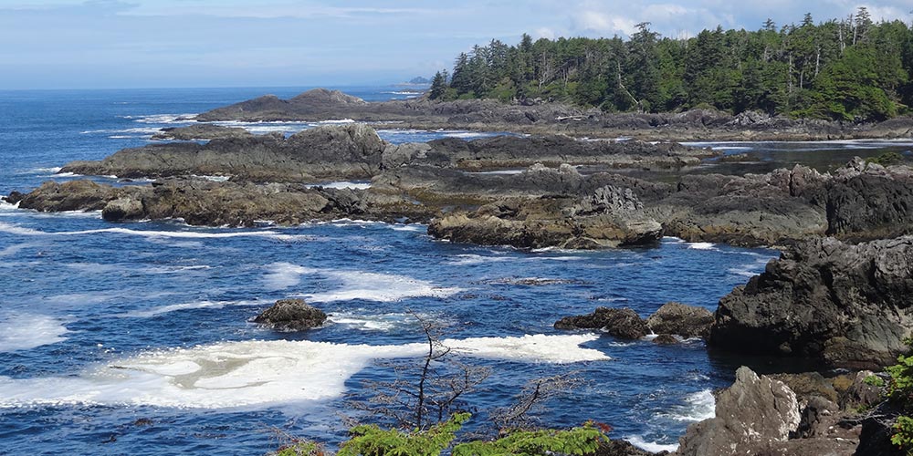
From the marina, it’s only a few blocks’ walk on city streets to the ocean side of town. But this time, it’s not a beach but a developed trail called the Wild Pacific Trail that mostly meanders along the top of cliffs overlooking the ocean. Trail sections called Artist Loops provide access to particularly scenic overlooks and even storm-watching decks. We like walking it from both directions since the views are always different when you are looking over your other side.
At the south end, separated from the main trail by a road walk, is a loop around Amphitrite Point that includes passing the lighthouse. Since there is a public road almost to the light, this section is often crowded but worth the walk for the fantastic views in almost every direction.
From the start of the loop around Amphitrite Point to the trail’s north end is about 5.2 miles, not including the 1.5 mile necessary road walk separating the north and south sections. But there are many access points along the trail so you can easily do only part of it at a time. In fact, we like doing the north half one day and the south half another. Between the city amenities and the great trail, Ucluelet is always a worthy stop for West Coast cruisers.
BOTANICAL BEACH
Port Renfrew, located off the Strait of Juan de Fuca about half way between Sooke and Barkley Sound, is remote enough that only a West Coast cruiser would be likely to come here. Which is why Botanical Beach, located just east of the entrance to Port Renfrew, is included in this list, even though it isn’t strictly on the West Coast.
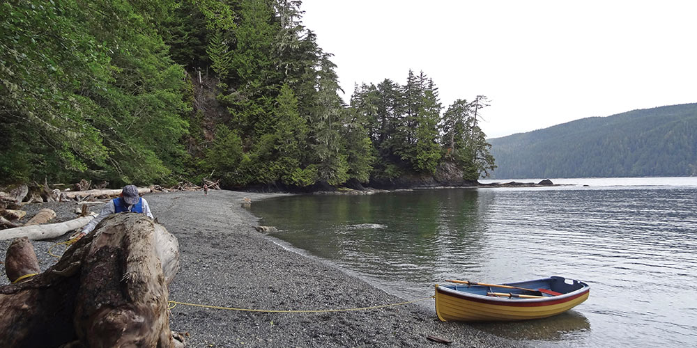
Botanical Beach is a popular destination by car from Victoria, but getting here by boat is another matter. The inlet of Port Renfrew is uninviting, being completely open to the southwest. One possible refuge is the new Pacific Gateway Marina at the head of the inlet on its southeast shore. The other, which we’ve used, is a small one-boat anchorage called Mill Bay, located behind the Woods Nose group of islets. From here, the Mill Bay Trail leads to a road which ends at the Botanical Beach parking lot and the loop trail to the beach. From the marina, it’s a bit longer.
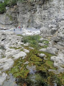
Botanical Beach offers one of the best places to view intertidal marine life on Vancouver Island. It’s a must-visit destination at low tide. You can walk a long way out across flat sandstone and granite outcroppings with tide pools filled with multi-colored sea stars, urchins, anemones, sea cucumbers and more. So significant is this location that a research station was first established here in 1900. Though visiting here by boat is challenging, it remains one of our most loved walks when cruising the West Coast.
From Mill Bay it’s a bit over a mile to the Botanical Beach parking lot; from the marina it’s around 2 miles and you might be able to schedule a taxi. The loop trail from the parking lot to the beach is about 1.9 miles, longer for true beach explorers. The tide should be 4 feet or less for the best tide pool viewing.
Whether circumnavigating or heading west from Puget Sound via the Strait of Juan de Fuca for an out-and-back voyage, there are rewards aplenty along this beautiful and inviting southern section of Vancouver Island’s West Coast. You won’t regret your choice to venture out and enjoy the many anchorages and hiking opportunities that it has to offer.
Michael and Karen have been cruising the Salish Sea and beyond for more than 20 years, hiking every chance they get. For more resources for hikers visit their web site at mvmischief.com/library. Photos by Karen Johnson.