Talk to any sailor long enough and you’re bound to get an earful about one topic: weather. Or more specifically, the wind. It makes sense that we would concentrate so enthusiastically on where the breeze will come from tomorrow, the next day, the day after that, and beyond. It’s what allows us to move under sail, or it stops us in our tracks while we wait for a more favorable wind to carry us on toward our next destination. When discussing the wind and how we’re going to use it to get from place to place, a term you often hear repeated is “weather window.”
For mariners of all stripes, a weather window refers to a period of time when the weather conditions you’ll be sailing in are appropriate to complete a passage. Understanding what weather is coming your way and then using that knowledge to either make the passage, alter course, or wait to avoid storms and potentially rough seas is paramount to the safety of your vessel and crew. As recreational sailors, choosing the right weather window also makes sailing and cruising more comfortable and enjoyable. Perhaps even more important in our experiences cruising on our Grand Soleil 39, Yahtzee, has been the ways that learning to be savvy with weather windows has unlocked cruising routes and opportunities that lead us away from some of the most well-traveled conventional paths.
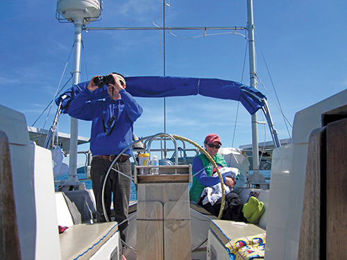
I should say here that I am not a professional meteorologist, but as an experienced sailor, I’ve been finding weather windows for a long time to get from point A to point B. When looking for a weather window along a route I’d like to take, I think about these major factors: Wind speed and any potential shift in velocity or direction; wave heights; tides and currents; the likelihood of encountering inclement weather or fog; amount of daylight; and whether or not the barometric pressure will be steady, rising, or falling. Then, as I’m watching these variables play out in real time, I’m open to abandoning the route altogether or making changes to the plan if needed.
Fortunately, in the past decade or so, technology has vastly improved to make weather routing and predicting weather patterns much easier for the average sailor. While I do look at and interpret GRIB files, weather maps, and forecasts, my main tools lately are the apps Predict Wind and Windy. Both offer vast amounts of information about the factors I mentioned above, and I’ve gotten to the point where I know when to trust certain models or predictions, and when to wait for more information. Generally speaking, if the various weather models that you’re looking at don’t agree, the uncertainty raises a red flag and makes me more cautious. Despite all these helpful advancements that we have at our fingertips, boaters (perhaps especially those in the Pacific Northwest) know that nature remains unpredictable, the sea is always changing, and unexpected shifts in weather patterns can, and do, occur.
Before I contemplate any weather window, though, I’m thinking about what the ultimate goal is. Where am I now and where do I want to go, and what do I want that experience to be like? Am I willing to sail part of the passage upwind or am I committed to a window promising a reach or run the whole way? Sometimes you can’t have it all. A long, windy upwind passage will be hard on any boat, but it’s even harder on the sailors who are trying to eat and sleep while bashing into waves at any heeling angle over about 10-20 degrees. So, crew comfort typically determines the lens at which we look at weather as much as anything else.
Then it’s a question of how far it is and what is the timeline to get there? One of the major keys to planning a route and choosing a weather window is to think about your schedule. Do you have one and, if so, how flexible can it be? This last part is where I’ve evolved most as a sailor in the past 10 years or so. We’ve waited weeks or months in places like Alaska and Colombia for the seasonal shift to bring the conditions we were looking for. No matter how long the passage, being patient and selective about when to go and when to stay has paid off for us.
Short Hops
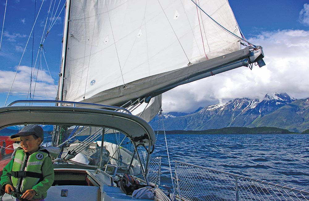
After years of sailing on the Great Lakes, East Coast, and Caribbean, my wife Jill and I moved to Seattle in 2012 and bought a sailboat to start cruising the waters of the Pacific Northwest. One of the things that we were initially surprised by was how many wonderful destinations were so close to the marina where we lived. We started making short hops on the weekends and figuring out the weather patterns and tides of Puget Sound was a learning process.
At first, we kept our range from Shilshole Bay Marina relatively small and found so many incredible places to visit nearby. Kingston to the north, downtown Seattle to the east, Blake Island to the south, and Poulsbo to the west created a sort of skewed-rectangle-shaped cruising area that we started to explore. Experience quickly taught us that we had to pay close attention to the wind forecasts and tide tables, even for trips of less than 10 miles.
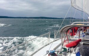
One early spring weekend, after a lovely Friday and Saturday spent at Blake Island, we went to head back to Shilshole on Sunday and were met with a ferocious northerly breeze meeting an ebb tide. The wind against tide situation kicked up lumpy seas that were close together and, while the beat wasn’t far, it wasn’t fun, either. It ended up being an excellent learning experience, because even though I’d seen the forecasted northerly for Sunday, I didn’t think it would be so strong. Cold wind moving swiftly over chilly water going running the opposite direction packs a punch. I remembered that lesson.
With that forecast, it might have been better to have gone north first and then ride the wind back. Or we could have sailed across the sound to the top of Bainbridge Island and then reached home more comfortably. After that weekend trip, I decided to take a local “weather for mariners” course and to find different sources of weather information to help our short hop cruising strategy be more successful. It helped immensely, and I soon felt confident broadening our horizons beyond our Central Sound cruising bubble.
Medium Hops
From our short hops in central Puget Sound we started making medium hops farther north and south. Gig Harbor, Tacoma, Olympia and the South Sound, Port Townsend, the inside of Whidbey Island, and the San Juan and Gulf islands all took a bit longer to reach and finding weather and tidal windows in every season was important. When we started stretching our legs, we were also pushing the boundaries of our schedules ashore, which is inadvisable when cruising. So we learned to keep our plans reasonable to alleviate the stress of having to push through a bad weather window or potentially getting stuck somewhere.
When heading out for these longer cruising adventures away from our homeport, I understood that we could plan, but we also had to take the weather as it came. Weather forecasts are most reliable within a 72 hour period, outside of that, it starts to get more variable. Accordingly, we planned our medium hops carefully and linked them up to make longer trips. We didn’t stick to hard-and-fast destination decisions outside of the 72 hour window and, when possible, we had several suitable anchorages or ports in mind should the weather change and we needed to duck in somewhere.
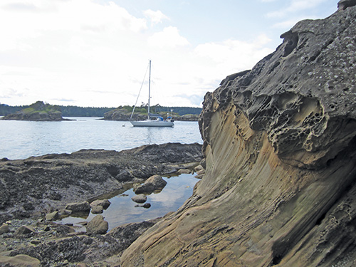
On one two-week trip to the San Juans, we caught an excellent weather window to get north to Port Townsend and then across the Strait of Juan de Fuca in a southerly. Once we got to the islands, the weather deteriorated for a few days and we tucked into anchorages that best fit the weather. When it was time to head back south, we started watching the weather well in advance and the best option was to leave slightly earlier than planned and head to Anacortes, then down the Swinomish Channel, inside Whidbey Island to Langley, and back to Seattle. It worked like a charm. In essence, we learned to remain flexible and found more joy in cruising because of it.
This is an aspect of cruising in the Salish Sea that is particularly special. In addition to selecting appropriate weather windows, there are often multiple routes offering alternative experiences, protection from wind and waves, more or less current, and a different array of hidey-holes to take cover in, should you need it. Still, you have to plan wisely to make it all work.
Large Hops
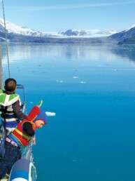
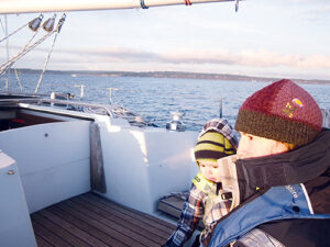
After almost two years of doing these short and medium hops, and with two kids in tow at this point, we cast off Yahtzee’s dock lines for full-time cruising. Now able to travel much farther, weather windows became an even more important part of the lifestyle. During trips to Desolation Sound and around Vancouver Island, we learned a lot about when to go, when to stay, and when to just call it a day if the weather changed. While tacking up Queen Charlotte Strait in a brisk northwesterly, we made the snap decision to seek a calm anchorage in Booker Lagoon. Such a relief after what turned out to be a long day. And before rounding the notoriously boisterous Nahwitti Bar at the top of Vancouver Island, we waited in nearby Bull Harbour for the right wind and sea conditions to make the rounding.
During the winter months, we kept it short and cruised the San Juan and Gulf islands. It was here that we gained an acute understanding of the seasonal weather patterns far more intimately than while living in the relative comfort of a marina.
This was before the Windy app was really a thing, and GRIB files and weather information from NOAA and Environment Canada were essential to picking the right windows. If we needed to stay put for days at a time, we did. And when it was time to go, we made miles. During this time, we started to seriously plan our voyage to Alaska and to think about routes and what weather windows would be absolutely necessary for a safe and mostly fun trip north.
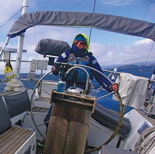
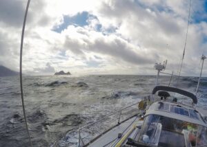
What we settled on was an unconventional route out the Strait of Juan de Fuca, up the west coast of Vancouver Island to Haida Gwaii, and then on to Southeast Alaska. The idea to go outside spawned shortly after we circumnavigated the island. It was summer then and the north and west winds were prevalent, yet we knew that spring southerlies on the ocean could present an opportunity to ride north. Sure, the seas might be larger, but we’d actually have wind. If we took the inside route, the winds would be far more variable and we’d likely need to motor more, especially in narrow, current-swept channels. To us, potentially waiting for weather windows and sailing more sounded much better than potentially signing up for long days under power. Outside it was.
We left Victoria in late March 2017 on an unusual easterly wind and ebb tide that flattened the seas through Race Rocks and spit us out to Barkley Sound. The first weather window had worked. Once there, we endured two days of wind and rain before beautiful spring weather settled over the region. Closely following the forecast, though, we knew a big spring southerly was coming so we got a slip in Ucluelet to wait for the tail winds and to top up on food, water, and diesel.
Then, using the southerly winds as the storm passed the island, we made hops up the coast. Again, by waiting for the right moment, the window worked out. From Quatsino Sound on the top of Vancouver Island to Haida Gwaii and then to Alaska, we successfully used this stop and go method and ended up only encountering light headwinds for about 90-miles of the entire passage. Overall, the nearly 800-mile journey north took a month, but by being patient and not sticking to a schedule, we got a bigtime education in playing the weather to our advantage and enjoying the rewards. Little did we know, this would pay off over and over in the years to come.
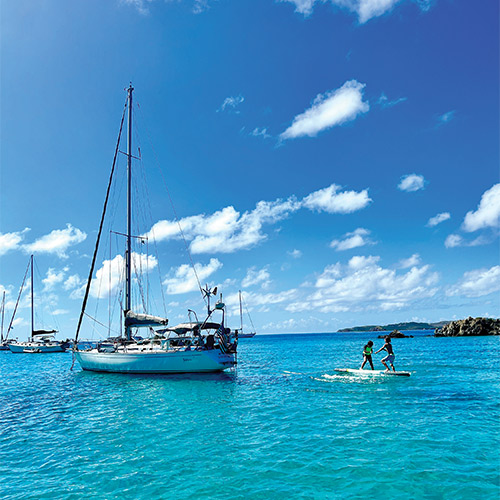
Now, seven years later, as I write this from Yathzee’s nav desk in a beautiful bay on the east side of St. Thomas in the U.S. Virgin Islands, I can say that the experience we gained in the Pacific Northwest and Alaska was incredibly profound. Fighting the infamously strong easterly trade winds that flow across the Caribbean Sea was a tall task, and making those small, medium, and large hops in the most favorable conditions possible was critical. From Panama to Colombia, Aruba, Curaçao, Puerto Rico, and now the Virgin Islands, it wasn’t always easy, but by employing what we learned all those years ago, it has been doable and became almost routine. Our boat and family can handle it, we typically know what to expect on passage, and we have appreciated the new routes that have been unlocked by this approach, which feels like a priceless education.
Andy Cross is the editor of 48° North. After years cruising the Pacific Northwest and Alaska with his family aboard their Grand Soleil 39, Yahtzee, they sailed south and are currently in the Caribbean Sea. You can follow their adventures at SailingYahtzee.com.