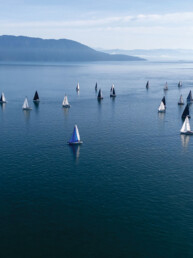
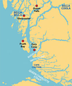
 The Central Coast of British Columbia is the region between Cape Caution—approximately opposite the northern tip of Vancouver Island—and the Alaska border at Dixon Entrance. Part of the Great Bear Rainforest, this remote and wild land of deep inlets is an ambitious and self-reliant cruiser’s paradise with narrow channels and a multitude of islands offering tantalizing itineraries—we’ve always cherished our adventures here. There is little access beyond the shoreline except for logging roads, but there are notable exceptions that include some outstanding hikes we have taken many times.
About half way up this coast is the First Nations community of Bella Bella, the Central Coast’s only sizable population center and its only grocery store, along with the nearby resort of Shearwater with its pleasure boat marina and boatyard. This article has some of our favorite hikes in the southern half of the coast, between Cape Caution and the Shearwater/Bella Bella area.
FURY COVE
Whether northbound or southbound we always take Cape Caution seriously. We know we will be exposed to the open Pacific Ocean with wind and waves mostly on our beam. Since I really don’t like being seasick, we wait for decent weather and dash between protected anchorages. More often than not, Fury Cove on Penrose Island, at the northern entrance to Rivers Inlet is one we choose. It is about 55 miles from Port Hardy. Traveling north from there, you won’t be exposed to the ocean again until you reach Dixon Entrance and the Alaska border.
Entering Fury Cove is easy, even in rough weather and, once inside, there are a number of possible places to anchor. The cove is marked by a gently sloping white clam shell beach. At this time, BC Parks is requesting that people not anchor in Fury Cove proper, in front of this beach. The on-shore cabin and surrounding wooded area are strictly off limits but camping on the beach is allowed.
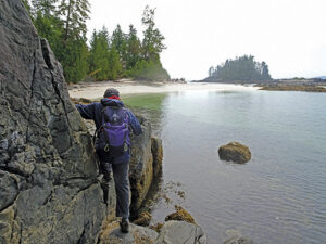
Beyond the clam beach is where the real hiking begins with a succession of small sand and shell beaches facing the ocean and separated by rocky reefs with tide pools and driftwood. Some of the beaches are used as camp sites by touring kayakers. It’s easy to hike to most or all of them so long as the tide is fairly low; but at least one area floods at higher tides. If the tide gets too high you will have to wait; there are no bypass trails through the woods and bushwhacking looks brutal. This is lovely seashore and tidepool hiking, and comes at a welcome moment after the passage around Cape Caution.
PRUTH BAY
At the western end of Kwakshua Channel, Calvert Island’s Pruth Bay is separated from the Pacific Ocean by a narrow strip of land occupied by the Hakai Institute, a natural science research institution. Anchoring is easy, though perhaps a touch deep for smaller boats. We have found crabbing to be particularly good in an adjoining bay to the south. Pruth Bay must be one of the most popular anchorages on the Central Coast; it consistently has a dozen or more boats, which is a large number for an anchorage in this area. Here, it’s all about the hike.
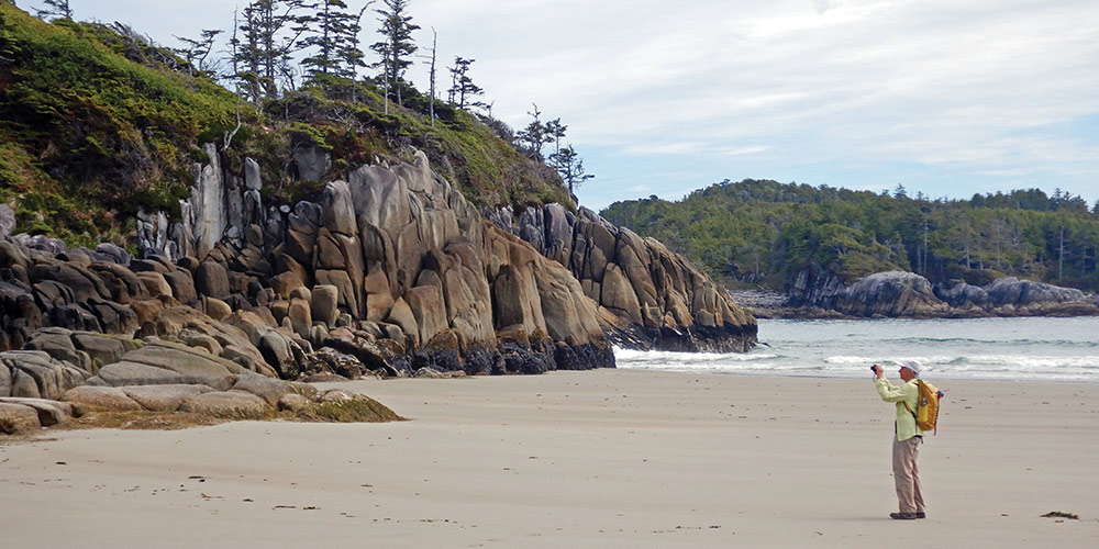
Although the Hakai Institute land is private, they allow visiting boaters to tie dinghies to a designated area of their dock. At the head of the dock is an information board with their guest WiFi details and a map of the hikes. You can then walk the designated path through their property to the first beach—and what a beach it is. The short, level, quarter-mile trail ends at large, crescent-shaped and sandy West Beach. It’s a beautiful place and many boaters stop here; some even swim. But for us, the BC Parks maintained trails are the main attraction.
One trail crosses the headland at the north end of the beach and, passing Hood Lake along the way, ends at North Beach after half a mile or so. Walking is fairly easy with marshy areas covered by boardwalk and steep sections supplied with stairways and/or hand ropes. At the south end of West Beach, a much longer trail connects to a succession of six more beaches, each with its own character. The trail is lined with a profusion of bunchberries, some climbing into nearby trees and each beach has its own type of stones above the sand. It’s about 1.5 miles from West Beach to 7th Beach. Again, stairs and hand ropes supplement the trail in the steeper parts.
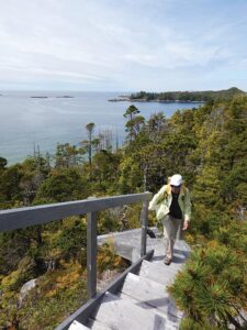
Along this south trail, between West Beach and 2nd Beach, a short spur trail intersects the main trail. It leads to a communications tower located on nearby Lookout Hill. Not only are the 360 degree views outstanding, the area surrounding the tower is a kind of alpine zone of exposed rock, dwarf trees and shallow tarns—all at only 150 feet above the sea. This is hiking at its very best.
OCEAN FALLS
At the head of Cousins Inlet is a tall dam and hydroelectric plant with a small town at its base. This is Ocean Falls. Once a pulp mill and more recently a site for Bitcoin mining, it is largely, but not completely, abandoned and slowly falling down. There is a small pleasure boat marina providing some protection from the typically strong inlet winds; and excellent crabbing, we’ve caught some that have been over 9 inches.

From the marina, there are a number of walking and hiking opportunities. The easiest walk is to explore the town, perhaps getting an ice cream or coffee at one of the few open shops. Nearly Normal Norman’s Ocean Falls Museum is not to be missed; he spent years collecting the things left behind by former residents when the mill closed and the town was largely abandoned. It’s a microcosm of life in the 1930s, 1940s and 1950s. And Norman is great to talk to as he is one of the few long-time, year-round residents of Ocean Falls.
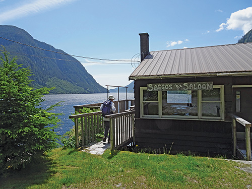
For a short hike out of town, you can take the old road to the top of the dam and then walk along Link Lake for a ways before the trail peters out. But the best hiking is from the community of Martin Valley which is about a mile west of the marina along the road. This used to be a bedroom community for Ocean Falls workers and is now largely vacation homes for avid fishermen. There are hikes up the Martin River and off the Twin Lakes Road, southwest of the village. If your timing is right, you might be able to stop for a brew at Saggo’s Saloon; it’s open three days a week from 4-7 p.m. or until the beer runs out.
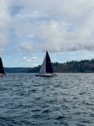
SHEARWATER
Centrally located, the resort community of Shearwater is the only full-service marine center on the Central Coast. It has a marina, fuel dock, restaurant, laundry, convenience store, liquor store, marine store, and boat repair shop with a travel lift, and is owned and managed by the Heiltsuk Nation. Most people traveling this coast stop here for fuel, supplies, laundry, and general shore leave. That can include a very nice hike.
At the head of the ramp is an information board with a map of the area, including the trail to Eddie Lake. It leaves the airport gravel road a short distance from the Shearwater school and initially follows muddy old logging roads. Wolf prints can usually be found here. The mostly-level trail continues south past a couple of lakes for 1.5 miles or so to Eddie Lake and an old cabin, now just a concrete foundation and a mostly collapsed pile of lumber. Along the way, a spur trail leads east to Swannell Lake for a bit of a diversion. The terrain here is mostly open with many bonsai-like trees and a few patches of full size timber. Easy bushwhacking to higher viewpoints can extend your hike as much as you wish.
As remote as it is, the Central Coast has some wonderful hiking opportunities for walker-cruisers of all abilities. A future article will highlight some spectacular hikes in the northern half, from Shearwater to Dixon Entrance.
Michael and Karen have been cruising the Salish Sea and beyond for more than 20 years, hiking every chance they get. For more resources for hikers visit their web site at www.mvmischief.com/library