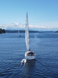
The San Juan Islands are one of the great treasures for boaters in the Pacific Northwest, and that is even more true for boaters who like to go hiking. The large number of state parks and forest areas mean hiking trails abound. Most of them have trail maps posted at a kiosk on shore and are well maintained and gorgeous to boot. I’m sure many readers will have their favorites, but please don’t be surprised if they aren’t here—space is limited so we can only discuss a few. We will share more favorite San Juans hikes in future installments.
For now, as we sail into cruising season with the longest days and warmest weather still ahead of us, it’s a perfect time to dream about and plan where we might hike during our waterborne adventures in the weeks to come. In the San Juan Islands, you can hardly make a bad choice.
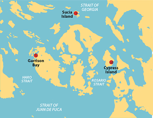
CYPRESS ISLAND
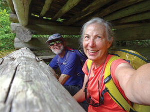
Cypress Island lies on the east side of Rosario Strait, northwest of Anacortes. The Washington Department of Natural Resources (DNR) manages a network of trails covering most of the island that offers many interesting hiking opportunities. For the boater, there are three somewhat sheltered areas on the east side of the island where DNR has placed mooring buoys (free at last visit) and where anchoring is also possible. They are Pelican Beach, Eagle Harbor, and Cypress Head.
Our favorite is centrally-located Eagle Harbor, which has many buoys; though some of them would be too shallow on a zero tide for even a small sailboat. More than once, we have picked up a buoy only to move when one in deeper water became available. All the buoys make for somewhat tight anchoring, so be aware of your swing radius when dropping a hook. Eagle Harbor is well sheltered from westerly winds, but is open to wakes from boats traveling Bellingham Channel, so I consider it an adequate, though not perfect, anchorage.
While the anchorage may not be ideal, the hiking can’t be beat. In Eagle Harbor, the best place for landing a dinghy is at an old log dump on the west side of the harbor. Once ashore, there is an information board with a map of the island’s trails. There are enough to keep you hiking for many days. We never spend less than two days here.
One favorite of ours is the Eagle Cliff Trail, but be sure to note that it is closed between February 1 and July 15 to protect sensitive species habitat. Hiking north past Duck Lake, the trail begins near the north end of the island and heads west, climbing on easy slopes to the top of a tall cliff overlooking Rosario Strait and looking due west to Obstruction Pass. The payoff is superb on a clear, sunny day; less so when it’s foggy. It’s about 3 miles from your dinghy if you take the shortest route.
Another hike we can recommend is up to the Old Airfield—a runway built on a stretch of high ground during WWII, though never used. It is interesting to see how the runway is reverting back to nature and how long the process is taking; it’s been 80 years since construction and the area is still clearly recognizable as a runway. There are several trails leading to the Airfield, but our favorite is the Old Airfield Trail that starts on the east side of Reed Lake. Near the start of the trail, at the northeast corner of the lake there is a low, well hidden blind from which you can watch the wildlife coming to the shallow north end of the lake. Relax, eat lunch and enjoy the view. The airfield is about 2 miles from your dinghy via Old Airfield Trail, but slightly longer via other routes. The elevation gain is about 1,000 feet.
GARRISON BAY AND ENGLISH CAMP HISTORIC PARK
On the northwest side of San Juan Island, off Mosquito Pass, is the entrance to landlocked Westcott and Garrison bays. The entrance is narrow enough and shallow enough that, when we first started coming here, we tried to avoid low tides. Once inside, we prefer Garrison Bay and like to anchor close to the English Camp dinghy dock since our dinghy is human-powered. The bottom is soft mud and the holding is good. We’ve never had a problem here despite the large number of other boats sharing the bay with us during high season. But we are not here for the boats, we are here for the hiking.
Within the English Camp site there are a number of trails, some by the water, some inland. We always take the one to Young Hill with its great views of the Olympic Mountains and the nearby Canadian Gulf Islands. In itself, this is a wonderful hike. But continuing off the back of Young Hill takes you into a network of trails and old logging roads. We have hiked many of these trails but always come back to one that follows a logging road on the west side of Briggs Lake. Midway down the lake is a spur trail that takes you to a beautiful lake overlook with plenty of dragonflies and often bald eagles, osprey, herons, and other birds. No swimming though; the lake is the water supply for Roche Harbor. A loop hike of Young Hill and Briggs Lake is around 5 miles, depending on which trails you take. The climb of 650-foot Young Hill is the most strenuous part. We often plan a route that allows us to climb it twice.
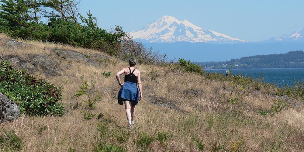
SUCIA ISLAND STATE PARK
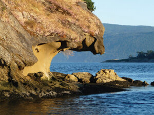
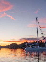
Sucia Island State Park may be the ultimate boating destination for many area boaters. There are many bays with mooring buoys and room to anchor. None of them are perfect—each is open to one direction—but all of them are safe in normal summer weather. Over the years, we’ve moored or anchored in most of them but we have stayed in Shallow Bay on the west side more times than any other, mostly because of the potential for spectacular sunsets. For us, no trip to the San Juans would be complete without at least one visit to Sucia Island.
The island has many fingers and arms with trails that go out to the tips of most of them. Each has its own set of unique views and other charms. We’ve hiked them all, many times, but every time we go it seems we find something new. On one, we saw a newly emerged cicada with bright, sea green wings just getting ready to fly.
On our last trip, we even discovered a trail we had never hiked before; it wasn’t on the published map. It goes around the southwest shore of Shallow Bay and follows the shoreline southeast past Fox Cove to the Fossil Bay campground. It’s about 2 miles one way, a typical distance for Sucia Island trails.
The San Juan Islands are rich with hiking opportunities. All of the state parks and much of the public forest land have trail maps that can be downloaded from the web. A search before you leave home can equip you with maps for more than enough hikes for multiple future cruises. Enjoy!
Michael and Karen have been cruising the Salish Sea and beyond for more than 20 years, hiking every chance they get. For more resources for hikers visit their website at https://mvmischief.com/library/
For additional hiking information in this area Michael and Karen also recommend: Hiking the San Juan Islands by Ken Wilcox and https://sanjuanislandtrails.org/ describing the trails around English Camp.
