The Canadian Gulf Islands are just across the border from the San Juans and are similar in many respects—in the large number of islands, the many marine parks, and the wealth of opportunities for boaters, including hiking. Of course, the Canadian islands and the cruising experiences there have their own flavor as well. Whatever your Salish Sea homeport, there’s a decent chance that some summertime exploration of the Gulf Islands is in your future. Our previous article about boat-accessed hikes in the Gulf Islands from 48° North’s August 2024 issue covered some of our favorite hiking destinations, and here we’ll share a few more.
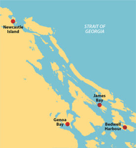
SOUTH PENDER ISLAND’S BEDWELL HARBOUR
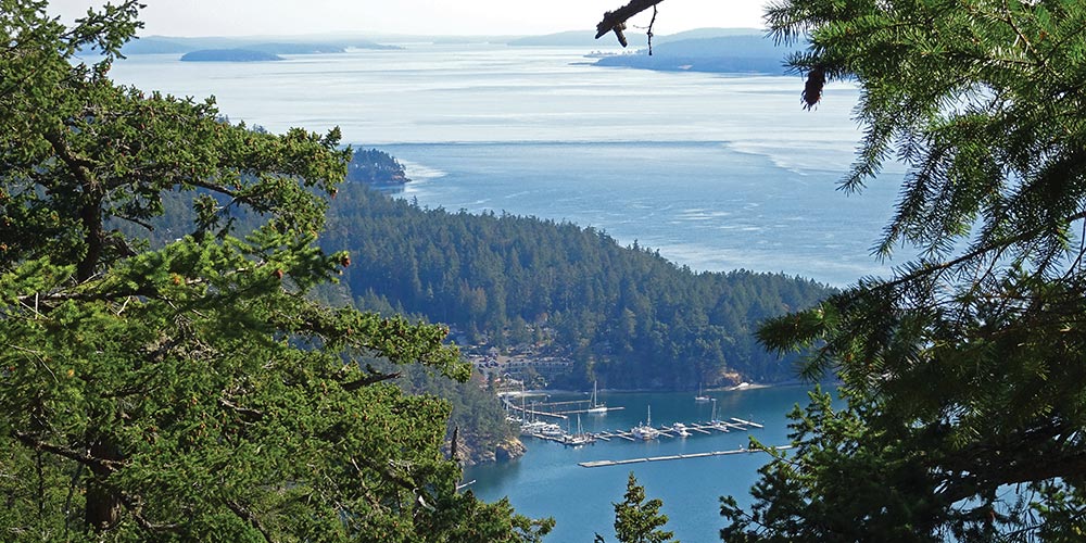
Bedwell Harbour on South Pender Island is a popular destination for a variety of excellent reasons. Since it’s a Canadian Port of Entry, it’s the first place many U.S. boaters visit in Canada. Some immediately continue their journey, but there are good reasons for a proper visit to Bedwell Harbour besides clearing in. There is a marina/resort, Poets Cove Marina, that has road access with hikes (not discussed here) and a swimming pool. Beaumont Marine Park is in the bay just north of the marina, with a number of mooring buoys and hiking trails. We prefer to anchor near the buoys and have always found room and good holding. Even though it seems somewhat open to the south, we have never had a problem with weather. There is a lot of boat traffic, but it typically dies off at night. For us, the main attraction is Mount Norman.
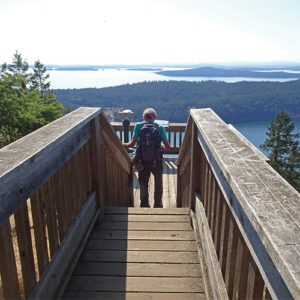
We like to land the dinghy near a set of stairs on the beach and begin our hike to Mount Norman there. The trail goes through forest before it turns steeply uphill, then winds through rock outcroppings to the top of a ridge. As much as the weary hiker would like it to be, this is not Mount Norman, merely a ridge on the route that must be crossed. The trail continues down the other side then heads back up an old road to the Mount Norman summit platform. The views from the 800-foot summit are outstanding: in the foreground, the Gulf Islands and in the background, Vancouver Island and, on a clear day, the Olympic Mountains to the south. If we wander a little bit east we can even look down on our boat resting peacefully at anchor. It’s 4.4 miles round trip from our dinghy and more than worth the trip.
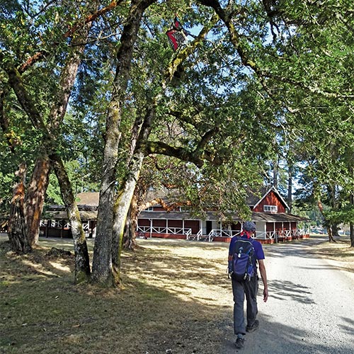
VANCOUVER ISLAND’S GENOA BAY
Genoa Bay is on the north side of Cowichan Bay and, on the chart, looks to be a decent anchorage; but many times we have had problems there. Winds from both the north and south seem to funnel through the bay. Even in good weather, the breeze often seems to build after sunset, instead of dying. Once, we were there when two large sailboats that were rafted together had to split at midnight and anchor separately because it was just too rough. On the bright side, the bottom has good holding and there is room to anchor, though less so now that float houses occupy part of the bay. The saving grace is Genoa Bay Marina, which has some facilities and a restaurant, and is well protected. Truth be told, we might not continue to come here if it weren’t for the fabulous hike.
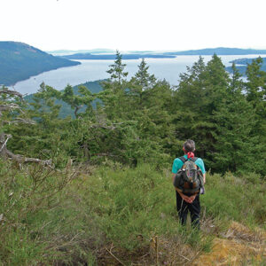
The rounded summit of Mount Tzouhalem stands at 1,574 feet, but the tall, broad cliff on its south face makes it recognizable from far away in the San Juans. From the main road near the marina, the trail to the top starts at a large, brown electrical box near the marina turnoff; the trail heads away from the road, shortly turns left, then climbs steeply to a ridge that follows the cliff top. At several locations along the ridge, there are viewpoints where you can look down the vertical cliff face for hundreds of feet and out over Cowichan Valley. At the highest point you are only about 50 feet lower than the summit. This is where we usually stop, to enjoy the spectacular view and often, to watch vultures soaring along the face of the cliff below our eye level, three or four at a time. It’s a strenuous but rewarding 4.7 miles round trip from the marina.
PREVOST ISLAND
Prevost Island has four short, narrow inlets on its northwest side; our favorite is James Bay. It isn’t very long and is open to northwest wind and wakes from ferries and pleasure boats in Captain Passage, but we’ve never spent an uncomfortable night here. Even though the anchoring space is limited, there seems to be room for every boat that shows up.
The north arm of James Bay ends at Pielle Point and there is a well-defined boaters’ trail from the beach out to the point. A boaters’ trail is one made by years of repeated use by hikers, but otherwise not maintained. It’s mostly flat, easy to follow and ends at a point with 270 degree views of Captain Passage and Trincomali Channel. We love to eat our lunch here and watch the boats go by, many on their way to Montague Harbour, directly across from the point. It’s about 2.5 miles round trip from your dinghy on the beach.
From Selby Cove, another of the narrow inlets, there is a trail starting at a small rocky beach on the north side of the cove that goes over the hill and ends in the James Bay kayak camp, creating a longer hike option to Pielle Point.
NANAIMO’S SAYSUTSHUN MARINE PARK
(Formerly Newcastle Island Park)
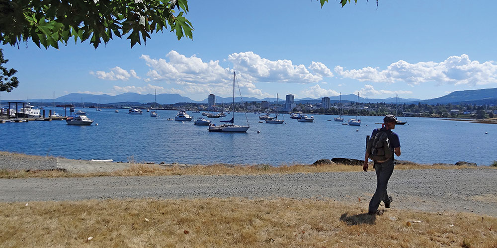
Newcastle Island is a fairly large island which, together with its smaller companion, Protection Island, actually form Nanaimo Harbour. It is a popular marine park with public floats and many mooring buoys in Mark Bay on its south side. The buoys all look the same from a distance, but each is marked with the maximum boat length allowed so you have to make a close approach to even see if you fit that particular buoy. Anchoring is allowed in Mark Bay but there are a number of closed areas that have to be avoided, including a seaplane landing area. Careful attention to the chart is required. In midsummer, especially on weekends, it can be very crowded. If you want some town time, you can even stay in Nanaimo, which is nice to explore on foot—you can then take the regular water taxi to the island.
Once the boat is secure, we dinghy to the public float and walk the island. According to the trail map at the top of the ramp, there are many possible walks with loops from as short as a mile, and others as long as 7 or 8 miles. Near the north end of the island, there is a lovely lake to visit and on the southwest side there are old stone quarries that reveal some of the island’s history. Trails go along the top of bluffs with spectacular views of the Strait of Georgia and also access the water in numerous places around the island. In the afternoon, we gravitate to the warm, sunny shell beaches on the west side where we can watch the boat traffic in Nanaimo Harbour. The variety of hiking on Newcastle Island—and indeed, throughout the Gulf Islands—keeps us returning year after year. It’s really that good.
Michael and Karen have been cruising the Salish Sea and beyond for more than 20 years, hiking every chance they get. For more resources for hikers visit their website at https://mvmischief.com/library/
For additional hiking information in this area Michael and Karen also recommend: “Hiking the Gulf Islands of British Columbia” by Charles Kahn.