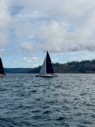
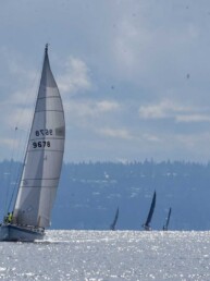
Ah, the Broughtons, one of the dreamiest cruising destinations in the entire region. It is a cruiser’s reward, whether you’ve just challenged often-blustery Johnstone Strait or are ducking in from the bigger water of Queen Charlotte Strait and the Pacific Ocean beyond. This area offers much more than just protection from winds and waves, however—it is a treasure trove of islands and waterways to explore and enjoy.
In this column we are using the Broughtons as shorthand for all the islands, inlets and communities spread out around the south end of Queen Charlotte Strait, not only the specific islands of the Broughton Archipelago. Here, while there are opportunities to get off the boat, including substantial towns on Vancouver Island, real hikes are well spread out. Often, even in marine parks, the only way to get past the beach is to bushwack to nowhere, a strenuous and not very rewarding activity. Still, we have come here enough to have discovered a few favorite opportunities.
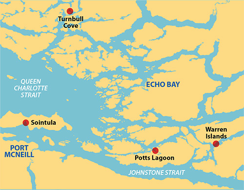
PORT McNEILL
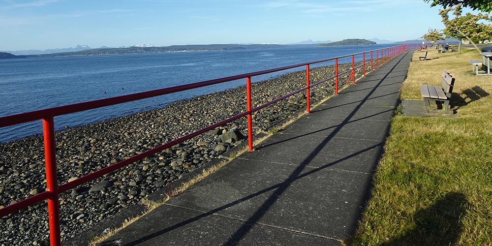
The large Vancouver Island town of Port McNeill is our preferred provisioning stop and the private marina is our preferred moorage, mainly because they have long hoses so you can fuel your boat right at your slip. It’s also the closest marina to the laundromat—a real plus since hauling loads of laundry up and down docks is not one of our favorite activities. With a proper supermarket nearby, the essentials of provisioning are taken care of, and if we aren’t walked-out from the chores there are also hikes.
Heading east along the water is a road along a bluff with great views, which after a mile or so leads to a trail near the shore for another mile. This four mile hike has plenty of interest without any appreciable up and down. We’ve done it in both good weather and bad and think it’s gratifying at any time.
SOINTULA, MALCOLM ISLAND
But for a lovely hike through the woods from Port McNeill, we have to take a bit of a trip. We catch the BC Ferry to Sointula where we can explore a super nice small town (people offer to give you a ride even if you are just walking along the road) and go for a wilderness hike. Starting at the eastern end of 9th Avenue is the Mateoja Heritage Trail, which goes for several miles through many different terrains, including an area regrowing from a 1923 forest fire, ending at Big Lake. It is easy walking and a very rewarding 4-mile round trip from the trailhead. Of course, you don’t have to come here from Port McNeill by ferry. You can come to Malcolm Island by boat and stay at the Sointula Harbour Marina. The walk to the trailhead is not much longer. We like both options.
TURNBULL COVE
Turnbull Cove is a mainland cove at the head of Grappler Sound, across Queen Charlotte Strait from Port McNeill, but you don’t have to expose yourself to open water to get there. Instead, most cruisers get there via a totally sheltered route through the islands of the Broughtons. The cove is a large, landlocked bay with great anchoring everywhere. The hillsides are very steep and show evidence of prior landslides. In fact, a major slide in 2005 ended in the water close to where we had been anchored only a week before. There must have been a substantial tsunami. We prefer anchoring away from steep hillsides now.
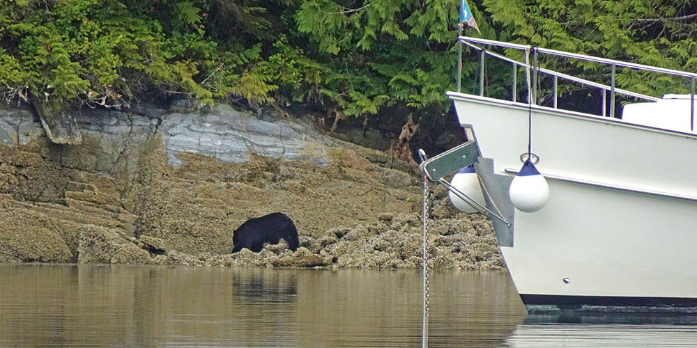
This is a marine park and it has a hike. The trailhead is in a small cove on the north side and goes straight up the hill following an old logging road to Huaskin Lake where there is a ramp from shore out to a float; it even has a picnic table. It’s only half a mile but the road is slowly becoming overgrown and the trail gets harder every year. From the float you can only see a small portion of the lake but its arms extend many miles in several directions. It would be fun to kayak the lake, though hauling the kayak up there from the cove, less so. We’ve seen bear tracks on the trail and in 2023 a black bear was walking the rocks along the shoreline near our boat when we got back from our hike. As with most hikes it’s important to be bear-aware.
LOGGING ROAD HIKES
Logging roads are a good way to stretch your legs, if not always the most desirable hikes. Some were recently in active use so they aren’t as pretty, since trees haven’t filled in yet, but that also means they may offer expansive views. The best access is usually at the old log dump, which is often close to some good, or at least adequate, anchorage. Here are some we have used. There are many others we have seen from the water but haven’t visited. New ones come along regularly, of course; an active logging site today may be an interesting hike in some future year.
Opposite the entrance to Potts Lagoon on the north side of West Cracroft Island is a fairly recent logging road. We were there just after it was abandoned and there were lots of signs of bear activity.
In the Warren Islands at the entrance to Call Inlet is a logging area that closed down just prior to our visit in 2022. From the top of the road there was a spectacular view of Havannah Channel and surrounding area. The bad news: when they abandoned the site they cut deep swales across the road every 100 feet all the way to the top. It was for drainage, presumably, but it made hiking challenging; walk 100 feet, climb down 5 feet of loose rock, climb up 5 feet on the other side then repeat. It felt like we covered three times the distance and it was just as hard going down.
Close to the entrance to Roaringhole Rapids, near Turnbull Cove, is a new log dump with a fairly good road going up the hill and then north towards Nepah Lagoon. There are some excellent views and not too many deep swales cut into the road. As it heads north it joins older logging roads with more woods. We anchored in Turnbull Cove and rowed the dinghy to the log dump. It’s about a mile from the boat.
Many of the marinas in this area, including Port Harvey, Kwatsi Bay, Shawl Bay, and Greenway Sound have all closed in recent years. From the Jennis Bay Marina site on the north shore of Drury Inlet you can access a number of logging roads that provide excellent hiking opportunities. There is excellent anchoring in the bay if the marina is unavailable.
In 2023, we saw active logging in Greenway Sound near the old marina site, in Tsakonu Cove on the south shore of Knight Inlet and at the south entrance to Sargeaunt Passage. Make a note, in a few more years there may be hiking opportunities here as well.
Unlike the more developed hiking opportunities farther south, hiking in the Broughtons is often an exercise in exploration and discovery; we wouldn’t have it any other way.
Michael and Karen have been cruising the Salish Sea and beyond for more than 20 years, hiking every chance they get. For more resources for hikers visit their website at https://mvmischief.com/library/