A Circumnavigation Reinforces Cruising Confidence
As a sailor in the Pacific Northwest, I’ve pursued a modest bucket list—sailing to popular destinations including Princess Louisa Inlet and Desolation Sound. But a remaining item on that list was to sail around Vancouver Island. So, in late June 2024, I embarked on a 780 nautical mile trip that is now among my most satisfying memories.
Knowing this venture would not be a walk in the park, I considered joining a cruise-and-learn flotilla that Nanaimo Yacht Charters used to conduct twice a year. Unfortunately, I learned that they had recently discontinued that program. I asked their opinion about doing the trip by myself and they mentioned something about being careful because “people get in trouble out there.”
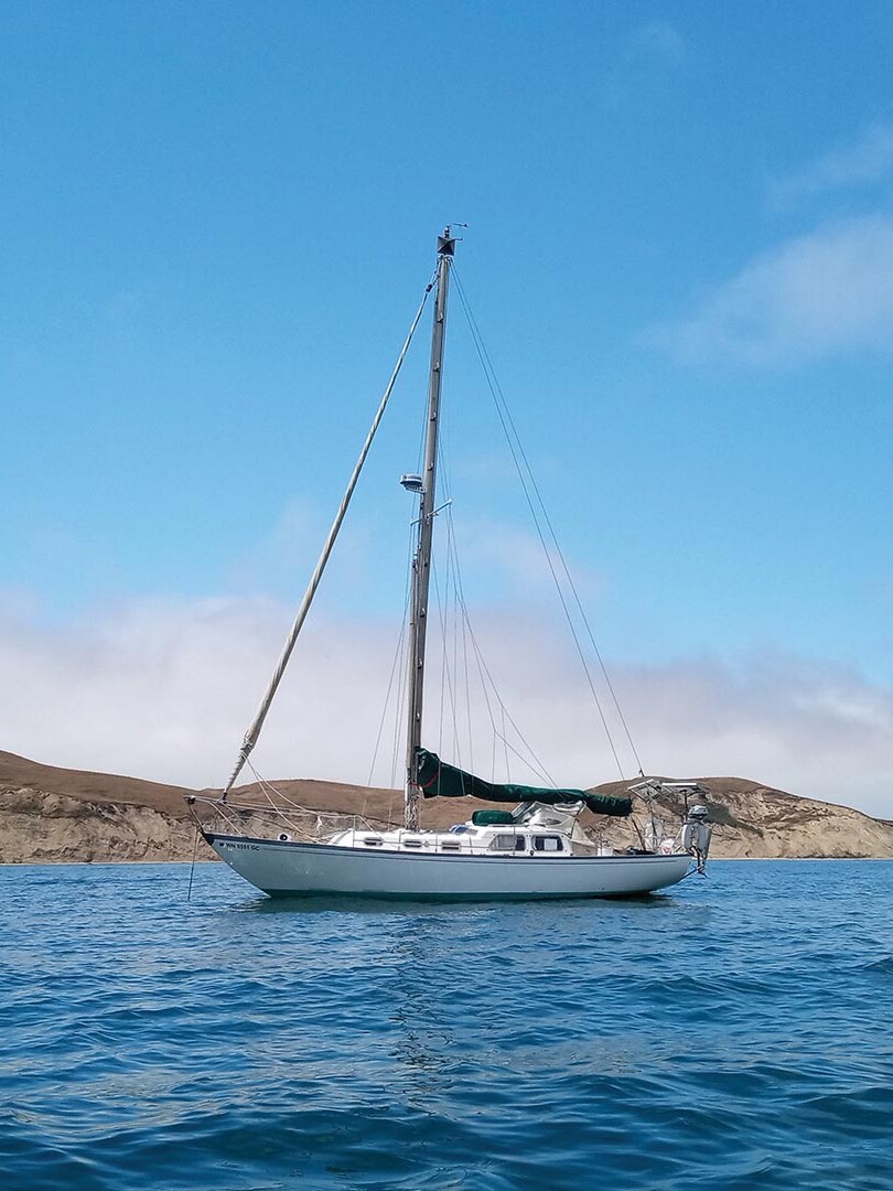
So, I looked at my 1990 Hunter Legend 35.5, Exhilaration, moored at the Port of Everett, and decided two things: 1) I would get this boat ready for the trip; and 2) I would find an experienced guide because I didn’t want to be one of the people who “got in trouble.”
Readying the Boat
I’ve always been a fan of the Hunter Legend series—my boat is fast and smooth. But it’s only 13,000 pounds; in addition, it’s got a shallow draft keel, no running backstays, and a sugar-scoop transom—not ideal for offshore. So the question was, “how much will that matter on the outside of Vancouver Island in the waves and swells of the Pacific Ocean?”
Structurally, all I could do was to have my rig evaluated ahead of time. So it was off to Port Townsend to visit Brion Toss Yacht Rigging and have co-owner Ian Weedman give me an inspection, a tune, and a clean bill of health for my trip.
Also, the navigation system needed a complete update, and this trip was a great excuse to get it done. Heritage Marine Electronics in Everett installed a complete Garmin system to replace my sorely outdated electronics, along with a new radar, and AIS.
I bought eighteen paper charts for every step of the way around the island. I downloaded PDFs for Canadian Tide and Current, Volumes 5 and 6 (which are no longer available in printed form). A copy of Ports and Passes was, of course, essential. I also rented a satellite phone for a month. I got both a life raft and an inflatable dinghy ready to go. And I purchased three yellow 5-gallon jerry cans to carry extra fuel to supplement my petite 22-gallon tank.
Finding a Guide
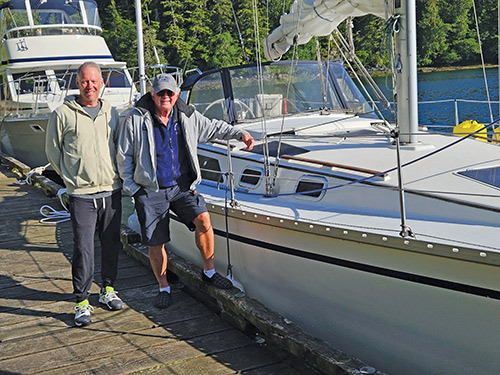
I typically invite friends or family to sail with me, but this trip was different. Those words, “People get in trouble out there,” kept echoing in my head. None of my potential sailing mates were particularly skilled or experienced. I once again turned to Nanaimo Yacht Charters for advice and they recommended Dave Martin, a captain from White Rock, British Columbia.
Hiring Dave was truly the smartest part of my planning. Interestingly, after his numerous times around the island, he called this trip, “The Mount Everest of Sailing.” At first I thought that was silly. How could you compare BC sailing to climbing to the top of the world? Eventually, it made sense.
If an experienced mountaineer hires a guide for places that are unfamiliar, challenging, and potentially dangerous; so would I, an experienced sailor, hire someone who had done this trip in various conditions. To further the analogy, when climbing a mountain, how you deal with weather and surface conditions is the difference between success and danger. Similarly, this journey would have notorious and potentially life-threatening segments along the way—or as Dave called them, “hurdles.”
Hurdle 1: Seymour Narrows
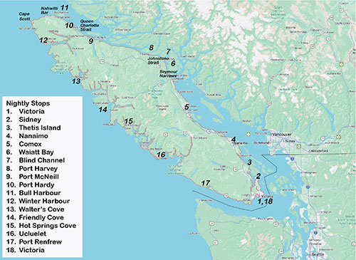
Starting from Victoria, everything up to Campbell River was familiar to me from years of family cruising. So, I picked up Dave in Nanaimo and, as we spent the first night in Comox, we planned for what would be all new territory for me.
The first hurdle that lay ahead was the infamous Seymour Narrows near the south entrance to Johnstone Strait. Now commonly known thanks to Race to Alaska, it’s a three-mile section of water that can hit 15 knots during peak current and gets further riled up when strong winds oppose the tide, creating massive standing waves and dangerous whirlpools.
If you’re racing to Ketchikan, you’ll take the shortest distance and go straight through, but the rest of us have options. Dave suggested we bypass Hurdle 1, and instead of entering Johnstone Strait and facing the Narrows, we would turn northeast and sail up and around the east side of Quadra Island and join the Strait farther up.
Nonetheless, there is no escaping narrows and rapids in British Columbia, especially in this cluster of islands and passages along Johnstone Strait. We would transit several over the next few days. However, each would be much shorter and quicker to get through than Seymour Narrows, especially for my little three-cylinder Yanmar. The essential tasks were to know where these rapids are located and when slack current would allow us to pass safely.
First, we transited Beazley Passage at Surge Narrows between Quadra and Maurelle Islands, after which we anchored for the night at Waiatt Bay, near the Octopus Islands Provincial Park. The next day, continuing around Quadra Island, we transited Okisollo Rapids. I can only imagine what either of these would look like at peak current—completely different animals—but when timed properly, they were quite manageable and we got through in a matter of minutes.
Hurdle 2: Johnstone Strait
Rounding Quadra Island, we caught up with Johnstone Strait well north of Seymour Narrows. We were destined to tangle with sections of this 68-mile Strait, but at our discretion. Winds are generally from the north here and the currents reach 6 knots. Dave did a great job of helping us decide when it would be best to sail certain stretches of the Strait and when it would be best to continue diverting around nearby islands for gentler conditions.
We entered the Strait near Chatham Point and enjoyed a day of dynamic tacking upwind in 18 to 20 knot winds. By late afternoon, we ducked out for a side trip through Mayne Passage to a lovely marina called Blind Channel Resort on West Thurlow Island. This well-kept establishment offers an outstanding dining experience with an equally impressive view.
Always monitoring wind and current, Dave recommended avoiding the Strait the next day. So we stayed in the protection of the islands and took on our next narrows, Green Point Rapids, after which we anchored for the night in Forward Harbour, north of Wardwicke Island.
The next day, we were back out in Johnstone Strait for another stretch of exciting upwind sailing, followed by an anchorage in Port Harvey on West Cracroft Island.
The following day, we said goodbye to Johnstone Strait as it gave way to the Queen Charlotte Strait and Port McNeill. The town was a much needed place to find a hardware store, groceries, ice, and fuel.
Our final taste of city life was Port Hardy, just 30 miles up the coast—a town with a more industrial feel than Port McNeill, providing us with one last marina to grab ice and snacks before heading into the wild and remote north end of Vancouver Island.
Hurdle 3: Goletas Channel
Leaving Port Hardy, the next hurdle was Goletas Channel, a 20-mile stretch of water that led us along a northwest course to our highest latitude on the trip. The problem was that, while the scenery was gorgeous, the adverse wind and current, along with swell from the open ocean, made progress painfully slow. Accordingly, we headed for a spot Dave knew, a tiny inlet on Balaklava Island nicknamed “God’s Pocket.” Here we dropped anchor and waited for the current to change direction.
Our goal was to reach Bull Harbour on Hope Island by the end of the day, which was the northernmost point on our trip—almost 51 degrees north. It’s a nearly desolate island operated by the Tlatlasikwala First Nation, who restrict general access except for one small dock that we grabbed for the night.
The arrival at Bull Harbour signified the end of our uphill climb. From here on, we would sail west across the top of Vancouver Island and down the Pacific side. We raised a glass to “making it to the top.” Little did I know that the scariest day of my sailing career was just hours away.
Hurdle 4: The Nahwitti Bar
Dave gave his most cautionary explanation about the next day’s adventure—crossing the Nahwitti Bar. It’s a giant sandbar that catches inflow from the open Pacific Ocean and turns it into sharp waves. This bar lay between us and our next destination: Cape Scott on the northwest tip of Vancouver Island.
The Nahwitti Bar is one of those places where people can get in trouble and the nearest source of help is 30 miles back in Port Hardy. Our best bet was to cross the bar at high slack tide in order to later take advantage of a 2-knot southerly push around Cape Scott. But on that particular day, high slack was in darkness at 3:30 a.m., so we waited for first light to depart Bull Harbour and made it to the bar around 5:00.
Who knows whether the waves would have been any gentler 90 minutes earlier? In any case, we were in for a ride—relentless sharp waves coming in from the Pacific were compressing on the bar. As we motored through, I steered with one hand and gripped so hard with the other that I’m pretty sure I etched my fingerprints into the binnacle handrail.
We knew beforehand that there were other options for getting around this bar, but an alternate route to the north, going around the top of Hope Island and then west, would have involved backtracking and adding hours of extra time. We also could have turned south toward shore and navigated the Tatnall Reefs, which are supposedly more protected but bring their own risks. We opted for a straight course across the bar.
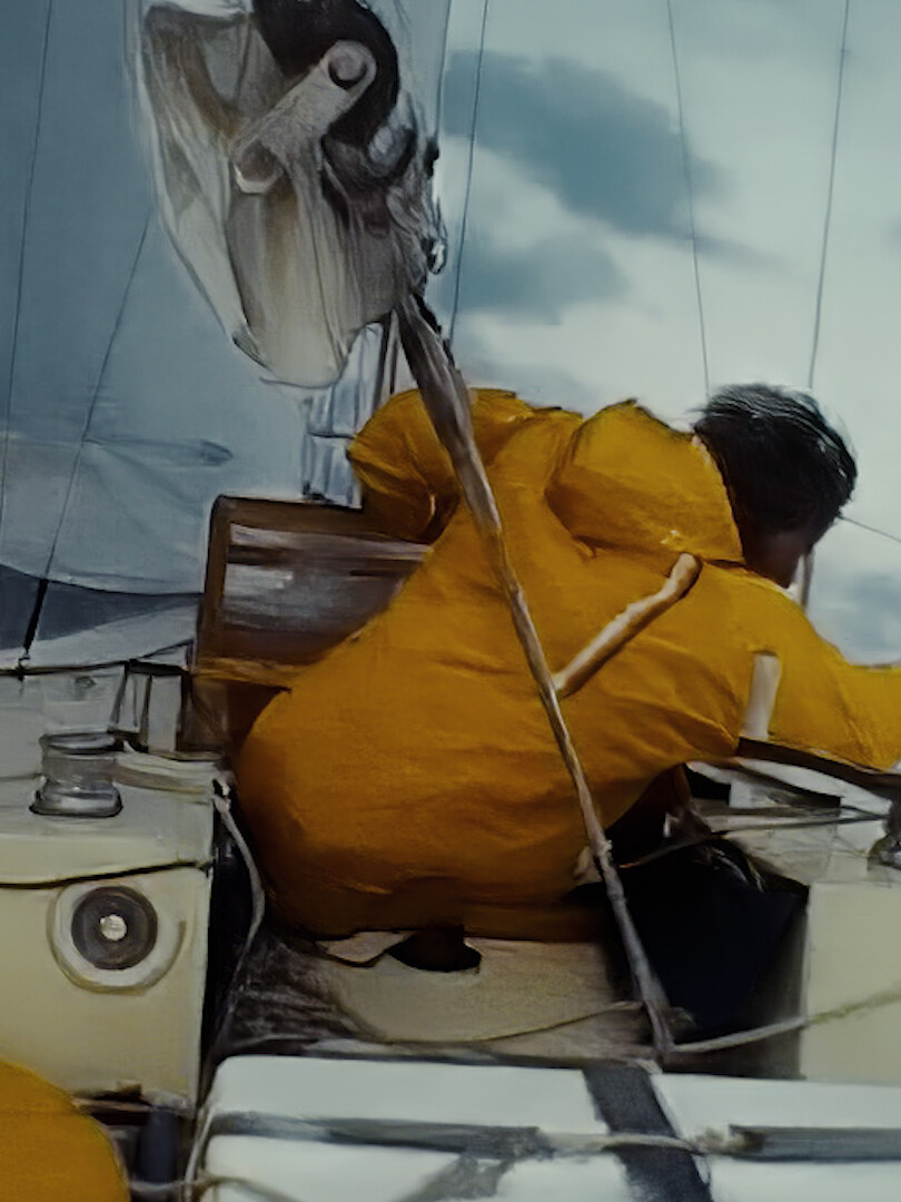
This was the first time on the voyage when I wondered if my boat was up to the challenge. Would the rig tolerate this up and down? I suppose the saving grace was that a rig’s worst enemies are time and repetition. And while it felt like an eternity, it was maybe 2 or 3 hours of peak intensity until we got past the worst of the bar.
Once I could take my pulse and confirm that I was OK, I focused on the wonder of the rugged surroundings. We were on a 20-mile dash to Cape Scott, after which we would turn south and begin to descend the west coast of Vancouver Island.
An oddity in these northern waters was the frequent sighting of otters, hundreds of them, floating at sea in groups large and small—just happy and lazy with their bellies to the sky. Apparently an attempt to repopulate otters in this area some years ago worked exceedingly well!
As we reached Cape Scott, the sharp waves that previously washed over our bow gave way to larger but gentler rollers on our stern. They treated the boat like a toy, forcefully but manageably raising and lowering us as if we were on an elevator.
As we rounded Cape Scott and the rollers subsided a bit, we unfurled one of our headsails and got the first taste of West Coast Vancouver Island downwind sailing. This is what I came here for—to see Vancouver Island from a vantage point that few get to experience, to feel Mother Nature’s conditions whimsically changing, and to be under sail.
At the end of one of the most unusual days of my life, we motored into Quatsino Sound around 7:00 p.m. and continued a few miles up to Winter Harbour for a dock, some fuel, and a breather. The bare-bones docks were operated by the Outpost Marina, which also offered a limited grocery store and fuel. No power, no water. Small fishing boats were all around and folks were out on the docks cleaning their catch.
I grabbed two empty jerry cans and walked over to the fuel dock, triple checking that I was filling with diesel and that it wasn’t old fuel. I figured if the fishing boats mostly take unleaded, who knows how long the diesel sits around? But the attendant assured me, the fuel truck had just been in last week.
For the rest of the evening, the overriding feeling for me was gratitude that arguably the most dangerous stretch of the journey was behind us. Or was it? The next day would be the final hurdle.
Hurdle 5: Brooks Peninsula
After the Nahwitti Bar, I figured the rest was a cakewalk. But Dave reminded me that the Brooks Peninsula, which protrudes 12 miles out into the Pacific, can have gale to hurricane force winds throughout much of the year, even when nearby areas closer to the island do not.
Fortunately, today was not a storm force day. In fact, this day turned out to be perhaps the best downwind sail of the trip—a sunny cloudless day with crisp scenery. Up to 31 knots of wind blew us comfortably downwind past the peninsula and its sentry, Solander Island.
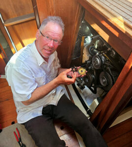
After rounding the peninsula, the destination was Walter’s Cove, a tiny community with no services. Upon entering the cove, we had one of the few mechanical challenges of the trip—an overheating engine. The moment the alarm went off, we grabbed a dock space and shut off the engine. I checked the usual suspects: The impeller was fine. The strainer was OK. What could it be? Seaweed blocking the intake perhaps? I removed the intake hose and plunged the through hull and water streamed in. Success! This was a reminder that, when sailing in remote places, self-sufficiency may be all you have.
Hot Springs Cove—A Welcome Reward
With the hurdles behind us, we left Walter’s Cove and continued south around Estevan Point. Though not as protruding as Brooks Peninsula, it is an important piece of geography that Environment Canada uses to distinguish weather regions, north and south.
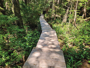
Today’s destination was Hot Springs Cove, and it suddenly dawned on me, I can shed these clothes I’ve been living in and cleanse myself! As soon as we tied up and paid a nominal fee to the family that oversees the park, I was in my swim trunks and trotting the mile-long boardwalk to the hot springs. The springs are natural and rugged—sharp rocks everywhere making flip-flops a must. Once I found a place to get comfortable, I gladly let the hot water baptize me again and again.
Home Stretch
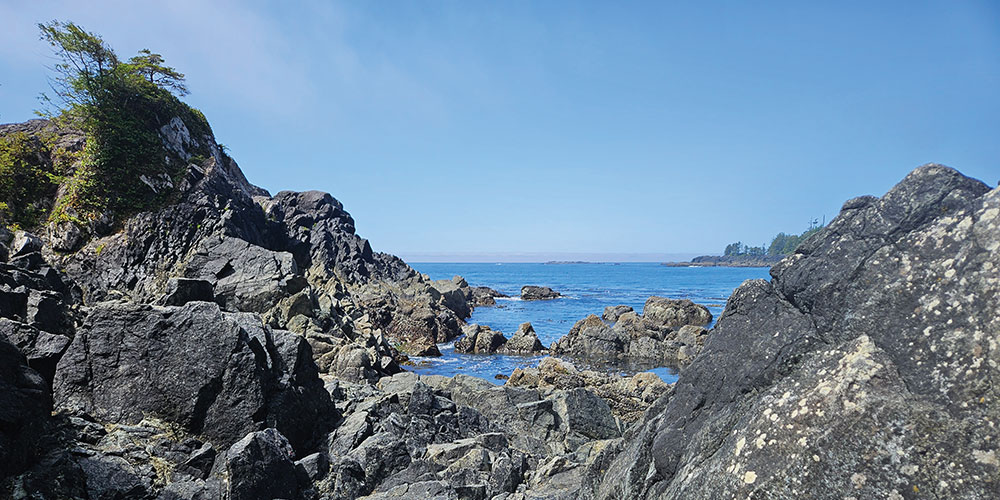
Leaving Hot Springs Cove, we approached the southern portion of Vancouver Island and the town of Tofino. We decided to sail another 20 miles and stop in its sister town, Ucluelet, otherwise known by its well-deserved nickname, U-Fog-let. Sure enough, the next morning, a thick fog awaited our departure. With large rocks outside the harbor, we kept a close watch as we got underway. By midday, the fog gave way to a view of Barkley Sound, an archipelago that beckoned to be considered for a future trip. Today’s goal was simple: enter the Strait of Juan de Fuca.
Finally, I was back in familiar territory. I knew these waters from past Swiftsure races and the Olympic Mountains of Washington State were a welcome and familiar sight, as I had grown up in view of them.
Our final night out was at the aptly named “Pacific Gateway Marina” in Port Renfrew, directly across the strait from Neah Bay. The next day, we surfed the rollers back to Victoria and a pair of orcas welcomed us near Race Rocks.
Upon landing at the Wharf Street docks in Victoria’s Inner Harbour, I said “so long” to my excellent guide, Dave, and watched him head off to hop a seaplane home.
Pleasantly exhausted and a bit weary from days of rocking rollers, I relaxed in Victoria with unrestrained access to sushi and fish and chips.
Heading home across the Strait of Juan de Fuca under sail on a sunny mid-July day, I basked in the afterglow of a trip that reinforced my sense of confidence, while also reinforcing my awareness that Mother Nature had allowed me, once again, to pass through her domain and return home safely.
Mark Herlinger, originally from Tacoma, is a corporate media producer.