Starpath Navigation’s David Burch takes us through local weather analysis, with a focus on the 2020 Toliva Shoals Race
For local weather, meaning inland and near coastal, we need regional models. For the day of the sail the workhorse is likely to be the HRRR model, but it goes out only 18 hr for most forecasts.
Here is a summary of the models we would use:
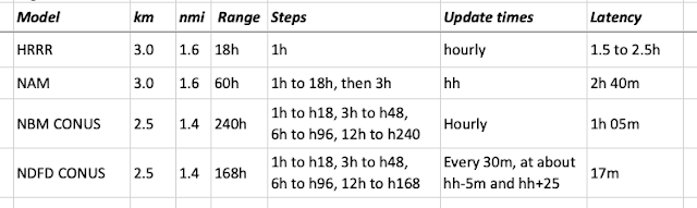
The last one listed is not really a model, but the National Digital Forecast Database, which is the digital form of the forecast made by meteorologists of the local Forecast Offices. The HRRR model actually goes out to 36 hr, but only for the runs at the synoptic times (hh=00,06,12,18z), and at least for now, none of the 3rd party providers are offering it. If needed, we can download it manually from here, using instructions from here. Sources of these hi-res files include Expedition and LuckGrib. Note that some third party sources of NAM and NDFD offer only the 12-km resolutions, which are not often suitable for regional work. If needed, we get the data directly from NOMADS.
One approach is to use the bottom three the night before to be prepared for what to expect on race or sailing day, and then start out with HRRR, updated throughout the day, checking NBM and NDFD periodically.
Checks along the way would be bouy or station reports along your route…. or spot checking the NDFD to see if they have changed the forecast.
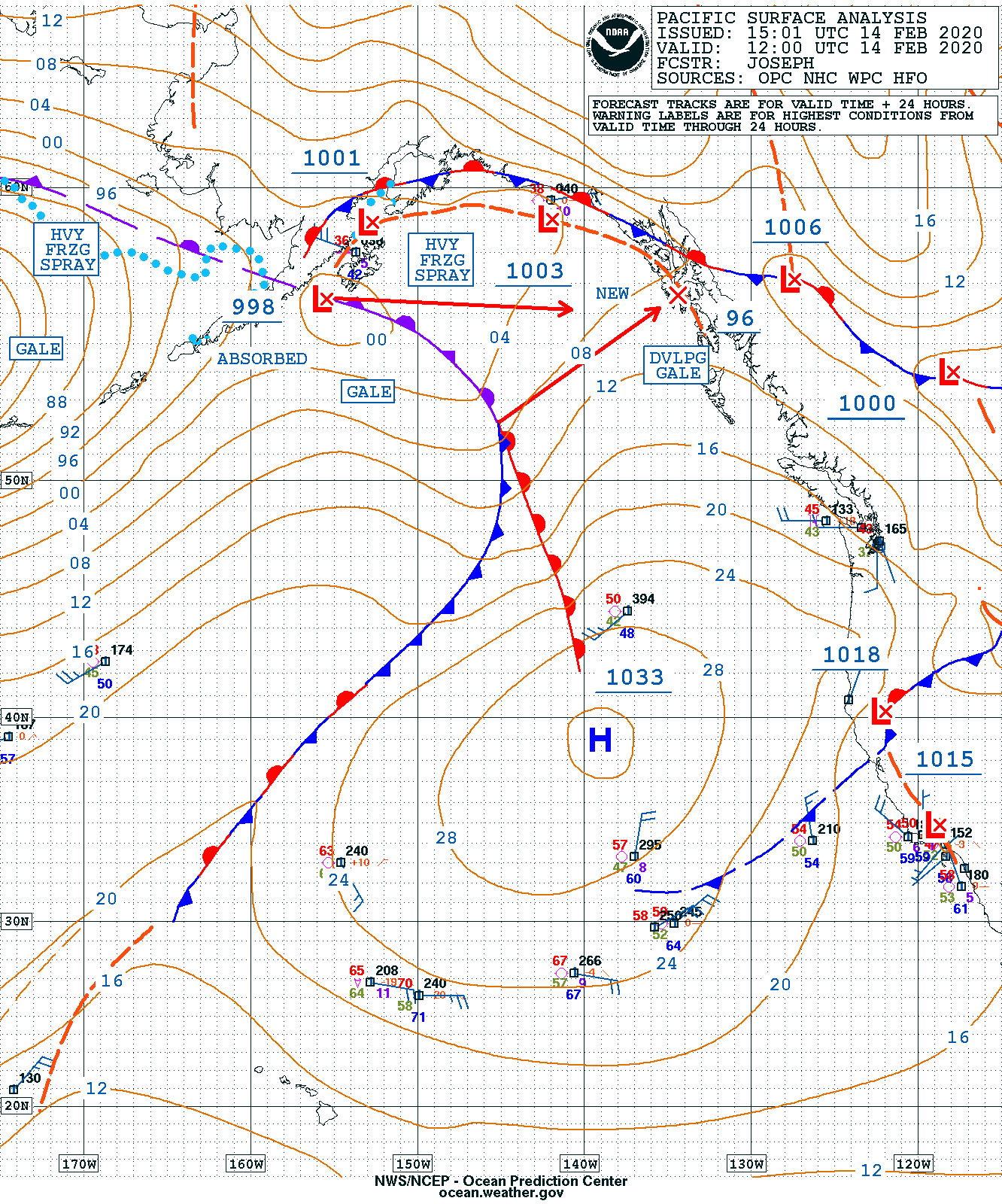
As an example we look at an anticipated frontal passage, which is always a prominent event in local waters, because we anticipate a notable veer at the front that can have tactical significance.
Here is a an example from 2020 Toliva Shoals race that took place today in the south end of Puget Sound, which we looked at yesterday late afternoon.
Based on the OPC surface analysis and 24 hr forecast, we anticipated a front crossing the course, possibly during the race.