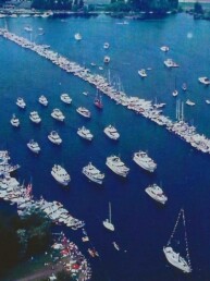
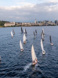
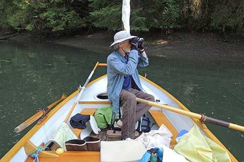
Navigating the waters of the Pacific Northwest with simplicity and satisfaction
“Didn’t you get lost?” a visitor asked me at the Port Townsend Wooden Boat Festival, after I told him that I navigate only with paper charts. He’d been in the audience at my presentation about a journey through the Inside Passage in an 18-foot sail and oar boat.
“Well, I had the goal of always knowing where I was,” I replied, hoping I sounded confident, rather than cocky. “So, I looked around all the time, triangulating and observing the landscape.”
He looked me over carefully. I wondered if he was evaluating my sanity, but in the end, I didn’t care what he thought. Not only was I still here to tell the tale, but my decision to navigate the old-fashioned way was based on sound reasoning—and it worked.
In an age when virtually everything is available via smartphone, chart plotter, or home computer, sometimes it can feel unnecessary even to leave the house (or the nav station). After all, someone else has not only already discovered your destination, but they’ve captured it for you in a photo, video, or map. I like computers. I think they’re one of humanity’s most useful inventions (even when I’m using mine to watch cat videos). But one of the reasons I got excited about small craft was the ability to get away from it all and leave the electronics behind.
When I first started boating, I daysailed and rowed on rivers. It was pretty hard to get lost, since I never went too far from where I started, and I never moved very fast. Returning to the boat ramp was as easy: just follow obvious landmarks along the shore.
When I started going farther afield for overnight trips, beginning in the south portion of the Salish Sea, navigating became more complex. Now it was no longer a question of up or down the river, so I began to buy maps. Yes, maps. In the time before smartphones, my local kayak shop sold “Fish-n-Maps.” These protocharts were advertised as waterproof and tearproof, and they folded down to a 4-inch by 9-inch rectangle. Using one, it was easy to navigate from Olympia to Seattle. All for just $7.95.
A convenient size for a small boat, Fish-n-Maps showed landmarks, boat ramps, depths, all major landforms, and tidal areas. True, on the Fish-n-Map scale, one inch equaled about a nautical mile (1:66,700). But in a boat that could float in only a few inches of water, the maps provided a guideline for true adventure and discovery; using one, you could explore the edge without falling off it. I found that they actually worked for my needs and that I liked navigating with a map and compass.
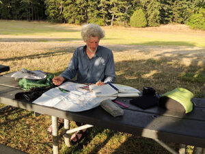
As I ventured farther north into the less familiar, and more rocky, unforgiving waters of the San Juans and Gulf islands, I read books about navigation and, through a lot of practice, I learned how to identify the edges of landforms from afar. I also acquired more sophisticated NOAA- or Canadian Hydrographic Service-authorized charts printed on thick, waterproof paper. Larger in scale, more detailed, and beautifully illustrated, they were awkward to handle in a boat with a 5-foot beam. I sometimes imagined that, in a pinch, they would be lashed to my spars and used as a storm sail. Still, I found ways to fold them into useful accordion-like shapes and sizes, enabling me to flip them as I moved through days of cruising. I loved how the islands revealed themselves as I progressed, transforming the shapes on each chart from flat drawings into familiar landscapes.
My navigation station consisted of a direct read, portable compass that could be moved when rowing or sailing, my proper nautical charts, and a pair of water-resistant binoculars. Aided by paper tide and current tables, a digital watch, a Rite in the Rain log book, and a pencil, I had the tools I needed to navigate a small boat through typical spring and summer conditions.
Along with these charts, I began carrying a GPS unit that I strenuously avoided using. Historic mariners, I told myself, had far less to go by, and even small craft users as recently as the 1990s did what I was doing, and they mostly survived, right? Nevertheless, I continuously made mental notes of my speed, of how long I’d been on the water, my current compass bearing, and what landmarks were in view. Out sailing, I felt fully immersed. Between adjusting sails, looking for marine traffic, identifying floating hazards, and what I now know as dead reckoning, I consistently made it where I wanted to go.
Did I ever get lost? Sure. But these were mostly minor incidents, when I mistook one headland or bay for another. In my years of voyaging over thousands of miles, I’ve only used the GPS unit three times. It’s convenient, close at hand, and impressively accurate; but I resist its use because it’s too easy to reach for it. GPS in hand, the game is over; all the learning of the coastline is gone, all the attention to detail is slackened, the focus on the seascape shifts to a tiny triangle on a glowing screen. I try to think of the location button not as a last resort, but as a consultation with a trusted professor.
On one of the few occasions that I used my GPS, I was engulfed in fog after crossing from the United States into British Columbia. “I believe I am north of Gooch Island, approaching Fairfax Point on Moresby Island,” I whispered to myself before peeking at the screen. Sure enough, that’s pretty much where I was—thankfully not in the shipping lanes. An external source of validation calmed the captain and crew, even as we continued blindly until we could see the shore. On the other two occasions, I used the locate feature out of desperation, late in the day while winding through clusters of islands farther north, where my margin of safety to find an anchorage was running too thin.
These incidents reinforced my feeling that it’s one thing to play a game, to build a skill; it’s another to risk one’s life, or worse, to put others in danger through foolish resistance to using a tool. Still, for the vast majority of the time, my paper charts work for me, allowing me to learn from observation, and to be engaged and fully involved in sailing and the landscape around me. My methods may be old-school, but they’re satisfying—and isn’t that what we’re all looking for on the water?
Author’s note: Each boater needs to choose their own level of risk and reward, along with the tools that bring them satisfaction and safety on the water. I sail small boats, where grounding or getting lost is often of little consequence. Since I usually sail solo, there’s a lesser chance of involving others, should a problem occur. In a deeper draft and/or a faster vessel with crew, my approach might be very different.
Bruce Bateau sails and rows traditional boats with a modern twist in Portland, Oregon. His stories and adventures can be found at www.terrapintales.wordpress.com.