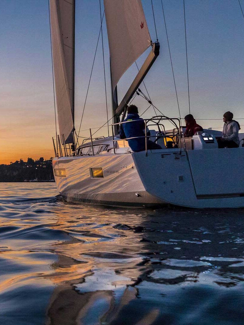
Desolation Sound has long been a mecca for cruising boaters. Muriel Wylie Blanchet wrote about her family trips of the 1920s and 1930s in the classic, “The Curve of Time,” and Pacific Northwest cruisers could surely pen volumes of love letters to such a breathtaking destination. Its draw extends beyond the region as well, with charterers arriving from around the world to explore this beautiful locale.
Desolation Sound is the large area stretching east from the northern end of the Strait of Georgia that includes many islands, bays, and inlets along the mainland shore. There are numerous opportunities for hikes, both short and long, that are easily accessible from a variety of anchorages. For hike-happy cruisers like us, a good anchorage with access to multiple hikes is something particularly special. Here are three of our favorites.
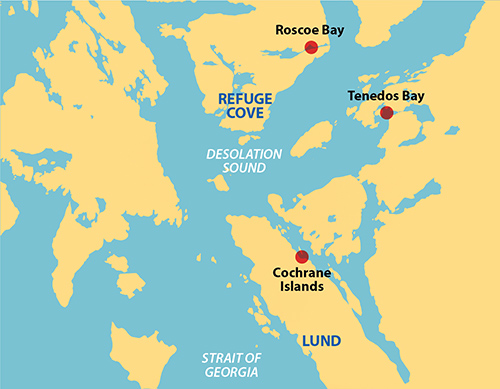
MALASPINA INLET’S COCHRANE ISLANDS
The Cochrane Islands, about two miles into Malaspina Inlet off its west shore, provide room for several boats to anchor between the islands and the shore. We’ve found the bottom to be rocky in places so you have to choose your spot with care. Once well set, we have always felt secure here. It’s rarely crowded, but if you can’t find room it’s only a short dinghy trip from other nearby anchorages in Malaspina Inlet.
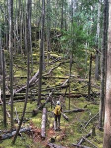
At the southwest corner of the anchorage is an obvious, rocky beach with a somewhat flat shore area. This used to be a designated camping area on the Sunshine Coast Trail, which goes between Saltery Bay and Sarah Point, but the trail has been rerouted around this site and there is no camping here now. However, remnants of the older trail, currently unmaintained, head both north and south, and meet up with the main trail after a short walk. When we take these paths, we mark any uncertain areas with surveyor’s tape so we can find our way back since the trail is slowly becoming overgrown. Taking the path to the north, we have hiked all the way to Sarah Point. This makes for an interesting albeit long day, since the distance is about 10.7 miles round trip.
Going south, you first climb to Wednesday Lake in about 1.5 miles. The trail continues gaining elevation to Manzanita Bluff where there is a major campground to go with its expansive views to the west. At that point, you are almost due east of the town of Lund but you can’t see it because of the hills and trees. We like to watch the water taxi going between Lund and Savary Island. If it’s warm, you can always grab a swim in Wednesday Lake on the way back; there’s a nice rocky bluff overlooking the lake. Round trip to Manzanita Bluff is 6 or 7 miles.
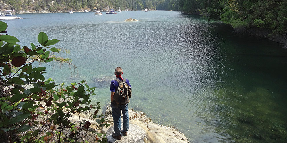
TENEDOS BAY
Tenedos Bay is the very first place we ever saw in Desolation Sound (we flew in on a float plane to meet a boat we had chartered) and it continues to hold a special place in our hearts. The center of the bay is too deep for convenient anchoring but there are many places to anchor around the edges, several of them quite intimate; attention to tides can also be important for some. We particularly like 3-Fathom Hole behind the unnamed island, if it isn’t already filled. Most boats are often found near the outlet stream from Unwin Lake.
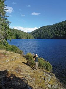
Unwin Lake is accessed via a short trail from the east corner of Tenedos Bay that follows the outlet stream. The lake appears after a quarter mile but the best areas for swimming are along the rocky west shore of the lake, so you need to backtrack a bit to a bridge across the stream shortly before the lake. We have taken a dip here many times over the years since our first time in 1987.
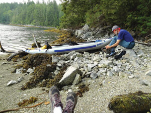
Sometimes we want more of a hike, and get it by continuing on the trail along the lake until it heads into the forest and meets a trail coming in from the left. This new trail leads past several lakes and eventually comes out at an old log dump in Melanie Cove, Prideaux Haven, about three miles from Unwin Lake. It is a boater-maintained trail and only gets cleared of blowdowns every few years, which means in off years it can be rough going. The first lake you pass has a spur trail leading out a peninsula to a lovely swimming spot, though we didn’t swim when we were there. Just as we were about to go in, quite surprisingly, the phone rang. We had accidentally butt-dialed 911. So instead of swimming, we spent our time convincing the RCMP we weren’t actually in danger; not so easy to do when you are at an unnamed lake off an unofficial trail in the middle of an unpopulated wilderness. We have adventures of all sorts on our hikes.
ROSCOE BAY
The cruising guides all warn about the entrance to Roscoe Bay, which has a bar across its entrance that dries at zero tide. Believe it! We always double check our tide chart before entering, just to be sure, and only come here when the conditions are right for both entering and leaving. Once inside, the anchoring is excellent with good holding and moderate depths, though a stern tie will be required in high season because this well-protected anchorage is very popular.
The main source of Roscoe Bay’s popularity is probably Black Lake, which is but 10 feet above the level of the Bay and only a short walk away. There is good swimming and we’ve seen folks with kayaks on the lake. We prefer to hike the trail along the north shore ending at a rocky area that slopes gently into the lake. Perfect for informal swimming. Round trip from the dinghy is 1.2 easy miles.
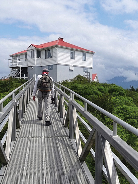
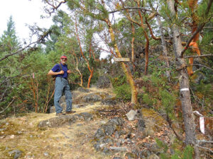
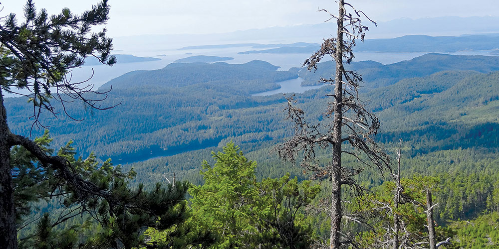
While Black Lake is clearly the main attraction here, for hikers there is more. At an old log dump on the north shore of the bay there is an overgrown logging road, and then a trail that leads to the summit of 2,165-foot Mount Llanover and expansive views. The last section of the trail in open forest is very steep. Judging by the fact that we have always met others on the trail, the 8-mile round trip appears to be fairly popular.
On our last trip, we discovered a new (to us) boater-maintained trail—one step above a bushwack, really—that starts on the south side of the bay just inside the entrance bar and goes up to the top of the ridge above the bay. From the trail end at about 850 feet above sea level, there are good views through thin trees out over Desolation Sound towards Prideaux Haven. The trail ends at a vantage point but the ridge does continue on for the intrepid hiker wanting to extend the trail. Up to this point it is fairly well-marked with surveyor’s tape, at least once you’ve made your way past the major blowdown right near the beginning. It’s about 2.2 miles round trip, but the challenging route-finding made our progress slow—it took 3 hours including our short lunch break. Just another hiking adventure.
Desolation Sound’s picturesque appeal is well known and documented for cruisers near and far, and rightly so! Including some lesser-known hikes and vistas on your next visit will only add to the richness of your adventure.
Michael and Karen have been cruising the Salish Sea and beyond for more than 20 years, hiking every chance they get. For more resources for hikers visit their website: www.mvmischief.com/library/