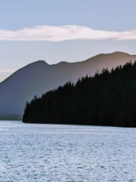
Autumn can provide some of the absolute best times on the water, and good times are also a fair expectation when you dinghy in to stretch your legs on a lovely hiking trail near Salish Sea anchorages throughout the fall. In this season, cruisers rightly tend to condense their distances, but since we’re not into the winter approach of short days in backyard waters, options abound—including in the Strait of Georgia.
Many might think of locations like these—north of Nanaimo, before you get to Desolation Sound—as great choices for a stop when breaking up a longer trip. However, we think these are also excellent destinations in their own right, and some have ideal hiking opportunities and are worthy of a longer stay. Our previous article on the area covered some of our favorites including Smuggler Cove, Pender Harbour, and Hornby Island’s Tribune Bay, and the following shares details about three more.
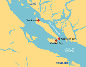
JEDEDIAH ISLAND
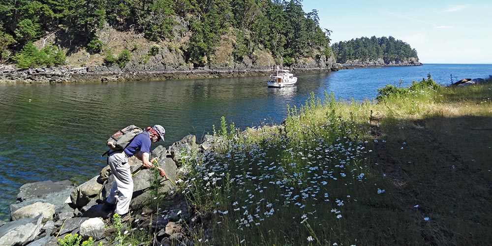
Tucked in between Lasqueti and Texada Islands, Jedediah Island was once a privately owned homestead farm but is now a Provincial Marine Park. There are several bays on the west side with stern tie rings allowing a number of boats to moor. The most protected of these is probably Deep Bay, which also has good access to the island trail system. The space is quite narrow, so a stern tie to one of the stern tie rings is definitely required.
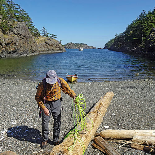
Our favorite Jedediah anchorage, however, is a small, narrow, unnamed bay on the southeast side of the island. A wooden sign nailed to a tree identifies its local name as Codfish Bay. There is room for one or two boats to anchor, maybe more if you set up a stern tie. We will usually stay here if it is empty when we arrive, provided severe weather from the southeast is not expected, as it’s open in that direction.
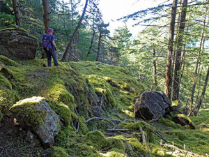
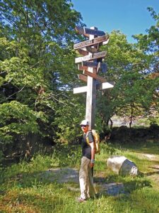
There are trails that go all over the island, so from a hiking perspective it doesn’t really matter where you anchor because trails connect all the anchorages. It’s fun to visit the old homestead on the east side of the island, which is being allowed to slowly decay. Some of the structures are already falling down and have been fenced off for safety reasons. There are old orchards, woodlands, and a fair amount of open pasture that is kept cropped by small herds of sheep and goats that roam the island specifically for that purpose.
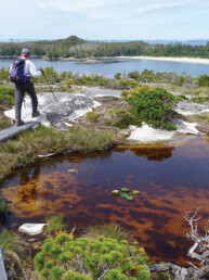
A short distance from Codfish Bay next to the “official” trail, oyster shells mark the junction with a faint track heading west up the hill. This is a boater-maintained trail that winds its way to the top of nearby Mt. Gibraltar, the highpoint of the island. It may only be 450 feet high, which is why it’s actually called Gibraltar Hill on some maps, but it is fairly open at the top and has commanding views of Sabine Channel and the Strait of Georgia to the south. In the summit cairn there’s a register you can sign. The trail can be faint in places and, near the bottom, it tends to splinter into several tracks, all of which lead to the official trail. The boater trail is short, only 1 mile round trip from the oyster shells, but we love the view and always have a sense of accomplishment from the climb.
ANDERSON BAY, TEXADA ISLAND
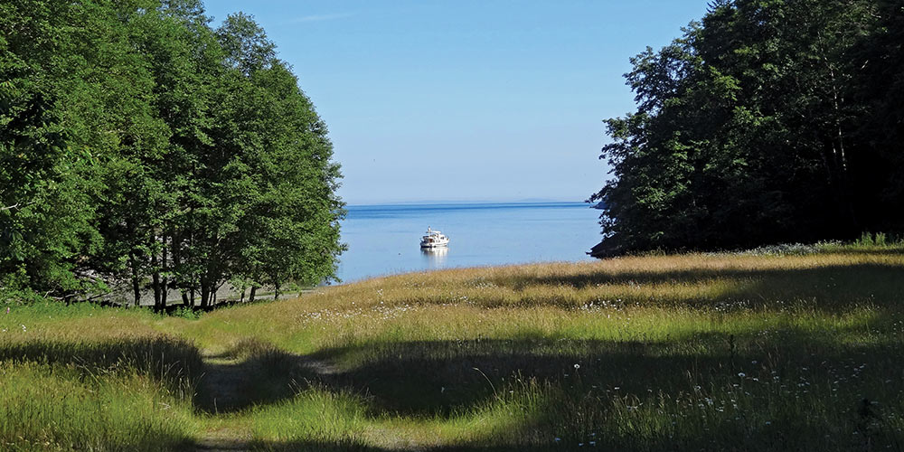
Near the southeast corner of Texada Island is a narrow, one-boat anchorage, Anderson Bay Provincial Park. It is very nice in settled northwest weather, but totally open to wind and waves from the southeast so it’s important to consult the weather forecast before staying here. In good conditions, we pass by to see if it’s empty, stopping only if it is; it would be a bit tight for two cruising boats—another reason to check it out in the offseason.
From the head of the bay, a short trail leads to a dirt road/utility right-of-way. It’s easy walking through forest, gaining almost no elevation. There are no views, just a good stretch of the legs. About 3.5 miles later you will come to some old roads/trails, one of which climbs almost to the summit of 2,795 foot Mt. Shepherd, the highest point on Texada Island. It’s a long way from Anderson Bay, but with time and ambition (or a bicycle) it’s a big, rewarding adventure.
For a shorter hike we usually bushwack out the peninsula on the east side of the bay. From the end, you have nice views looking back at your boat, north up Malaspina Strait, and east to Secret Cove. I don’t think bushwacking is really hiking, though; you don’t get enough exercise to compensate for the scrapes and bruises. But that doesn’t stop us from doing it.
STURT BAY/VAN ANDA, TEXADA ISLAND
For many years we passed by Sturt Bay, preferring to stop on the mainland side at Westview or continue on our journey north or south. Now, we realize that we were missing out on a delightful, low key small town experience. While you can anchor in Sturt Bay and dinghy to the docks, we’ve heard there may be logging debris on the bottom so we prefer to tie to the guest dock—that is, the outermost dock at the Texada Boating Club. They are very welcoming to visitors and it’s inexpensive. There are usually Boating Club members working on their boats and a tent at the outer end of the dock serves as a meeting place for drinks, meals, and conversation with residents and visitors alike. It’s very friendly.
At the head of the dock you’ll find a map to help you explore the town of Van Anda. A short distance from the marina, up on a hill, is the Elementary School, also home to the Texada Island Museum. Perfect for history buffs I should think, though it has always been closed at the time of our visits. Texada Island still has a major quarry operation to the north at Blubber Bay but, at one time, Van Anda did also and you can still walk to the old commercial barge dock a bit farther east. A few blocks away is a small but surprisingly well stocked grocery store where we invariably find something we need.
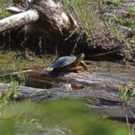
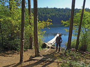
Even with all the great aspects about Van Anda, for us the main attraction is the hike along old roads followed by the trail to Emily Lake—known locally as Turtle Lake for the Western Painted Turtles seen here. On one trip, we stopped near the outlet, fascinated by a pool filled with tadpoles. The trail goes along the east side of the lake and the locally posted trail maps show a connecting trail continuing around the lake to nearby Priest Lake, where you can hook up with more roads and more trails. The roads are practically deserted so they seem almost like wide trails. There’s lots of exploring to do here. Van Anda has a bit of everything for the visiting boater and hiker, and it has become our preferred destination along this section of coastline.
As we’ve seen, the Strait of Georgia between Nanaimo and Desolation Sound can be a wonderful destination, whether or not you’re there as a part of a bigger journey. Cruisers looking to get out for a hike will find good opportunities at many places throughout this region.
Michael and Karen have been cruising the Salish Sea and beyond for more than 20 years, hiking every chance they get. For more resources for hikers visit their web site at https://mvmischief.com/library/. For additional hiking information on the islands in this area Michael and Karen also recommend: Hiking the Gulf Islands of British Columbia by Charles Kahn.