At the northern end of the Strait of Georgia, between Desolation Sound to the east and Vancouver Island to the west, there are a number of islands with wonderful anchorages and some of our favorite hikes along this section of the British Columbia coast. Many boaters include this area on a trip to Desolation Sound, but there’s enough to like that it’s worth a standalone trip if you’re short on time.
The largest of these islands are accessible by car ferry from Campbell River, which means there are roads leading to hikes. There are also good places to provision—another reason for visiting the area. We always stop here for a hike or two, and sometimes to get groceries.
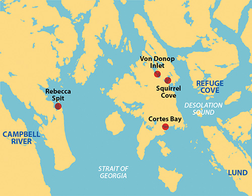
QUADRA ISLAND’S DREW HARBOUR AND REBECCA SPIT
Drew Harbour is sheltered by the white sandy beaches of Rebecca Spit on its east side and the populated shore of Quadra Island on the west. It is just around the corner from Heriot Bay, which has a public dock with a full size grocery store just up the hill. Anchoring is possible anywhere in the harbour, but the most popular locations are close to the outer tip of Rebecca Spit. It was high season the last time we were here and we ended up in the middle of the harbour and, it seemed to us, right in the traffic lane for high speed boats coming from the park at the head of the bay. Despite that, it was calm at night.
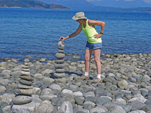
The attraction here is the Spit itself, with fine white sand on the inside (the Drew Harbour side), large cobbles on the outside, and a line of trees down the middle almost to the end. A road goes about halfway out the spit to a parking lot; after that it is walking only all the way out to the end. This isn’t wilderness (most visitors take a ferry from Campbell River and drive here) but the chance to walk a sandy beach is not to be missed here in the Inside Passage where most beaches are rocky. We enjoy it, particularly on a sunny, warm summer day.
CORTES ISLAND’S CORTES BAY
Cortes Island has plenty of roads and some nice bays. On the south shore is busy Cortes Bay, which has yacht club outstations and a public dock with seaplane service. It has good anchoring, but the bay tends to be windier than the Strait of Georgia just outside the entrance. We always set the anchor well and try our best to be away from other boats so we can use more scope. Once we are comfortable, we head to the public dock to access the road and our chosen hike.
Easter Bluffs is the viewpoint at the top of the highest hill overlooking Cortes Bay. To get there, turn right on the main road and walk to a trail crossing in 3/4 mile. Follow the trail to the east for a short distance to a panoramic viewpoint of the northern Strait of Georgia with Cortes Bay below you in the foreground. We are always amazed at the quality of the view from a height less than 600 feet and such a short and easy walk. Heading back to the road, the trail continues across the road to the west, ending up around Hague Lake near Manson’s Landing Marine Park, making for a much longer walk from the Cortes Bay side of the island.
If, when you walk up from the public dock, you turn left on the main road instead of right and walk about 1 1/4 miles you come to a turnoff for Hank’s Beach. This is a beautiful sand beach on the southern shore of Cortes Island with beach walking galore when the tide is out. When the tide is high, most of the sand is gone and what beach remains is rocky and filled with driftwood.
CORTES ISLAND’S SQUIRREL COVE AND VON DONOP INLET
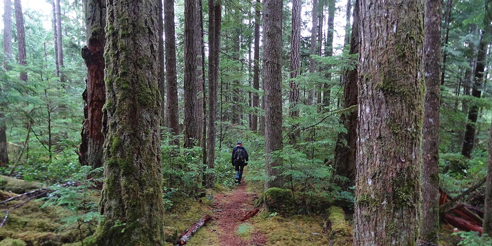
The northern portion of Cortes Island has no roads. Instead, the many trails are accessed from two bays, Squirrel Cove on the east side and Von Donop Inlet on the west. Because of its close proximity to Desolation Sound, Squirrel Cove gets quite crowded in mid-summer, so we prefer Von Donop Inlet. There is plenty of anchoring room and even more trails, some of which connect to Squirrel Cove. The main trailhead is in the large bay at the head of the inlet, but you can anchor almost anywhere—there is no bad spot. We always set our anchor well and it often brings up a sizable piece of Von Donop bottom when we weigh.
From the Von Donop trailhead, there are lots of hikes to explore, some very easy and some not so much. Four of them go to different locations in Squirrel Cove. The main trail between them is the Norway Loop trail that connects the Von Donop side with a small beach on the west side of the inner anchorage in Squirrel Cove. The Squirrel Cove trailhead is marked with buoys hanging from a tree. The Loop trail continues on to the north making a big loop, about 3.9 miles in total length. In years past, much of the trail was obscured by blowdowns; but when we last hiked it in 2023 the obstructions had been cleared away and you could easily do the whole loop in 2 hours. There is a funky, but accurate, trail map posted on a tree near the Squirrel Cove trailhead.
Another option is a short hike from the main Von Donop trailhead to Mud Bay, a small nook within Von Donop Inlet. Just for something different, we sometimes dinghy to Mud Bay and begin our hiking from there.
Yet another interesting and popular hike from the Von Donop trailhead goes south along easy slopes until it meets the Whaletown Road in about 2 miles. If you follow the road east for a mile, you come to the Squirrel Bay store where you can buy a nice ice cream treat or something cold to drink on a warm summer day.
On Cortes Island, opposite the Lewis Channel entrance to Teakerne Arm, there is a peak with a large cliff on its eastern face. This is Cliff Peak, and there is a trail to the top. It leaves from the top of the Norway Loop and is equally accessible from Squirrel Cove or Von Donop Inlet. It follows old logging roads, first around the lagoon then up the fairly gentle south slope of Cliff Peak. When we hiked it a couple of years ago, it was brutal—every 100 feet or so was a blowdown you had to climb over or crawl under or find your way around. We stopped when the road ran out at about 1,000 feet above the water, well shy of the summit’s 1,450 feet, at a lovely, mossy spot where we took stock, applied bandaids to our largest cuts and scrapes and turned around. When the trail is cleared, this will probably be a most interesting 8 mile hike.
Throughout the Salish Sea, the chance to get off your boat and stretch your legs on a great hike is one of the true treasures and pleasures of cruising. The islands of the Northern Strait of Georgia are a wonderful place to do just that, boasting many more trails that are accessible to boaters. These are just some of our favorites, and it’s worth coming here to explore and find out which of the many trails strike you as the best. Enjoy!
Michael and Karen have been cruising the Salish Sea and beyond for more than 20 years, hiking every chance they get. For more resources for hikers visit https://mvmischief.com/library/ For additional hiking information in this area Michael and Karen also recommend: Hiking the Gulf Islands of British Columbia by Charles Kahn.