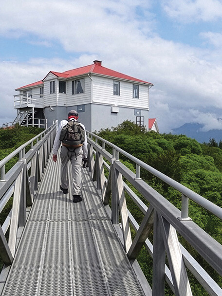
Ah, the dawn of the high cruising season around the Salish Sea. It’s always an exciting time to make plans for where you’ll travel and what you might explore when you get there, and also a great chance to start getting out there! For us, finding and enjoying lovely boat-accessed hikes sits near the top on the list of priorities, and our experiences with that pursuit are what this column seeks to illuminate.
Before pointing the bow farther afield when you’ve got maximum daylight and more consistently pleasant weather, many cruisers take advantage of springtime to embark on a few shorter trips in local waters to bust off any winter rust and discover—anew or again—the innumerable close-to-home gems the Pacific Northwest has to offer. For those around Puget Sound, the southern reaches of this exquisite waterway can deliver some unexpected wonders by boat and by foot.
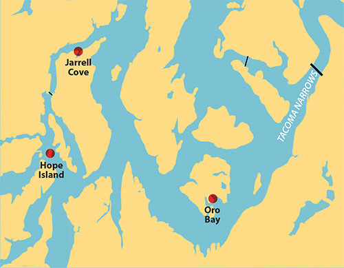
Hope Island State Park
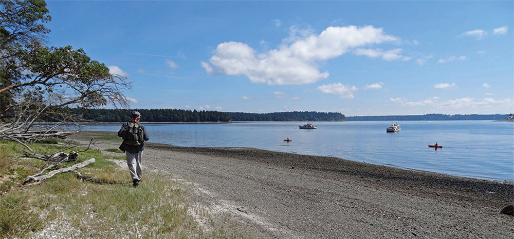
While lovely and generally quiet, the shoreline of the South Sound is mostly private land, which limits access; but there are more hiking opportunities than you might think. About 8 miles north of Olympia is Hope Island State Park. Like many island state parks, there are facilities both on and off shore. There are mooring buoys on the south and west sides that we usually take, if available. The alternative is anchoring, but the island sits at the confluence of Totten Inlet, Squaxin Passage, and Hammersley Inlet and significant tidal currents can make setting your hook a bit tricky, especially during spring tides. We have anchored on the east side and found it to be rocky in places; it took several tries to find a place where we could get a good set on our anchor. The west side provides secure anchorage, though it might be a bit deep for some boaters. The south side has the largest anchoring area but is most subject to wakes from passing vessels. We feel secure there, but not comfortable enough to spend the night during prime boating season. Sometimes we just stay for the hike.
Hope Island has a mostly level, well maintained trail going completely around its perimeter, typical of many state park trails. The trail can be accessed from the water in two places, via a set of stairs on the west side of the island or from the campground on the south end. We’ve never found it crowded. We particularly enjoy coming to Hope Island after visiting Olympia; trading urban hiking for a peaceful trail through the woods.
Jarrell Cove State Park
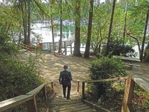
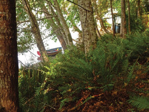
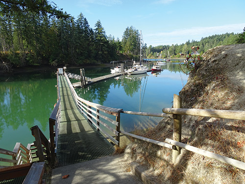
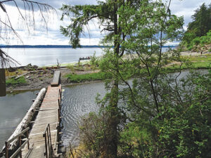
Jarrell Cove State Park is only 8 miles northeast of Hope Island, though this direct route is for small boats only as it passes under a fixed bridge with a 31-foot clearance. Sailboats need to take a much longer route to get there. This cove is one of the most popular destinations in the South Sound for good reason. It is almost landlocked and the protection is near perfect. There are plenty of mooring buoys and a new state park mooring float that even has electricity available, a rarity for state parks. Yet with all of that, there is still some room to anchor.
We like the hike through the park lands but find it a bit too short; just as we are getting into the rhythm of the hike, it ends. There is a longer hike to Harstine Island State Park and its trail network but it requires significant road walking to get there. Still, either might be just right for you! Compensating for the limited hiking is interesting exploration of several small streams and inlets via kayak or dinghy.
Anderson Island
To the southeast, Anderson Island is located about 10 miles south of the Tacoma Narrows Bridge. At its southeast corner is Oro Bay, which actually consists of two bays, an outer bay with easy access but more exposure to southeast winds and Nisqually Reach wakes, and an inner bay with a somewhat complex entrance but more protection. Friends tell us the cell phone coverage and view of Mt. Rainier is better in the outer bay but we have always headed for the inner bay where the derelict Ocean City ferry is slowly rotting away. Whichever you decide, the anchoring is good and there are rarely more than a couple of other boats.
We find the hiking here to be the best in the South Sound. It’s not one park but three that are separated from each other by short road walks. You can hike one, two, or all three. The first is Jacob’s Point Park on a peninsula jutting into Oro Bay. Access to the well maintained trail is from a set of stairs ending in the outer bay, just east of the buoy marking the entrance turn into the inner bay. From here you can walk a circular loop around the Jacob’s Point peninsula, mostly in trees, with many views out to the water. Or you can continue via a short road walk north (turn right) to the next park, Andy’s Wildlife Park.
The Andy’s Wildlife Trail is a circular loop through a mixture of terrains, from wetlands to meadow to forest with some modest elevation gain. At a wet time of year, waterproof boots may be required, but we’ve only done it in late summer and fall when the trail has been merely damp in places. At about the midpoint of the loop, a short spur leads to another road and a short walk north (another right turn) to the third park, Andrew Anderson’s Marine Park.
The Marine Park trail heads west to the shore of Anderson Island. There are several interesting loops that can be followed including one through a stand of old growth timber. Eventually you end up on a beautiful pebble beach with driftwood and views out to the southwest over Nisqually Reach. One time, we were there eating our lunch when a large native canoe pulled up to the beach and all the paddlers piled out for their own lunch break. The total round trip hike from Oro Bay to the beach is about 7 miles and, while it has ups and downs, the total elevation gain is only 200 feet or so.
A cushy forest trail, not too long, not too strenuous, with good views along the way and a rewarding half-way lunch spot are qualities that make for a wonderful trail for the adventurous boater. We search for trails like these wherever we go. There are many other places to explore and hikes to be done in this area. These are just some of our favorites. For additional hiking information check out: Afloat and Afoot in South Puget Sound by Marge & Ted Mueller. It’s old but still useful.
Other South Sound Boat-Accessed Hikes
McMicken Island Marine State Park
This is a small day-use-only island park with 1,661 feet of beautiful South Puget Sound saltwater shoreline. It is only reachable by boat, except during low tide when you can walk across a tombolo to and from Harstine Island for a few hours each day. Moorage is available around the island with five buoys available and anchoring is easy.
Tolmie Island State Park Four Cedars Trail
Located on the mainland southwest of Anderson Island, this park has a 1.98 mile loop trail where you’ll pass through coastal forest as well as shoreline and creeks. Starting from the end of the paved parking area, interpretive signs inform hikers about native animals and the role wetlands play in creating healthy habitats. Boaters can anchor just off the park and land dinghies or kayaks on the beach.
Frye Cove County Park
Located on the west shore of Eld Inlet, north of Flapjack Point on Steamboat Island, this park has a 1.25 mile loop trail, with other trails branching off of it. The route has rolling hills that drop down repeatedly to sea level near the water then heading back up through the forest. The trail is mostly forested with views of Frye Cove along the south and east portions.
Penrose Point State Park
With mooring buoys and anchoring aplenty, this is a favorite for many boaters who venture to the South Sound. There are two miles of saltwater shoreline and two main trails. The Boundary Trail is a 2-mile loop that offers scenic views of the park and its surroundings, including Puget Sound. The Penrose Point Loop Trail is a moderate difficulty level hike spanning about 3 miles around the peninsula with stunning water views on both sides.
Michael and Karen have been cruising the Salish Sea and beyond for more than 20 years, hiking every chance they get. For more resources for hikers visit their website at https://mvmischief.com/library/