In our latest Throwback Thursday, 48° North contributor Michael Boyd shares some tips for preparing for a voyage up the beautiful and rugged North Coast of British Columbia.
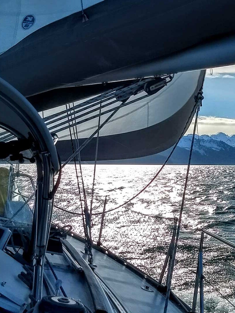
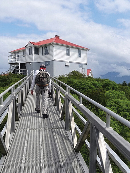
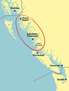
The North Coast of British Columbia is the area between the northern end of Vancouver Island, Cape Caution on the mainland side, and the Alaska border. It’s a land of wild beauty, from the fjords reaching deep into the mainland Coast Range to thousands of islands along the Pacific shore with their white sand beaches. There are no cruise ship stops, so the only tourists are fishermen at fly-in resorts and cruisers on their own boats. We love it.
Getting there requires time and commitment. Cape Caution is about 300 miles from Seattle. The section of the coast around Cape Caution is exposed to the Pacific Ocean and weather, which might require waiting for a good window to get around. But once past, the waters are largely protected and the possibilities for cruisers almost endless.
We love cruising there on our Eagle 40 pilothouse trawler, Mischief, but found neither our experience throughout the South Coast nor the guidebooks fully prepared us for this new area. So, here are some thoughts about the boat, navigation, anchoring, and living aboard that we have discovered from cruising the North Coast.
The Boat
Good news, even though most of the boats we encountered on the North Coast tend to be large, so long as you choose suitable sea and wind conditions for your craft and your experience, almost any boat can cruise this wilderness paradise. It’s how you manage the boat that makes the difference when cruising a remote area like the North Coast.
Be failure-proof as much as you can. This means preparing redundant systems and workaround procedures for as much of the unexpected as possible. On one trip, most of our problems were related to the house batteries and luckily we had more than one way to charge them.
Take critical spare parts with you. We’ve used some of our spares on every trip, and were glad we had them. There is no real marine supply store for a stretch of almost 300 miles between Port Hardy on the northern tip of Vancouver Island and Prince Rupert, which is only about 20 miles south of the Alaska border.
Plan for engine maintenance, such as oil changes, during the trip. Yes, this means sailboats too. With a lack of wind in the summer months, you probably won’t be sailing as much as you’d hope, so the engine hours tend to pile up. There is boatyard-type service available in Shearwater, but that’s the only place until you get to Prince Rupert. And they tend to be very busy, so expect to wait. We inquired about getting help for our battery problems and were told the marine electrician wouldn’t actually arrive for another 10 days and there was already a two week waiting list. In other words, building skills in advance and bringing tools that allow you to do a bit of your own basic engine work is a very good idea as you travel farther north.
Navigation
Even the direct route taken by ferries, cruise ships, and tugs will have its navigational challenges. But for almost every cruiser, most of your North Coast exploration will be off that route and into the intricate fjords of the mainland side or the myriad islands and passages of the ocean side — and that raises the degree of navigational difficulty.
Your main navigational challenges, other than not hitting something hard, will be related to finding a place to drop the hook that satisfies all your needs for that particular day, and getting there at the right time. Additionally, larger tidal swings and narrow passages create significant current effects and other tidal considerations that will be new for the average Salish Sea cruiser.
It’s possible to navigate the North Coast without a chartplotter, but I don’t recommend it. In addition to the many rocks and reefs, there are a great many islands that all tend to look the same from the water, making line of sight navigation difficult even if you have great visibility. We even have a backup in the form of a charting app on a phone; in tricky places we have both going at the same time. Redundancy comes into play in this realm as well.
While electronic charts are wonderful, there can be issues. Sometimes the little boat marking your position on the chart may not actually be in the correct place. It can be disconcerting to see the little boat on land when navigating a narrow stretch. We always use radar in narrow passages to confirm our actual location. And most importantly, in this age of electronics, we take our eyes off the screen and look around us.
Big tides can create various challenges. There are very few published current stations along the North Coast. Mostly you will need to infer the currents from the tide charts.
Many inlets can only be accessed at slack water and some can only be accessed at high slack. This is a good time to read your tide tables twice. And if you are using Canadian Government tables remember the times shown are Standard, not Daylight Savings.
Narrow passages can be tricky. Go through at low water so you can see all the reefs. Or go through at high water when the clear passage is wider and deeper. Pick your poison, but in any case go through slowly and carefully near slack water with a lookout on the bow.
Wide tidal swings make for strong currents, sometimes in places you wouldn’t expect. Passages between islands often have current and sometimes the direction is hard to predict. Plan for it, especially if you are in your kayak or dinghy.
Published information may be incomplete and/or hard to access. Wi-Fi and cell coverage are very sparse throughout this area, but we did have VHF reception almost everywhere.
Our cruising bible for this region, Exploring the North Coast of British Columbia by Don and Reanne Douglass, is vast and extremely useful. But as large as it is, it still doesn’t cover every possible anchorage. We’ve explored whole inlets not included in the Douglass’s excellent book. Be prepared to use your charts and, equally important, your common sense. It’s important to remember that help may be far away and a long time coming.
Even information on the charts may leave some details to the imagination. Detailed charts of some areas were only first issued in 2017, so make sure you have the latest ones. Before that, some areas just said “Unexplored” and some still do. Be aware that your electronic charts may not be up to date, which is something best remedied at your homeport before casting off.
Listen to the weather forecasts on VHF but keep in mind they are mostly for ocean areas to the west of you. Your local weather may vary considerably from the forecast, so treat it as a rough guide and use common sense. This is particularly true for the mainland inlets where localized winds tend to blow either up or down inlet.
Anchoring
We love nothing more than anchoring Mischief in a remote bay with no other boats. This is pretty easy to do on the North Coast. On one trip, we spent half of our nights anchored completely alone. On our first trip to the North Coast, though, we found anchoring to be a bit different from what we were used to and had to adapt.
Be prepared to anchor deeper than you are probably used to — 40-50 feet on the chart is common. Tidal swings of up to 18 feet mean that a depth of 45 feet on the chart can be more than 60 feet in reality at high tide. We have anchored in depths of 100 feet on multiple occasions. As such, the quality and quantity of your anchoring gear is paramount.
Swing room can be quite limited or non-existent. Be prepared to anchor on short scope or with a stern tie or stern anchor. We often set the anchor at 4:1 or 5:1, then shorten scope if necessary. Luckily, our experience is that those tight places also tended to be calm… mostly.
We think of our laser rangefinder as a secret weapon. It makes short work of positioning the boat away from hazards and other boats and keeps re-anchoring to a minimum.
Anchors and anchoring gear choice is a personal preference, but make sure you’ve equipped your North Coast cruising boat with a trustworthy set-up that makes you comfortable when you are off exploring in your dinghy with no one on board and no other boats around in a bay with poor radio reception.
Living Aboard
We thoroughly enjoy traveling from place to place and, when we get to a new place, exploring all it has to offer. After all that activity, we look forward to just being comfortable, which on a boat cruising the North Coast has a few unexpected twists.
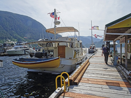
We try to take everything we can conceive of needing. Fresh food only lasts for so long. The only place you can provision from a real grocery store is the First Nations community of Bella Bella. The last time we were there, they got their once-weekly stock delivery on Monday mornings. Because dock space there is limited, most people dock at nearby Shearwater Marina and take a water taxi to Bella Bella. As you can imagine, Shearwater gets very crowded on Sunday and Monday nights as, it seems, every cruising boat on the North Coast wants to provision. In 2022, the Heiltsuk Nation purchased Shearwater Resort and Marina, which is part of its traditional territory. Some details of Shearwater’s offerings for cruisers might change but, in the past, their marina store was provisioned on Mondays as well. Bella Bella also has a small pharmacy (located in the hospital), which is open weekdays from 1-5 p.m.
Be prepared for cool, not hot weather. In each year we were there, we had only one day over 70 degrees in mid-summer. And we don’t plan on swimming either, the water temperature is mostly below 60 degrees.
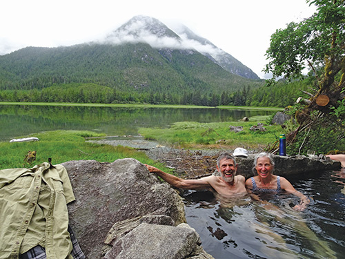
So you want a hot bath? There are a number of rustic, wilderness hot springs on the North Coast. We’ve been to only one so far — Eucott Hot Springs which is up Dean Channel northeast of Bella Bella — and it was a delightful treat with a perfect anchorage nearby. We highly recommend making this and other hot springs a part of your North Coast experience.
There aren’t many established hiking trails, so if you like to hike you will probably want to take advantage of any you can find. But be bear aware. We saw plenty of fresh tracks on our hikes as well as active bears from the boat — both black and grizzly. But even though we’ve looked, we’ve not yet seen a spirit bear.
If you like to spend your time meeting other boaters, head for the few marinas along the coast. Only a handful of the anchorages are popular enough to have even 10 boats on a busy day. Many will have only one, yours.
Cruising the North Coast can be a wonderful experience with very little commercial traffic, no cruise ship terminals, and fewer cruising boats. The other boaters will tend to be like you — knowledgeable, self-sufficient, and committed to the wilderness cruising experience. We love it and will return, and we hope to see you there.
 North Coast Cruising — Central Principles
- Redundancy, redundancy, redundancy: From systems to navigation, if you depend on it, back-up parts and work-around plans are necessary in this remote area.
- Provision for self-sufficiency: Options are very limited to resupply. Pack and plan accordingly.
- Tidal impacts are hugely important: With 18-foot tidal swings, cruisers must stay constantly aware of the ways big tides influence currents, anchoring, and narrow or shallow passages.
- Previous anchoring experience may not prepare you: Desirable anchorages are often very deep with limited swing room. Having gear that allows you to anchor in deep water, and/or employ stern-tie or stern-anchor techniques are necessary.
- It’s paradise, but it ain’t tropical: Weather is variable and forecasts are for the ocean areas. It is wise to anticipate cooler temperatures and more precipitation than you’d expect during a summer cruise on the Salish Sea.
Michael and Karen have been cruising the Salish Sea and beyond for more than 20 years, the last 11 aboard Mischief, a 40-foot Eagle pilothouse trawler with all the comforts of home. They are Waggoner Field Correspondents.