In our latest destinations installment courtesy of SalishSeaPilot.com‘s Jim Burgoyne, we take a closer look at an often missed cruising spot — Cypress Island.
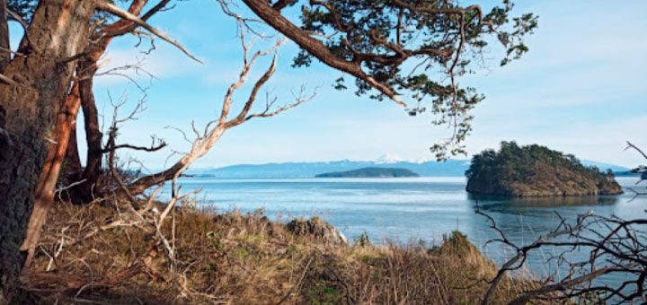
Cypress Island was always a lump in the distance, looming darkly on the other side of Rosario Strait. From where we sat, bobbing among the always sunnier San Juan Islands, it was so far away, rising into a misty gloom. Surely there was no good reason to visit.
And, somehow, for years we had managed to avoid it, and never discussed the island with sailors who had actually been there or read about it in guides, at least not until we got into the cruising guide business ourselves.
It is our Exhibit “A” that you don’t know what you don’t know.
 By and by, we learned that there were some mooring buoys on its eastern shore. Then, some years ago, when Lynne and I got into building the Salish Sea Pilot guides, we figured we better take this vague knowledge and have a closer look.
We found that it is indeed true that there’s not much on Cypress Island. Of course, that is probably the nicest of the many nice things you can say about it.
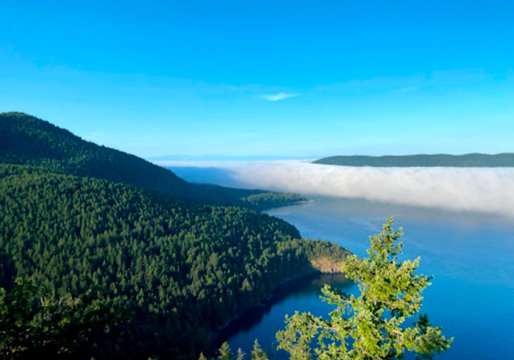
The heavily forested 5,500-acre island, with its 400 acres or so of private property, is home to a few dozen permanent residents. The rest, including a 3,800-acre Natural Resource Conservation Area, is rugged, forested terrain managed by Washington’s Department of Natural Resources. The dramatic topography, which has made the island a bit of a bust for commercial development, makes it attractive to boaters who appreciate natural surroundings.
A quirky story that is repeated in every article you will read about the island — so it must be true — is that the island was given its name by George Vancouver who visited in 1792. He named the island for the trees which grew on the island, incorrectly identifying Juniper trees as Cypress trees.
The island’s main attraction, apart from its beauty, is the 20-mile network of hiking trails that criss-cross its length, twisting along the shore and around pristine lakes nestled in the hills. Most of trails follow the remains of ancient logging roads, while some were built by youth and outdoorsy groups to link lakes and beaches to the main network.
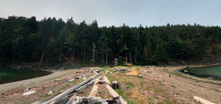
 The only way to get to the island is by boat. It’s a popular destination for kayakers, being only 4-5 nautical miles from the north shore of Fidalgo Island to one of the campsites on the east coast of Cypress Island where paddlers can pull up onto the beach.
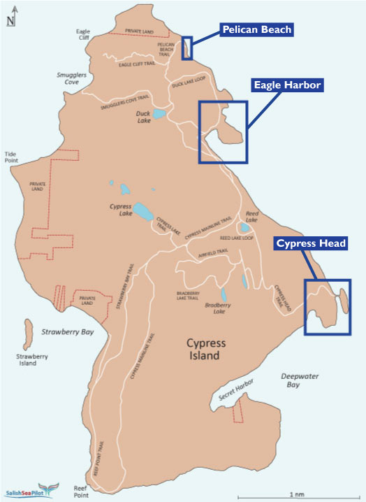
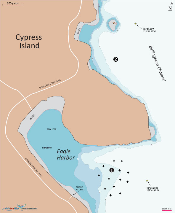
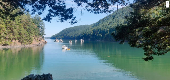
Unfortunately, there are no docks and few places where larger vessels can find protected anchorage. There are some two dozen mooring buoys available at Eagle Harbor, Cypress Head and Pelican Beach. It’s not unusual for the mooring buoys to be all taken.
On anchor, we’ve found good set and decent cover to the northeast and southeast of the mooring buoys in Eagle Harbor, but beyond that the choice is limited. Just to the north of Eagle Harbor, we have seen boats stern tied near Elephant Rock, though the Department of Natural Resources does not sanction or approve of the practice of stern tying here.
Once safely moored, boaters can go ashore to begin their exploration of the island trails. Dogs are welcome, but must be kept on a leash. As well, if the season is late, bring a plastic bag to fill with blackberries. Heed weather forecasts, while in the off season dress in layers and bring good, dry walking shoes.
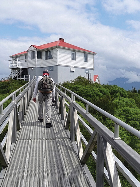
Among the most popular hikes is the challenging Eagle Cliff Trail near the north end of the island. The trail up to Eagle Cliff, most easily reached from Pelican Beach or Eagle Harbor, leads to an 800-foot summit with spectacular views over the San Juan Islands and to mountains all around. The last mile of the trail is closed from February to mid-July to protect nesting Peregrine Falcons.
Combining the Duck Lake Loop Trail with the Smuggler’s Cove Trail that takes hikers to the west shore of the island is also a wonderful walk. As well, the long trail south to Reef Point, which forms a loop with the Strawberry Bay Trail and the Mainline Trail is a good, long workout.
While Cypress Island is popular with boaters and kayakers, since there are limited accommodations for either, walking the trails you might believe that you, and your crew, are the only humans on the island.
Note: This article was originally published on SalishSeaPilot.com. The 2023 versions of Salish Sea Pilot’s cruising guides are available now.