Highlights From A Circumnavigation of Vancouver Island
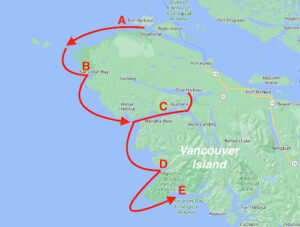
A) Bull Harbour/Nahwitti Bar
B) Sea Otter Cove
C) Quatsino Sound
D) Klaskish Basin
E) Columbia Cove.
Like many Pacific Northwest boaters, my wife Karen and I wanted to cruise the west coast of Vancouver Island but were intimidated by what conditions might be like on the ocean. I’m somewhat prone to seasickness, and she thought our boat at the time, a 25-foot motorsailer, was too small. A few years ago, we bought Mischief, an Eagle 40 trawler, and felt we finally had the boat and the experience to tackle it. We started our planning two years in advance by negotiating for the eight weeks away from our jobs we felt we would need to make such a trip without feeling pressured by time. After years of dreaming and planning, mid-June arrived and it was time to load the boat with provisions and go.
On our first day, we got an early start out of our homeport in Seattle, planning to reach Deception Pass for the late afternoon slack. We were a bit early and caught the last of the flood. Perfect, we thought. But we hadn’t paid sufficient attention to the weather forecast for the Strait of Juan de Fuca and didn’t realize the gale in the strait was going to affect us. Almost as soon as we were past the Deception Pass Bridge the waves started to build. By the time we reached Rosario Strait, we were facing steep 4- to 6-foot seas. In these rough conditions, we felt daunted bordering on terrified. We put on our life vests, picked up the things off the floor we had been careless about stowing, and pushed across Rosario toward the Lopez Island shore. The closer we got to the lee of the island, the smaller the waves became, and we were greatly relieved to make Hunter Bay and calm water for the night.
Thinking we’d just had a preview of the Van Isle coast, we were nervous about the future. As it turned out, these were by far the worst seas of our entire trip.
Like most circumnavigators we were going counterclockwise in order to have the wind, waves, and current behind us on the outside. Accordingly, we wandered our way up the east coast of Vancouver Island to Bull Harbour near the north end of the island; the traditional jumping off place for the west coast. It had taken us 15 days to travel the 370 miles from Seattle, the last of which were spent waiting for a suitable west coast weather forecast. It was predictably enjoyable to visit cruising stops as we made our way north, some new and others familiar. With almost six weeks of our trip remaining, however, we had now positioned ourselves for the main event.
Going over the top of the island, we left Bull Harbour at first light, skirting Cape Sutil closely to avoid Nahwitti Bar, and arrived at Cape Scott at slack. The wind was light from behind us and the swell was about three feet on our starboard quarter as we pushed down the coast.
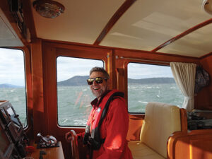
Karen and I were awed by the immensity of the scene. Vancouver Island was nearby to our left and, to our right, nothing but sea and sky. We put Mischief on autopilot and searched for the best place aboard to enjoy the ride south.
The wheelhouse had the least roll but the view out the windows was disconcerting; all we could see was water, then a bit later all we could see was sky, repeated every 20 seconds. The flybridge had a more pronounced roll but at least the view of water, sky, and the wild coast of Vancouver Island was much more stable. Before long, we had completed the day’s 35 miles of travel and were approaching the narrow entrance to Sea Otter Cove which, with the wind out of the northwest, was delightfully calm. We had successfully passed our first major west coast challenge, Cape Scott.
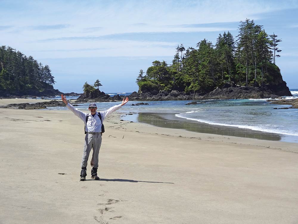
Sea Otter Cove was a perfect introduction to the west coast. We tied up to one of the huge commercial mooring buoys and took in our first west coast landfall. Behind us was a small island protecting us from waves coming in the entrance. Ahead was a large shallow bay and 100 yards to our left was a pack of three wolves arguing with a black bear over who had rights to a seal carcass on the beach. The bear seemed to get tired of the nipping at his heels and left, to return later after the wolves had eaten their fill. Once the local wildlife had wandered off, we took the dinghy to shore for a hike to Lowrie Beach on the outside. We truly felt we had arrived.
on Lowrie Beach.
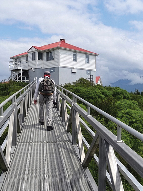
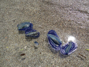
The “trail” was mostly a surveyor’s-tape marked route through a shallow swamp that happened to end on the beach. And what a magical beach it was. The sand was white and fine with absolutely no flotsam and no signs of any footprints but our own. Floating on the water were thousands of creatures we had never seen before — each a flat three inch disk of cobalt blue jelly with a clear, stiff sail standing up in the middle. The ones stranded on the beach by the outgoing tide had lost their color in death. We found out later they were called By-the-wind-sailors, and they’re related to jellyfish. Farther down the beach, we discovered the emergency shelter, a small cabin, really, placed by the government to benefit any human boaters that might be shipwrecked on this wild coast.
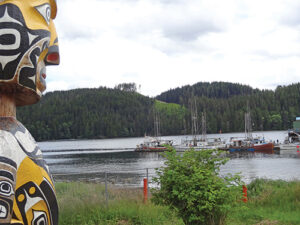
It was only a short way from Sea Otter Cove to Quatsino Sound, the northernmost of the five great sounds that indent Vancouver Island’s west coast. As we entered, we circled around the Gillam Islands, which occupy the center of the entrance channel, and spent some time admiring the sea otter colony making use of the kelp beds on the lee side of the islands. Although it is a long way from Seattle and challenging to get to, Quatsino Sound can’t really be called remote by west coast standards. At its entrance, along the shore of a small narrow inlet, is the coastal community of Winter Harbour and down its fjord-like arms are several small towns that are connected by road to the east coast of Vancouver Island.
Winter Harbour seemed like it might be civilization so we tied to the public dock and checked out the town. There are a few houses near the water, a nice boardwalk along the waterfront, a post office, and a small museum, but the community seems to be centered around the fish processing plant. It was very quiet; the fog and rain might have had something to do with it. Of course, there was also a small store, well stocked with canned and packaged goods, and a surprisingly good supply of fresh fruits and vegetables. This was probably because Winter Harbour does have a road going to it, likely a holdover from long past logging operations. The store also had a freezer so we treated ourselves to ice cream.
After topping off our water tanks, we met some of our fellow travelers, also circumnavigating as we were. They were a mix of sail and power with some, like us, out for the adventure of it all and others on their shakedown, getting a taste of the ocean before heading south for Mexico and beyond. Since we were all traveling at about the same speed and all going from sound to sound, we would meet many of them again on our trip. We moved farther into Quatsino Sound to tiny Pamphlet Cove on Drake Island, where we anchored all alone and watched the small boats heading to the fishing resort across from the entrance.
Retrieving the anchor proved somewhat difficult. When it finally came up, it was hooked to a large tree branch that took some time to remove. We finally got underway and headed for Holberg Inlet. We certainly didn’t expect to find aids to navigation there, but since nearby Rupert Inlet was once home to a large open pit copper mine, a line of lighted beacons was installed from the entrance of the sound all the way to the mine, warning boats away from hazards. We followed the beacons through Quatsino Narrows toward Rupert. While there are current predictions for Quatsino Narrows and it may be narrow by deep draft boat standards, we saw it as wide and deep with a maximum current of less than 4 knots — clearly not in league with the narrows of the Inside Passage with which we were more familiar. Next stop, Coal Harbour.
Only 12 miles from Port Hardy by gravel road, Coal Harbour is commuting distance for some of the workers there, and is a former whaling center. We tied up at the community dock, visited the small store, and took a tour of the local museum. Their artifacts covered the area’s past in whaling, logging, and mining. The star attraction was a jaw bone from a blue whale standing on end like a gigantic arch.
Near the head of nearby Neroutsos Inlet is another town with good roads, Port Alice, the site of a large pulp mill. Port Alice is large enough to have a dedicated small boat harbor located a couple miles away at Rumble Beach. We tied up at what we hoped was the guest dock in Rumble Beach Marina and chatted with a couple of locals. Then, a mile walk up a paved road brought us to a small supermarket, where we stocked up on as much fresh produce as we were willing to carry back to the boat. It was great to stretch our legs but we didn’t want to stay in the marina so we headed out to another small, quiet bay called Julian Cove. Again there were no other boats in the pristine cove — just how we like it.
While we had been exploring the waters of Quatsino and enjoying its many attractions, there had been gales in the ocean. We only knew this from the weather reports on the radio. The conditions even a short distance inside the Sound were completely different — mostly calm without a hint of swell, mostly cloudy but without the fog so prevalent along the coast. With the ocean forecast calming down, we agreed it was time to plan our journey back out into the ocean. This would present our next major west coast challenge, the Brooks Peninsula, and on to the next cruising destination, Kyuquot Sound. Again, I began to think about mal de mer.
The Brooks Peninsula is an almost-rectangular landmass that extends 9 miles straight out from the west coast of Vancouver Island. It forms such a major barrier that the Environment Canada weather forecast for that side of the island is broken into two parts: south of Brooks and north of Brooks. It can be a significant passage for a cruising boat, requiring careful planning for the wind, waves, and weather.
One can certainly go directly from Quatsino Sound to the outside of Brooks, but that route would be much more exposed than we were comfortable with. So we adopted a more timid approach — heading from Quatsino down the coast until we got to the peninsula, staying overnight near there and then going around the next day. We needed to have a good forecast for two days. The first would get us in position and the second would get us around.
The ocean was still a bit rough from the recent gales, but the forecast was for improving weather and diminishing seas, so we decided the time was right and headed for Klaskish Basin at the north corner of Brooks Peninsula. We immediately headed out to 120-foot depths on the chart to avoid all near shore hazards. Klaskish is a small, narrow inlet that has an entrance protected by a number of rocks and islands. When we got there, the islands had waves breaking on them and we threaded our way through in calm water. It was a spectacular entrance, a quarter mile long and 100 feet wide with high rock walls on both sides that opened into a lovely basin with plenty of room to anchor and waterfalls to serenade us. We dropped the hook in 19 feet and while some wind from outside seemed to enter the basin, the water was calm. We listened to the latest weather forecast which still called for good conditions the next day. Splendid!
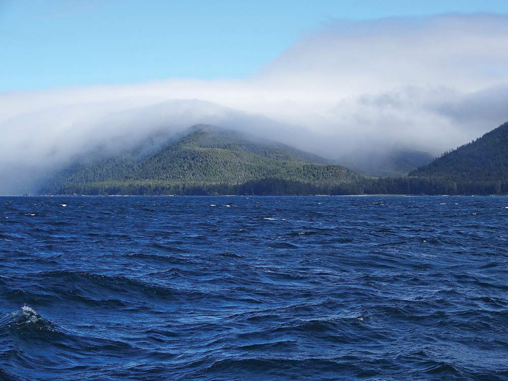
The next day we left Klaskish Basin early in calm seas and light winds and made for Solander Island, a large, barren rocky island on the west side of the Brooks. By-the-wind-sailors covered the water and dense low clouds obscured the forests from the top of the peninsula almost to the waterline. As we rounded Solander, the sun came out and we sighted a pair of Northern Fulmars, our first true sea birds. We were finally ocean travelers as well.
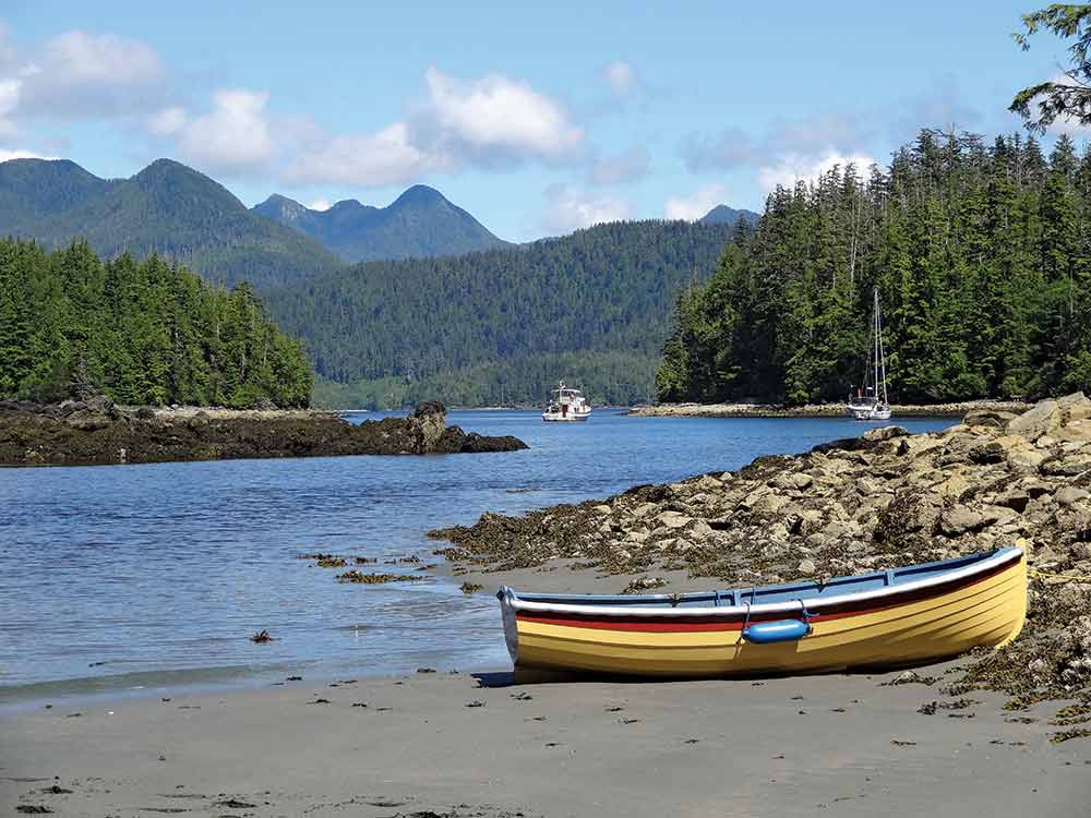
As we approached the coast along the south side of the Brooks, the wind dropped, the seas calmed and the sun returned. We anchored in Columbia Cove under sunny skies with dense clouds still covering the top of the peninsula a short distance away. We definitely breathed a sigh of relief; we had successfully passed our second major west coast challenge.
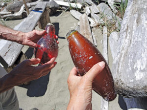
First order of business was a hike, out to Shed #4 beach. There were acres of fine white sand, shining in the sun, but how different it was from Lowrie Beach. While the latter had been pristine, Shed #4 was covered with flotsam; plastic floats, large chunks of styrofoam and many unusual things. It was probably debris from the east Japan tsunami, carried to this coast by the northern Pacific currents and hurtled against the Brooks Peninsula by southwest winter storms.
It was relentlessly breezy in Columbia Cove. The wind came down from over the top of Brooks and blew 15 knots most of the time and, with gale warnings, we were reluctant to leave. But after three days we had investigated everything we could reach in our rowing dinghy and we were ready to go. We retrieved our anchor and ventured out into the ocean to test things out knowing that we could always come back if conditions were horrid. But instead the wind immediately died. It seems Brooks also creates its own weather.
Our next stop was the Bunsby Islands, and we were equally eager to get there and grateful for the experience we’d had so far. Though, by mileage, we were only slightly more than one quarter of our way south along Vancouver Island’s wild west side, we had already seen so much — beauty, wilderness, and truly unique small towns. We’d also shown ourselves that, with thoughtful planning, we were capable of this style of ocean cruising. Mischief was certainly up to the task, and we were feeling increasingly assured as we continued and visited more and more wonderful, rugged, and remote destinations. After years of dreaming about it, we were really there — exploring the outside of Vancouver Island, and loving it.
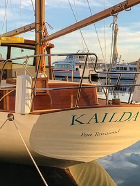
Michael and Karen have been cruising the Salish Sea and beyond for more than 20 years, the last 11 aboard Mischief, a 40-foot Eagle pilothouse trawler. They’re out cruising now — follow their journeys at www.mvmischief.com