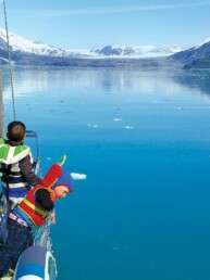
Our rather daring goal for the 2023 cruising season was to explore some of the inlets on British Columbia’s North Coast that are on the edge of the Pacific Ocean and Hecate Strait, some of which are open to the ocean waters, and to do it without too much drama. As Pacific Northwest cruisers are well aware, part of the magic of our expansive cruising grounds is just how much of them may be enjoyed by traveling almost exclusively through the relatively protected waters of the Inside Passage. What might we discover about cruising, our boat, ourselves, and the wilder waters and shores by venturing a little farther out? Among other things, we’d find sublime solitude, some barely-charted waters, and a strainer-choking quantity of jellyfish.
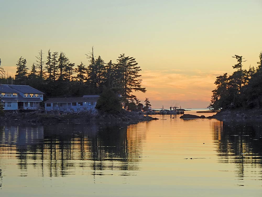
In keeping with our priority of low-drama ocean travel, we left Seattle in late May. The weather along the coast is less settled at that time than later in the summer, and we wanted to give ourselves more time to wait for good weather windows. Predictably, our progress northward was slower than we had hoped, so as we neared the Central Coast we had been out almost a month and needed some dock-time for all the usual things: battery charging, laundry, shopping, and more. Shearwater Resort near Bella Bella is just the place.
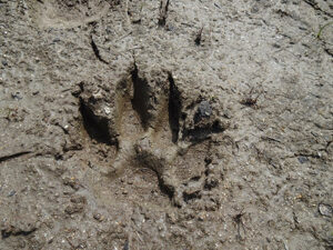
Being the only full service marina between Port Hardy on Vancouver Island and Prince Rupert near the Alaska border, everyone seems to gravitate toward Shearwater when heading north or south. Shearwater is actually a resort, with a lodge/hotel plus a well maintained marina. It has all the usual resort amenities: showers, laundromat, small grocery, marine store (mostly for fishermen), restaurant, and a bonus, a boatyard with travel lift. To stretch our legs, we took the hike of about two miles through interesting bog type terrain (called muskeg in Alaska) to Eddie Lake; there was no skinny dipping on this day, too cool. The muddy places in the trail had plenty of wolf and coyote prints and we even saw a new bird — a blue grouse and chick.
Of course, Shearwater has fellow boaters. When not hiking, shopping, or doing laundry, we spent most of our time socializing. Even though there were only 10 other boats, we ended up spending time with most of them. People stopped by to comment on our dinghy or the design of our Eagle 40, and the stories and connections were fascinating. One person recognized Mischief from our latest article in 48° North, and she just happened to be on a boat we had anchored with in Squirrel Cove three weeks prior. Karen sold some of her notecards to the boat across the dock that we’d stayed with at Chatterbox Falls in 2017. One man was there to deliver a boat to his 20-something daughter who was going to take it on to Haida Gwaii. We met two men in their 70s who were rowing a 17-foot Whitehall from Port Hardy to Ketchikan. The people were so interesting and the conversations so varied we almost felt like it was some kind of speed dating event.
After a wonderful and crazy busy time, we were glad to get away and were excited to begin our explorations farther north. The local forecast for the day was showers — instead we got dense fog patches alternating with sun and blue sky. At least the wind was close to the forecast “light” airs, so we headed west and ventured into a little bit of the ocean and then into a large open body of water called Milbanke Sound. From this point, there are two passages that you could take to the west side of Princess Royal Island: Higgins Passage and Meyers Passage. Higgins is the shorter, more direct route but it has a major problem — the middle of the passage is blocked by a dangerous bar that dries at 5 feet making it too shallow for Mischief, except on really high tides. There wasn’t going to be a sufficiently high tide when we needed it, so we took Meyers and had 14 feet of water at low tide. There were four kayakers taking the passage with us, just cruising along in the calm water, and we slowed down as we passed them in the narrow passage.
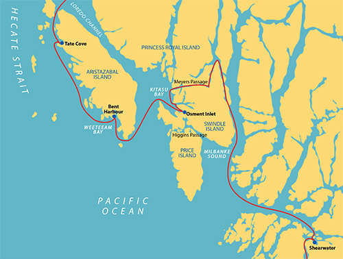
So far, the cruising had been easy and the waters calm, but now we were approaching the start of our objective for this summer’s cruise — exploration of the waters on the edge of the ocean, starting with Kitasu Bay. Part of Laredo Sound, Kitasu Bay has a number of inlets indenting its shore that are so remote the first large scale chart was published only 6 years ago, in 2017. Our chartplotter predates those charts, and only has an approximation of the location of the major islands with blank white areas where we would usually see blue soundings. We have an iPad with recent electronic charts with soundings but, as we were to discover, it had its own inaccuracies. Luckily, we also had the all-important recent paper chart.
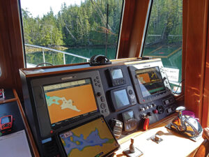
Armed with three navigational tools, we didn’t feel like we were pushing the boundaries of safe cruising and decided to explore Kitasu Bay’s inlets to find the best place to spend the night. The first one we tried was Coward Inlet, which has a narrow entrance that required a person on the bow to warn of rocks or reefs. We didn’t care for it, so we had to undertake the tricky navigation twice in one day. Our next option, Cann Inlet, was pretty but too deep for convenient anchoring. Osment Inlet, on the other hand, has a passage that winds among islands and reefs ending at a lovely anchorage with a mostly flat, mud bottom.
Mischief’s chartplotter was of no help, showing us on land when we were clearly still afloat. The iPad correctly showed the passages, islands, and soundings, but also displayed a “shallow area” in the anchorage where the paper chart showed a large rock that would be exposed at medium tides. Sure enough, we saw the rock and recognized it was more than just a shallow spot! At this point, we had used all our navigational tools and had arrived there safely.
Osment Inlet is completely landlocked at its head, but still had a mild breeze to keep away the bugs. It was surrounded by older forest with many silver snags, and was a lovely place worth the stress required to reach it. With one success under our belts, we were looking forward to more exploration of this sort.
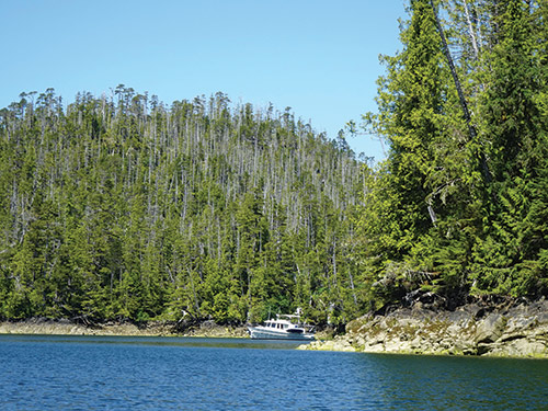
The next day started with light drizzle and fog that quickly improved to deep blue skies and intense sunshine. Doubly impressed by our surroundings in this new light, we decided to stay another day. With that decision made, our first order of business was putting out a crab trap. We had no idea if there were crabs, but setting the trap is the only way to find out. After that, we puttered around until lunchtime when, with a simultaneous low tide, we went on a rowing tour of the inlet with the hope we could find some place to land and stretch our legs. We succeeded beyond our expectations.
Osment Inlet ends in a long, narrow river delta that mostly dries at low tide. Equipped with our muck boots, we rowed to the edge of the water and walked along the shore, much of the time over sand and mud flats covered with clam shells. We continued a half-mile back into the head of the delta where multiple creeks enter the salt chuck. We could see the course of the streams and walk among the salt marsh grasses. Along the way, we saw the remains of two fish traps used by indigenous peoples so we knew this area was once populated and these were streams thought productive by the local population at the time. There was an eagle in an old snag patiently waiting for the tide to come in.
We continued rowing around our little world and spotted a lone sandhill crane high up on another beach near the remains of a float house along with the floating infrastructure of an aquaculture farm, which was no longer in operation and just being stored there. Later, back at the boat, a river otter swam by and an osprey soared overhead before making a dive into the water.
The inlet was crystal clear with a large number of water jellies, a delicate common jellyfish, of all sizes from tiny to about 6 inches, floating at various depths. Karen definitely thought our extra day stay was worthwhile. Despite the fact we didn’t catch any crabs, we loved being completely alone in this isolated anchorage.
The following day was one of those “interesting” days boaters are all too familiar with. It started well enough, dead calm with fog caressing the tops of the trees surrounding our bay. It was cool, about 57 degrees. We started the generator, turned on the heat and sat down to breakfast but, after about 20 minutes, Karen noticed smoke coming out of the generator and we quickly shut it off. In diagnosing the problem, a brief start showed it was running hot and there was hardly any water flow. Opening the raw water strainer clearly revealed the problem — it was so clogged with jellyfish that I could barely get the basket out. The hose from the through-hull was clogged, too, and maybe the generator engine itself. We spent the next hour cleaning the basket and the housing, reinstalling and starting the generator, running for a few minutes before shutting down, and doing it all over again. Eventually, the number of jellyfish in the basket declined and it was running at normal temperature with pretty much normal water flow; soon, we discovered no more jellyfish. Disaster averted.
By the time we’d resolved the jellyfish generator issue, the fog was beginning to burn off, so we decided to head out to our next destination “on the edge” — Weeteeam Bay, on the wild west coast of Aristazabal Island. Getting there requires leaving the protection of the Inside Passage and going out into the ocean waters of southern Hecate Strait. The forecast was for winds of 5-15 knots and ocean swells less than 3 feet, and that’s exactly what we got… that, plus fog.
The west coast of Aristazabal is encumbered with islands, rocks, and reefs for a distance of up to 10 miles offshore. It’s no place to be in the fog, even with a chartplotter. If it didn’t clear, the low visibility would have driven us to turn around and go somewhere else. But our karma must have been good because just as we approached the southern end of the island to start the delicate portion of the navigation, it vanished and we could see the scene around us. It was spectacular, with islands and reefs in almost every direction and the ocean swell breaking on them as we motored past. Some of the islands had trees and some were just large chucks of rock with birds on the top. We carefully rounded the southern tip of Aristazabal and headed northwest up the coast to rarely-visited Weeteeam Bay.
This bay has several possible anchorages; we chose one called Bent Harbour, named, I suppose, after the right angle bends the harbor makes through the many islands that provide its shelter. Those islands are low and provide only limited protection from the wind, but no waves or swell can get in the anchorage. We felt quite safe here and closed the day by again checking our strainers for jellyfish and, thankfully, found them clean. We hadn’t seen another cruising boat for days, which didn’t surprise us but delighted us nonetheless.
Bent Harbour was beautiful in the morning with fog patches rolling in from Hecate Strait then dissipating over the land. Even though it was perfectly calm, we delayed our start until the fog had burned off and we would have a clear view of the west coast of Aristazabal Island. We knew that it was better to negotiate the passage through the many islands, rocks, and reefs dotting the coast in good visibility; and the day proved excellent for travel with sunny skies, mild breeze, and gentle 1-2 foot swells. While requiring careful navigation, our journey northwest was calm, even relaxing — no white knuckles on this day.
The weather forecast was for strong southerly winds the following day so before rounding the top of Aristazabal we decided to seek shelter in Tate Cove, reported to be excellent in all wind conditions. The only drawback was a fishing lodge in a nearby nook, so we weren’t alone any longer. Karen, for one, found it welcome relief from the sometimes unsettling feeling of being “so far out that help might never arrive” that she experienced in Bent Harbour. If the winds materialized, we could stay another day rather than venture out into open water. And since Tate Cove is renowned for its large numbers of eagles, we would not be bored. Along a wild coast like this one, a mariner could certainly do worse.
We didn’t particularly care for the weather forecast, which called for wind and rain, but in the morning it was calm and dry, so we decided to travel anyway, starting off in a slight westerly swell. We were headed for more protected waters, away from the ocean and its swells, back to the cruising we were more familiar with. We had enjoyed our time on the edge of the ocean, in no small part because conditions had been as good as one could hope for.
After many years of cruising protected passages with incalculable rewards and enjoyment, much of our cruising in the last few years has pushed us outside our comfort zones as we ventured into ocean waters. With the portion of our 2023 North Coast trip that brought us to barely-charted Kitasu Bay and the wild west coast of Aristazabal as the latest example — time and prudent seamanship make it possible for cautious cruisers to explore these remarkable, remote, and potentially risky regions. And we are so glad we did.
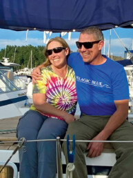
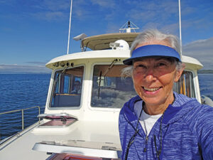
Michael and Karen have been cruising the Salish Sea and beyond for more than 20 years, the last 12 aboard Mischief, a 40 foot Eagle pilothouse trawler.