Hopping North Up the Coast to Get a Newly Acquired Grand Banks Home
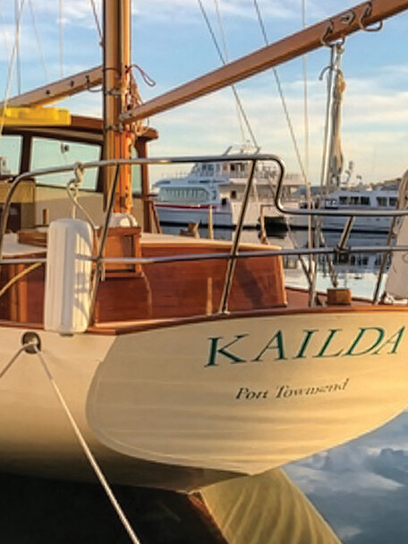
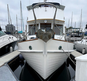 When I found a 1988 Grand Banks 36 for sale in Southern California’s upscale Balboa Yacht Basin, there were a host of things I had to do to make her ours. For starters, I flew down from the Pacific Northwest, gave the boat a thorough look, and made an offer. From there, I set up a pre-purchase general boat survey, sea trial, and haul out—all the normal stuff. Three weeks later came oil samples and a mechanical inspection on the auxiliary generator and the 210 hp Cummins diesel, which had 6,600 hours on it. I flew back south for these and, after all the surveys were complete, I re-negotiated the price. A few weeks later, the Grand Banks, Passage, was ours.
The big question now was: How do you get a trawler from Southern California to Astoria, Oregon? Answer: One day at a time.
Preparation and Planning
When planning a voyage of this length, especially with a new-to-us boat, it’s key to take in as much information as
possible about the boat and the most efficient route. The published weight of a GB 36 is 26,000 lbs and, with a single Cummins 6BT 5.9 main engine, its cruising speed is 7 knots at 1,600 RPMs with a fuel burn of plus-or-minus 1.75 gallons per hour (ghp). Most people run a boat like this at 1,800 RPMs, gaining a knot or so in speed, but it increases the fuel burn to 3.0 gph.
We had the typical safety gear aboard including lifejackets, flares, fire extinguishers, and an EPIRB. Passage is equipped with a Simrad G09 chartplotter/fish finder with radar and an AIS transponder on the fly bridge. I am a big fan of the AIS transponder for a slow boat like this, and I feel safer, especially at night, when other boats can see us and monitor Passage’s direction and speed. Commercial vessels are required to have an AIS transmitter, but some will disable it when fishing. It’s annoying when you are heading north up the coast in the dark and 300 yards on your port is a commercial fishing boat all a blaze in lights heading south with their AIS disabled while they process their fish with AC/DC blasting on deck.
Before we left on each leg of the trip we looked at parameters such as weather, sea state (a 4 foot wave height or less with an 8 second period would be ideal), tides and currents at the port we were leaving and the same at the destination. For tides and currents, we considered the departure time of day and estimated our arrival time. It can be challenging to match up the currents and light conditions at both ends of the leg. I think it is very important to enter an unknown harbor in daylight, so you can see the bar conditions and surroundings. An example from this trip is when we arrived at the Columbia River Bar. We were there two hours before the tide turned and it was dark. So we bobbed around until daylight and waited for the tide to turn. If I had planned more carefully, we would have slowed down, so our arrival would have meshed better with the bar crossing. In this case, we also needed daylight to start trolling for salmon, too.
We relied on the Predict Wind app for our wind and wave forecasting. The app allows you to move a cursor ahead in time and see what the waves will be doing in the next few days and see if they are getting larger or smaller. You can also move it along your route to inform your expectations. Along with Predict Wind, we looked at the NOAA buoys using various apps. I haven’t found any one app that I am crazy about, but they all mostly work.
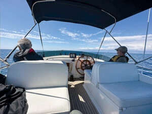
Joining me for the voyage was a friend from college named Gus, and my brother Rob. Another friend, Kim, joined us for the last leg of the trip. I think a crew of three is the perfect size on a boat like Passage. There is plenty of room for everyone, and it’s nice to have three if there is an emergency, like if someone falls overboard; one to drive the boat and another to do the rescuing. With the boat staged in Marina del Rey and the crew ready, it was time to point the bow north and go.
A Dark and Stormy Start
Hurricane Hilary arrived in Southern California on August 20, 2023, and we had a lot of rain while doing last minute preparations for our departure the next morning from Marina del Rey. We debated leaving on the morning of the hurricane; it looked like a good plan as long as the hurricane didn’t change course. But not knowing if Hilary would stay the course, we elected to stay put. Sometimes the best course of action is no action.
Departing in the morning one day later than planned, the first leg to Santa Barbara took us about 11 hours. We reached Santa Barbara around 5 p.m. with beautiful warm weather and little wind. I would have liked to have stayed in Santa Barbara for another night but we were on a mission to get north. We left a little before sunrise for the next leg to Morro Bay, which was 102 miles. The seas were once again calm with a little wind, and we were treated to a beautiful sunrise over the mountains to the east.
Due to the distance between safe navigable ports, we cruised overnight on several legs. On these legs, we would arrive in the morning shortly after sunrise, rest up and depart early the following morning for the next port. I didn’t like cruising in the dark and obvious things like crab pots, logs, rocks, and commercial draggers with their AIS turned off were serious concerns. On top of that, there is plenty of time to worry when it’s 2 a.m. and you’re on watch, sitting in the darkness listening to the engine drone and wondering if the transmission is making a new noise. “What’s that ‘tink tink tink’ sound? Or, since it happened once during the day, “Did the dinghy break loose?” As it turned out, the engine thankfully never missed a beat, day or night.
Despite our best efforts, we arrived at Morro Bay in the dark and followed the winding channel markers. We managed to find a buoy and tied up next to a dock full of sea lions that didn’t know how to keep quiet. They barked all night long, but that’s what they do best from what I have heard. The boats in the anchorage were so close together I didn’t feel like we could anchor and have enough room to swing. And because it was dark, it was nearly impossible to get a sense of where you anchored and the distance to other boats and potential obstacles.
Northern California to Oregon
We left Morro Bay for the 103-mile hop to Monterey Bay’s Moss Landing before sunrise in fog, with a strong current flooding the bay, making it very difficult to stay in the channel. Years before, I had flown small aircraft and obtained my instrument rating. Piloting a boat in the fog and current is much like Instrument Flight Rules (IFR) flying when visual references do not provide safe enough information to operate. Conversely, at 7 knots rather than 120 knots, everything is in slow motion so you don’t get overwhelmed. Still, you have to believe the chart and the instruments, otherwise you will get completely disoriented. Fortunately, our navigation was spot on and we arrived in Monterey Bay at dusk then made a quick turnaround the next morning for Half Moon Bay.
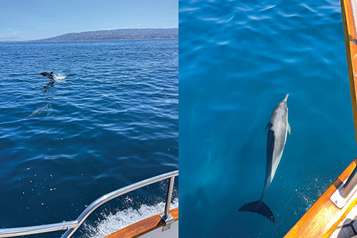
Half Moon Bay to Fort Bragg was 139 miles and was the most unpleasant leg of the voyage. When we left the bay, conditions were great: calm, no wind. We encountered whales from Half Moon Bay all the way up to crossing the shipping lanes outside of San Francisco Bay. I was concerned about ship traffic, since we crossed very close to the center of the traffic circle. Fortunately, we observed no traffic in that area, zero. We considered stopping in Bodega Bay for the night, but relied on the description of the bay in Charlie’s Charts, which recommended entering the bay in daylight the first time, due to the narrow channel and currents. It was also recommended to leave on a flood tide, so timing was an important consideration and it didn’t quite align.
Once we passed Point Reyes at about 6 p.m. the seas and wind started to build, and we were fighting a 1-knot current. Darkness fell and the swells grew to 6 feet or more and we were taking water over the bow that crashed against the windshield. We traded 1 or 2 hour watches throughout the night as Passage motored north, slogging along this way for the next 10 hours. We finally reached Point Arena about 4 a.m. North of the point, conditions improved dramatically and, by the time we reached Fort Bragg, the sea was dead calm. We arrived at Fort Bragg early on a Saturday morning as the fishing fleet was leaving to hunt tuna 35 miles offshore.
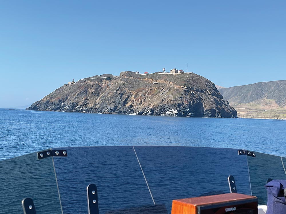
It was another early departure and we left Fort Bragg in the dark at 5:00 a.m. with calm seas. The most interesting part of this leg was Vandenberg Space Force Base. The installation is huge, covering about 14 miles of coast line, with numerous missile silos and large mysterious buildings. We arrived in Eureka at dusk, but by the time we wound through the narrow channel to moor with the commercial boats, it was completely dark.
From Eureka, the initial plan had been to stop at Crescent City, a 66-mile run, but we decided to skip Crescent City because it would have been a long haul in and out. Moreover, leaving there in the morning, with 110 miles to our next destination of Charleston, Oregon, we would arrive in the dark with a bar to cross.
So, we steeled ourselves for a big run. In retrospect, we should have stopped in Crescent City or Brookings. We got a late start because we needed fuel and Eureka’s fuel dock opened at 8 a.m., so we didn’t get going until 9:30. Staying in Eureka for a second night would have been a possibility, but I was always concerned that the weather could change, we could get stuck for a week, and then I would lose my crew. We had already dodged a hurricane, afterall. As it was, we ended up motoring for 25 hours, our longest stretch between ports, and crossed the bar to enter Charleston in daylight, ready for some R&R.
Homeward Bound
We lost Rob in Charleston — no, not overboard. He had a commitment that he couldn’t miss, so it was just Gus and me heading north to Newport. This was just a beautiful leg. We left at sunrise with a spectacular sky, flat seas, and no wind. During our whole journey to Newport, we kept between 2 and 5 miles offshore with a stunning view of land and an easy run to the beach in the dinghy, if that was called for.
In Newport, we added a new crew member, Kim, who had a lot of Columbia River Bar experience having grown up working as a skipper on a salmon charter boat out of Warrenton. Kim thought we could catch some salmon once we reached the Columbia River.
We left Newport at 2:00 p.m., crossing the bar with no wind and no waves. As we progressed up the coast, the conditions remained perfect. I got up for my 4 a.m. watch, relieving Gus, and I was pretty excited to see the bright white light of the Columbia River Buoy flashing at me as I entered the main cabin. The buoy looked so close I was worried we might collide but, with Gus’s masterful piloting, it was never a concern. The buoy is 6 miles from the mouth of the Columbia River and 18 miles from Astoria. It was time to get the fishing gear out, prepare for daylight, and try our luck for salmon.
As the sun came up, we got our lines in the water leaving the boat in gear at idle. Running at 700 RPMs, we trolled at 3.2 knots according to the GPS and, just minutes later, Kim’s line was tight and he landed a Chinook salmon. Gus caught one next, and then me. In no time, Kim and Gus had landed their limit of two salmon each. I was still trying to catch my limit with one more when we ran out of bait.
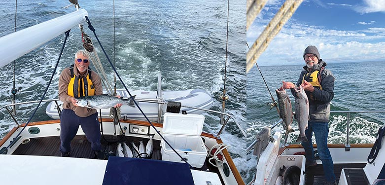
Not giving up, I showed Kim a bag of commercial gear I had kept from my dory fishing days long ago. We dug around and chose a spoon with a Mustad 0/7 hook. I dropped the spoon in the water and, just a few minutes later after only 10 line pulls, I had a fish on. It was very satisfying to have landed a fish with my gear from almost 50 years ago using a rod that was a gift from my friend John Rosenthal who had passed away about a year before. With our fishing effort successful and complete, we crossed the bar and headed to Astoria, arriving 2 hours later without incident.
Mission accomplished! The 950 miles from Marina del Rey to Astoria on Passage had taken us 196 hours, with an average speed of 4.9 knots. We left Passage in Astoria for a few days before moving her to Portland for the winter. We plan to run the boat up to Puget Sound in the spring to begin the next adventure.

Tom Sims started racing sailboats at the Willamette Sailing Club in Portland, Oregon in high school, spent a summer sailing a Cal 20 in the San Juan and Gulf islands, did a short internship with Bob Perry in 1976, fished a 21-foot commercial dory out of Depot Bay, and worked building steel boats at Marine Ways, Nichols Brothers, Kanppton Tugboat in Portland. In the last decade, he owned Sasquatch Brewery and sold it in August 2023. Now retired, he works on his boat and plans adventures on land and sea.