I have been fortunate enough to have spent my life on, in, and around boats. My earliest memories are of sailing with family and friends. I vividly remember playing pirate as a child aboard our family’s boat, Ariel. Today, when I am not sailing or boating, I dream of sailing or boating. Literally.
Over my lifetime, I have sailed and boated tens of thousands of miles, many of which have been with my dad. In early May, I was able to cast off once again on another father-and-son adventure, this time up the Columbia River in Oregon. My dad, Hugh, is 90 years old and can still operate a 50-foot motor yacht with confidence and precision, though he does require help getting the fenders up and down. Thankfully, I have been doing this since I was young, so together we make a good team. On this voyage, we were joined by longtime friend Scott Nordeng, who has been a dear shipmate for decades.
My dad and I voyaged up the Columbia some years back, but this was a first for Scott. Our float plan took us from Hayden Island, Oregon, to Hood River and back, approximately 60 river miles each way. Dad’s boat, Lady Anne, is a 48-foot Navigator, a popular make and design in the Pacific Northwest. Known for seaworthiness, comfort, and speed, Lady Anne has voyaged to Alaska and deep into the inner waters of Puget Sound. Our little cruise upriver is almost a footnote in her logbook.
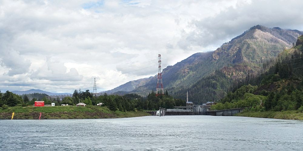
The Columbia River is one of America’s majestic waterways. Millions of years old, the Columbia has been a vital source of civilization for more than 10,000 years. Its grandeur and vitality have been a source of wonder and life. In 1792, Captain Robert Gray sailed into the river and named it for his ship, Columbia Rediviva. In 1805, the river famously led Lewis and Clark to the Pacific Ocean. Long before Western influence, the Columbia was sacred to Indigenous cultures. The river’s great food source, salmon, is a First Food—a sacred gift to be honored, respected, and celebrated.
The 19th century brought Western commerce to the Columbia River. Fur trappers were followed by missionaries, Oregon Trail settlers, barges, steamboats, railroads, and soldiers. The waterway west became a civilization corridor, a transit route for food, people, and goods. Commerce grew along its shores, building communities and extending the reach of the nation. Today, the Columbia River is a hydroelectric superpower and a defining source of energy in the Pacific Northwest. On our present-day voyage, we’d see firsthand the natural wonder, the history, and the modern technology that together make the Columbia River what it is today.
Rivers bend. They twist and turn. They have shallows, they surge, and they flow. Rivers are more than waterways; their endless motion and nurturance conjure spiritual qualities that have captured human inspiration for eons. Literature, poems, and song have embraced the river’s eminence and transcendence as a living being. Free fall flow, river flow. On and on it goes…*
We cast off at a leisurely 9 a.m. and made way for the Glenn L. Jackson Memorial Bridge, which spans the river connecting greater Vancouver, Washington, and Portland, Oregon. The weather was cloudy and a bit chilly, with a threat of rain. On the flybridge, it was crisp but comfortable. Once under the bridge, we passed Government Island State Recreation Area, public land accessible only by boat, with moorage, hiking trails, and campsites.
Navigating a river takes a different skillset than navigating the open ocean. Traveling upriver, we were powering against the current, and it became necessary to keep a vigilant eye on the aids to navigation. Red and green buoys mark the channel where the water is deep. Outside the channel, the water can get shallow very quickly. The helmsman needed to continually reference the charts and plan ahead for the next maneuver.
The Oregon side of the Columbia River is traced by the Vietnam Veterans Memorial Highway, a major transit hub and tourist byway with historic and natural sites along the way. Traveling by boat gave us the chance to pass these landmarks from a different view. Our first encounter was Rooster Rock, a basalt monolith that rises 120 feet from the river’s edge. From the boat, Rooster Rock is striking. Towering over the water, the black pinnacle is framed by evergreen trees that accent its upward thrust and natural prominence.
Called “iwash” in Chinook, meaning penis, Rooster Rock was a campsite for Lewis and Clark on November 2, 1805. William Clark was not particularly descriptive in his journal, writing simply: “We encamped under a high projecting rock on the Lard Side.”
Rooster Rock is far more impressive than a high projecting rock. Local businessman Victor Trevitt proposed the name Rooster Rock in 1854 so as not to offend the public. The surrounding area is now an Oregon state park, and perhaps ironically, the eastern end of the park is a clothing-optional beach; in fact, the first officially designated clothing-optional beach in the United States.
Two miles upriver from Rooster Rock is Bridal Veil Falls. There are several dramatic waterfalls along the Oregon edge of the river. Bridal Veil Falls drops 120 feet in two stages from underground springs on Larch Mountain. These springs are an ever-flowing watersource for the falls. In the early 1880s, timber was a successful industry along the Columbia, and the town of Bridal Veil was home to the Bridal Veil Falls Timber Company. Overuse of natural resources dried the water source, and the falls stopped. In 1937, the Kraft Company purchased the operations and, during World War II, manufactured wooden ammunition boxes. Today, the town of Bridal Veil is abandoned, with only a few old structures intact.
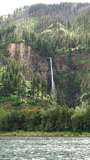
Another two miles upriver is Oregon’s most famous waterfall, Multnomah Falls. Spectacularly visible from the decks of Lady Anne, Multnomah does not disappoint. As we passed, the clouds cleared just for a moment, the sun struck the falling water, and a brilliant shower of diamonds cascaded down the cliff face. Multnomah Falls is so famous it is Oregon’s most visited natural attraction. Steeped in history, Meriwether Lewis wrote on October 30, 1805:
…passed Several places where the rocks projected into the river & have the appearance of having separated from the mountains and fallen into the river, small niches are formed in the banks below those projecting rocks which is common in this part of the river, Saw 4 Cascades caused by Small Streams falling from the mountains on the Lard.
Like his companion, Lewis sells Multnomah short. Its prominence on the river is unmistakable. Formed more than 15,000 years ago, Multnomah also carries Native American history. One story tells of a young woman who sacrificed herself to the Great Spirit to save her village from a plague by jumping from the cliff. In her death, the water flowed, and her people were saved.
The falls began as a tourist attraction in 1915, with a trail built by the Progressive Business Men’s Club of Portland. In 1925, Multnomah Falls Lodge was completed, and the grand cascade has been a destination ever since. River cruisers, however, will likely forego the shoreside experience as we did and admire from the water, since the closest transient moorage is a long way from the falls.
As we continued eastward upriver, I operated the helm from the flybridge, keeping an eye out for channel markers and shallow water. Our next landmark was Bonneville Dam, eight miles from Multnomah Falls. Built beginning in 1933 during the Great Depression, the dam is a product of the New Deal and was the first lock-and-dam project on the Columbia River. A key source of hydroelectric power, as well as the site of a major fish hatchery, Bonneville is a navigational gateway to the upper Columbia River.
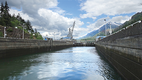
At Bonneville, we had to enter a lock, and Scott radioed the dam operator in advance of our arrival to identify our vessel and request entrance. We had to slow down and wait, as there was downriver traffic in the lock. This was our first encounter with barge traffic since leaving Portland. The Columbia navigation system includes the Snake River and runs 360 miles to Lewiston, Idaho. Barges carry approximately 5 million tons of cargo on the rivers annually.
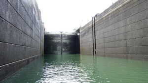
With the barge traffic past us, we got the green light from the dam operator and carefully entered the lock gate. The lock gates are two enormous steel doors, each measuring 95 feet tall and 50 feet wide, at either end of what is essentially a giant box that fills with water. At almost 50 feet, Lady Anne is a fair-sized motor yacht, but in a lock designed to move 250-foot barges and their towboat, she is tiny. Once we secured the lines to the wall of the lock, Scott radioed the operator, and the filling process began. Forty-million gallons of water filled the lock in about 20 minutes. The filling and emptying process is gravity-fed and controlled by valves. We watched as Lady Anne rose to the top of the lock. Then we got another green light, with the go-ahead to continue upriver.
From Bonneville, we had roughly 22 miles to Hood River, but immediately upriver from the dam is the town of Cascade Locks. Long before Bonneville Dam, the rapids in this part of the river were a major navigational obstacle and, before Western settlement, a major source of salmon for Native peoples. In 1878, the U.S. Army Corps of Engineers began building the Cascade Canal and Locks to bypass the rapids, and the town grew around that work.
Of this area, our historical river guide William Clark wrote:
This Great Shute or falls is about 1/2 a mile, with the water of this great river Compressed within the Space of 150 paces in which there is great numbers of both large and Small rocks, water passing with great velocity forming & boiling in a most horriable manner, with a fall of about 20 feet.
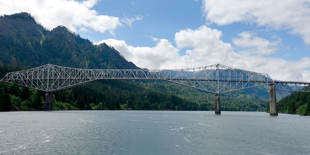
Today, the most striking feature in Cascade Locks is a bridge, and not just any bridge, but the Bridge of the Gods. Connecting Oregon and Washington, the 1,858-foot cantilever bridge rises 140 feet above the water and was built in 1926. As a modern bridge, the name is oversold. Its historical lineage, however, is centuries old, with roots in geology and mythology. Back in the 15th century, a tremendous landslide on the Washington side of the river temporarily dammed the Columbia. Klickitat oral tradition tells of a natural crossing, Tanmahawis, created by divine spirit—a place where one could cross the river “without getting your feet wet.”
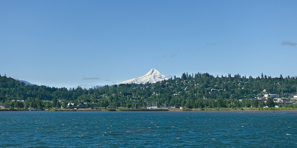
From Cascade Locks to Hood River, the river is known for very high and consistent winds. The area is a mecca for sailors, windsurfers, kiteboarders, and wing foilers, and the local conditions did not let us down… unfortunately. As we began our approach to Hood River, clouds developed to the west and a new cold wind blew strong. The entrance to Hood River Marina is shoal-choked, requiring a precise approach directly in line with the Hood River bridge. Making the navigation even more challenging, the local watersports enthusiasts were out in full force, buzzing from one side of the river to the other.
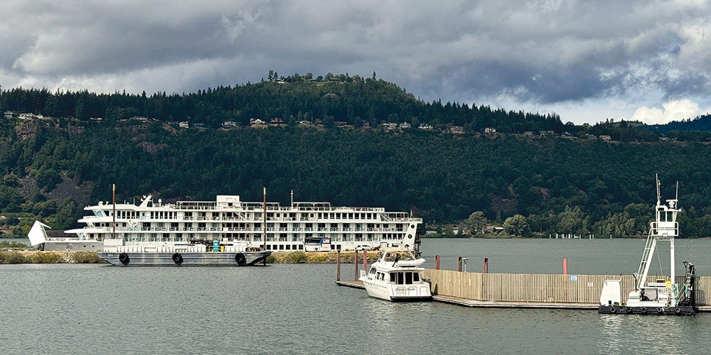
 As we advanced toward the bridge and located the harbor entrance buoys, a hard rain began to fall. The wind intensified to more than 20 knots, and the rain was now coming down sideways. On the flybridge, the rain stung my face as I tried to pinpoint the channel markers. Not being familiar with the harbor, all hands on deck were looking for the guest dock. I had to circle around the small bay before we could confirm our mooring assignment. The rain was still pelting, and it might have been hail; I couldn’t tell. One small miscalculation on the helm and Lady Anne could have been in trouble very quickly.
I turned the helm over to my dad and ran down to the side deck to help Scott with the dock lines and fenders. Dad made a broad turn to port to line up the starboard side with the dock and, thankfully, the wind was blowing us towards it instead of away. Still, if we carried too much speed, we’d risk a hard collision. With a steady hand on the throttles, he maneuvered us close enough so Scott could leap onto the dock. The deck was wet, the dock was wet, and it was hard to see through the sheeting rain. A simple misstep and Scott could end up between the boat and the dock.
Masterfully, Dad slid Lady Anne into position. Scott made his jump, and I threw the dock lines. A quick reverse on the throttles, and Lady Anne was sitting pretty with another story for the logbook.
After securing the lines, setting the fenders, and plugging into shore power, we all took a breath. While we were prepared for anything, we were not expecting all of that. We got out of our wet clothes and dried off in the cozy warmth of the salon. A quick glance at my watch and it is five o’clock—happy hour!
By about six, the clouds began to break and the sun peeked through the port salon windows. Cocktails in hand, we enjoyed a beautiful sunset over the Cascade Mountains.
*Yes the River Knows, Waiting for the Sun, Doors Music Company, LLC, 1968.
Cameron McIntyre works as a narrative cartographer, tracing the contours of place through immersive, expeditionary prose and photography that merges the authenticity of a field journal with the resonance of a lyrical travelogue.