Here’s our latest destinations installment courtesy of SalishSeaPilot.com‘s Jim Burgoyne, delving into the wonder and beauty of Haida Gwaii’s Bag Harbour.
Bag Harbour found its way onto our Haida Gwaii bucket list, via the tales of other boaters and their haunting photographs, and the only choice was not whether to go but which side of Burnaby Island to make our approach.
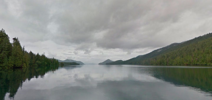
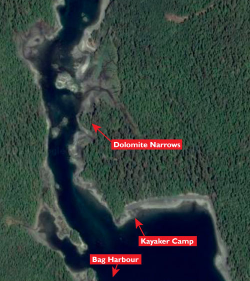
Which of course separates the brave from the rest of us. Assuming a north-to-south course, the brave take a route to the west of Burnaby Island, and down Burnaby Strait and through the shallow, twisting Dolomite Narrows, a shortcut to Bag Harbour.
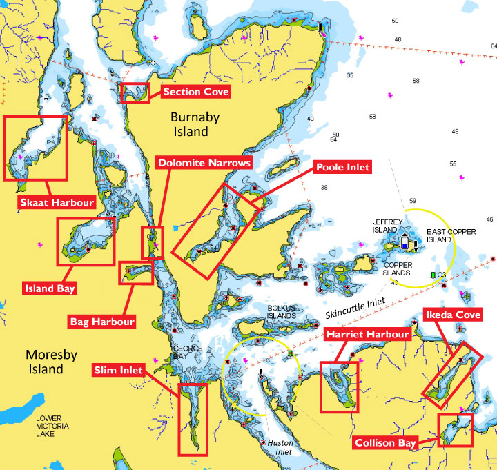
near the southern end of Haida Gwaii.
The rest of us (AKA sensible, or chicken-hearted if you prefer) take a route seaward of Burnaby Island, which itself has an unpleasant reputation when southerly winds are up. Friends of ours who do research afloat and under water here for Fisheries Canada during the off-season advised us to avoid the waters off Scudder Point at the northeast of Burnaby Island “like the plague” as they can erupt in wind against current conditions.
But in typical summer weather, an east coast transit of Burnaby Island is less worrisome than is the prospect of going aground in Dolomite Narrows which dries completely at the southern end. So that was the route we chose coming south from Hot Springs Island.
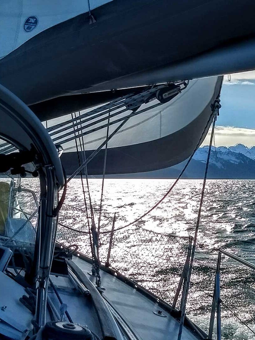
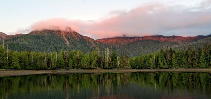
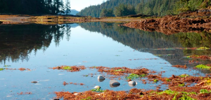
And we arrived at Bag Harbour, apparently named for nothing more noted than its shape (and had Lynne and me in a long conversation about how bags might have been shaped 150 years ago). It is a lovely place in certain late afternoon light, the hills to the east glowing various shades of green and gold, and snow-capped by wisps of cloud. Bears are a common sight on the tidal flats at the head of the bay.
Anchored alone here, where the depths are moderate and the holding in mud sublime, it’s hard to imagine the harbour once teemed with life. A clam cannery, built on the north shore around the turn of the last century, for many years supported a community of settlers.
We went ashore by kayak to investigate. Rusting cones of machinery still sit near the shore, and other bits, identifiable only as obvious discard, litter the apron of forest above the beach.
The only people we shared the area with or even saw pass through, at mid-June, was an outdoorsy couple who had been dropped off by a tour operator at the kayaker camp across from Bag Harbour on Burnaby Island at the south end of Dolomite Narrows. Friendly folks, but we couldn’t help but feel we were spoiling their deserted island experience, so we gave them ample space over the three nights we were anchored here.
Our friends who work for Fisheries Canada advised us to first go through in a dinghy if we felt up to navigating the narrows. Boats have been lost here. In our kayak, we hunted for range markers to assist boaters transiting the narrows, even spotted one or two, but they seem to have been mostly swallowed by the natural environment. We more or less mapped a route through the narrows with our iPad, but in the end decided we were already anchored in Bag Harbour and were heading farther south, so there was no point tempting fate (as chickens are averse to do).

A nautical mile north from the narrows is Dolomite Point, from where the aptly named Island Bay extends west, a splendid anchorage, with many islands at its entrance and at its head, a fun place to explore.
Farther north, past Kat Island, is the notorious Skaat Harbour. It has an idyllic setting in settled conditions, which can lull boaters into a sense of security, but is a virtual wind tunnel in a blow. Sailors with Haida Gwaii experience suggest avoiding it.
A few miles south from Bag Harbour is Slim Inlet, a narrow anchorage as its name suggests. It’s scenic and well protected, with nooks in the shoreline to hide behind. The creek at the head of the inlet is fun to paddle up, with lots to discover until detritus blocks your stroke momentum.
If heading south, don’t miss Ikeda Cove, an enchanting anchorage with an ancient mine site that is fun to explore. Remains of machinery and ancient structures be found ashore.
Perfect for the chickens among us.
Note: This article was originally published on SalishSeaPilot.com. The 2023 versions of Salish Sea Pilot’s cruising guides are available now.