When I worked in marine science, we’d sometimes talk about plankton and nekton. Most people are familiar with plankton: tiny organisms that drift to and fro in saltwater, pushed by currents and wind. Nekton are larger animals, like sharks and tuna, that swim largely unimpeded by the movement of water.
As a guy with three boats under 20 feet, I often feel like plankton. Motor cruisers and barges—motorized nekton—plow past me while I creep along, trying not to battle the tides. Under sail, my top speed might be five knots; with oars in hand, I’m lucky to maintain three. Many tidal currents in the Salish Sea can easily outpace me. Riding the tide effectively is an imperative in my life as a small boat sailor. Catching the right tidal current—or avoiding an adverse one—can mean the difference between a smooth day or a slog. That’s why I am studious and cautious about when and where I choose to travel.
In pursuit of this growing obsession with tidal currents, I once found myself reading a 300-page technical manual from 1981—Oceanography of the British Columbia Coast by Richard E. Thomson. You might not think a document of that vintage would interest the modern small boat sailor, but you would be wrong. Besides, some obsessions run deep (pun intended).
The contents of this tome were fascinating, but its introduction spoke to me profoundly. “Oceanographers are a cult unto themselves,” writes C.J. Yorath. “To outsiders they appear as people who, for reasons apparently known only to themselves, have a passion for analyzing water. Their god is the sea, their creed to understand, to interpret, and ultimately to respect its seemingly endless mysteries.”
In that quest for understanding, my own personal bible for the San Juans and Gulf Islands has long been a raggedy copy of the Current Atlas – Juan de Fuca Strait to Strait of Georgia. Published by the Canadian Hydrographic Service (CHS) since at least 1983, its maps and illustrations are useful, but also elegant.
My copy uses a sand color for the land masses, and a legion of azure arrows in different sizes for water, each one an indicator of current direction and strength at a specific time and day in the tide cycle. The arrow patterns, especially in the black and white version (available digitally from Fisheries and Oceans Canada for free) have a striking, modernist flair. In the straits they flow in a straightforward pattern, back and forth almost exclusively. But the arrows in the islands form swirls, collisions, and patterns that differ, depending on the flood or the ebb. The detail is impressive, especially given the technology available when the atlas was created. Or to put it as Yorath did, I am amazed by its “endless mysteries”.

Those current arrows have determined my travels for many voyages through the islands. Once, anchored at Pender Island, BC, I spent at least an hour flipping through the atlas, trying to determine when favorable currents would allow me to voyage to Sidney in relative speed and comfort. According to the atlas, it would be two days before a favorable set of daytime currents would let me cross those scant 10 miles. I didn’t want to believe it. Surely the book must be wrong, I told myself. Instead of waiting, I took off the next day. Soon I was creeping along, fighting to make a measly knot towards my destination. At one point, I paused in a still kelp bed tucked behind an island and watched a virtual river of water churn past me at several knots.
As I cursed the hubris that had put me in this predicament, I couldn’t help wondering exactly how the Current Atlas got it all so right. What tools, what methods, and most importantly, what magic did the CHS tap into back in 1981, before most of us even had desktop computers?
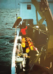
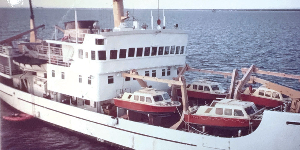
Back at home, I started digging into the fine print. I learned that computer models were used to create much of the atlas, but one portion was so special that the acknowledgments thank the officers and crews of four Coast Guard vessels: Moorhen, Sea Truck 701, and Hovercraft 021 and 039.
That seemed curious. Why were these particular ships so important to the creation of the Current Atlas? I reached out to Fisheries and Oceans Canada, who connected me to Fred Stephenson, a retired scientist. He directed me to Thomson’s book, and a string of scientific papers, from which I learned that the information in the Atlas was largely built on the work of oceanographers researching the impacts of tidal currents on fisheries, wastewater from industrial and domestic sources, and navigation.
Poring over these scientific papers, looking up terms like barotropic tides, progressive vector diagrams, and mooring profiles, I felt like I was back in graduate school. The models in the papers took into account variables like roughness of the underwater topography, salinity, freshwater flows, winds, and other physical factors. But to refine their results, the scientists needed to record data in the field. They needed to see what the water was actually doing.
That’s where the ships and people came in. Scientists aboard the Coast Guard vessels set out floating current meters at different depths (yes, currents move at different speeds within the same water column). Devices known as current followers, drift poles, or drifters were placed in the water by boats or divers. As these devices drifted with the current, the CHS scientists observed and recorded their movements to understand speed and direction. While they used radar in their work, the entire endeavor was time-consuming and physical in those days before GPS. It took creative muscle to leverage the technology into useful information and products. For those efforts, I am grateful to the people and ships who made knowing when to ride the tide easy for me today.
I like the tactile nature of the Current Atlas. I appreciate its beauty and its fail-safe nature; it can get wet, doesn’t require batteries, and its analog format suits my often planktonic pace. Best of all, it connects me to people of the past, and to the enduring mysteries of the sea that unite us all.
Bruce Bateau sails and rows traditional boats with a modern twist in Portland, Oregon. His stories and adventures can be found at www.terrapintales.wordpress.com.